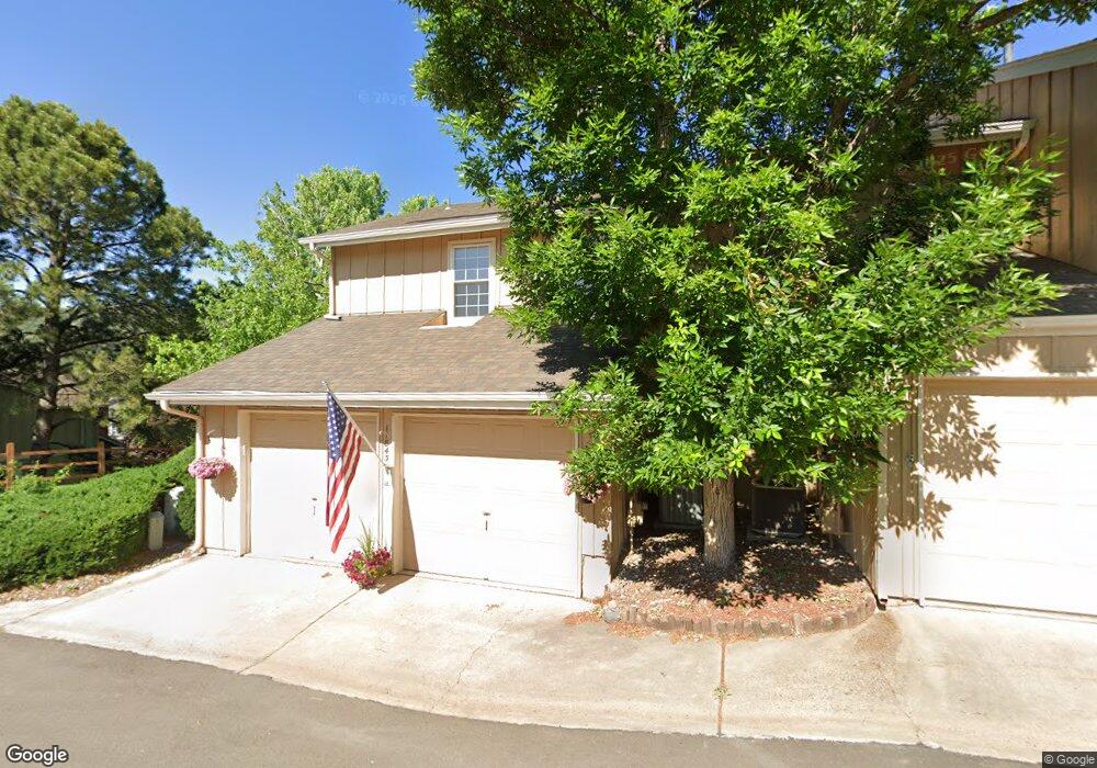
11843 Elk Head Range Rd Littleton, CO 80127
Estimated Value: $479,000 - $507,264
4
Beds
4
Baths
2,095
Sq Ft
$233/Sq Ft
Est. Value
About This Home
This home is located at 11843 Elk Head Range Rd, Littleton, CO 80127 and is currently estimated at $487,316, approximately $232 per square foot. 11843 Elk Head Range Rd is a home located in Jefferson County with nearby schools including Shaffer Elementary School, Falcon Bluffs Middle School, and Chatfield High School.
Ownership History
Date
Name
Owned For
Owner Type
Purchase Details
Closed on
Mar 22, 2022
Sold by
Colleen Culligan Mary
Bought by
Phillips Amber and Rizzo Kyle
Current Estimated Value
Home Financials for this Owner
Home Financials are based on the most recent Mortgage that was taken out on this home.
Original Mortgage
$441,750
Outstanding Balance
$413,837
Interest Rate
4.16%
Mortgage Type
New Conventional
Estimated Equity
$73,479
Purchase Details
Closed on
Dec 14, 2005
Sold by
Cantanach Virginia
Bought by
Pratt Michelle
Purchase Details
Closed on
Feb 27, 1998
Sold by
Wechsler Bruce J and Lind Wechsler Powell
Bought by
Culligan Mary Colleen
Home Financials for this Owner
Home Financials are based on the most recent Mortgage that was taken out on this home.
Original Mortgage
$132,925
Interest Rate
7.01%
Mortgage Type
FHA
Create a Home Valuation Report for This Property
The Home Valuation Report is an in-depth analysis detailing your home's value as well as a comparison with similar homes in the area
Home Values in the Area
Average Home Value in this Area
Purchase History
| Date | Buyer | Sale Price | Title Company |
|---|---|---|---|
| Phillips Amber | $472,450 | New Title Company Name | |
| Pratt Michelle | -- | -- | |
| Culligan Mary Colleen | $134,900 | Land Title |
Source: Public Records
Mortgage History
| Date | Status | Borrower | Loan Amount |
|---|---|---|---|
| Open | Phillips Amber | $441,750 | |
| Previous Owner | Culligan Mary Colleen | $132,925 |
Source: Public Records
Tax History Compared to Growth
Tax History
| Year | Tax Paid | Tax Assessment Tax Assessment Total Assessment is a certain percentage of the fair market value that is determined by local assessors to be the total taxable value of land and additions on the property. | Land | Improvement |
|---|---|---|---|---|
| 2024 | $3,115 | $29,093 | $6,030 | $23,063 |
| 2023 | $3,115 | $29,093 | $6,030 | $23,063 |
| 2022 | $2,664 | $24,333 | $4,170 | $20,163 |
| 2021 | $2,704 | $25,033 | $4,290 | $20,743 |
| 2020 | $2,410 | $22,376 | $4,290 | $18,086 |
| 2019 | $2,381 | $22,376 | $4,290 | $18,086 |
| 2018 | $2,235 | $20,282 | $3,600 | $16,682 |
| 2017 | $2,078 | $20,282 | $3,600 | $16,682 |
| 2016 | $1,980 | $18,284 | $3,184 | $15,100 |
| 2015 | $1,746 | $18,284 | $3,184 | $15,100 |
| 2014 | $1,746 | $15,196 | $2,229 | $12,967 |
Source: Public Records
Map
Nearby Homes
- 11872 Elk Head Range Rd
- 11710 Elk Head Range Rd
- 11703 Elk Head Range Rd
- 11673 Elk Head Range Rd
- 7646 S Bear Mountain
- 11851 Canyon Ave
- 7474 S Alkire St Unit 203
- 7454 S Alkire St Unit 301
- 7409 S Alkire St Unit 304
- 11235 San Joaquin Ridge
- 7369 S Gore Range Rd Unit 208
- 7355 S Alkire St Unit 203
- 8140 S Storm King Peak
- 7462 S Quail Cir Unit 426
- 7339 S Gore Range Rd
- 7359 S Mount Holy Cross
- Pinnacle Plan at Ken-Caryl Ranch - The Pioneer Collection
- Evans Plan at Ken-Caryl Ranch - The Pioneer Collection
- Tabor Plan at Ken-Caryl Ranch - The Pioneer Collection
- 12760 W Glasgow Place
- 11841 Elk Head Range Rd
- 11839 Elk Head Range Rd
- 11837 Elk Head Range Rd
- 11853 Elk Head Range Rd
- 11835 Elk Head Range Rd
- 11879 Elk Head Range Rd
- 11851 Elk Head Range Rd
- 11849 Elk Head Range Rd
- 11833 Elk Head Range Rd
- 11881 Elk Head Range Rd
- 11847 Elk Head Range Rd
- 11883 Elk Head Range Rd
- 11845 Elk Head Range Rd
- 11863 Elk Head Range Rd
- 11855 Elk Head Range Rd
- 11885 Elk Head Range Rd
- 11865 Elk Head Range Rd
- 11877 Elk Head Range Rd
- 11857 Elk Head Range Rd
- 11887 Elk Head Range Rd