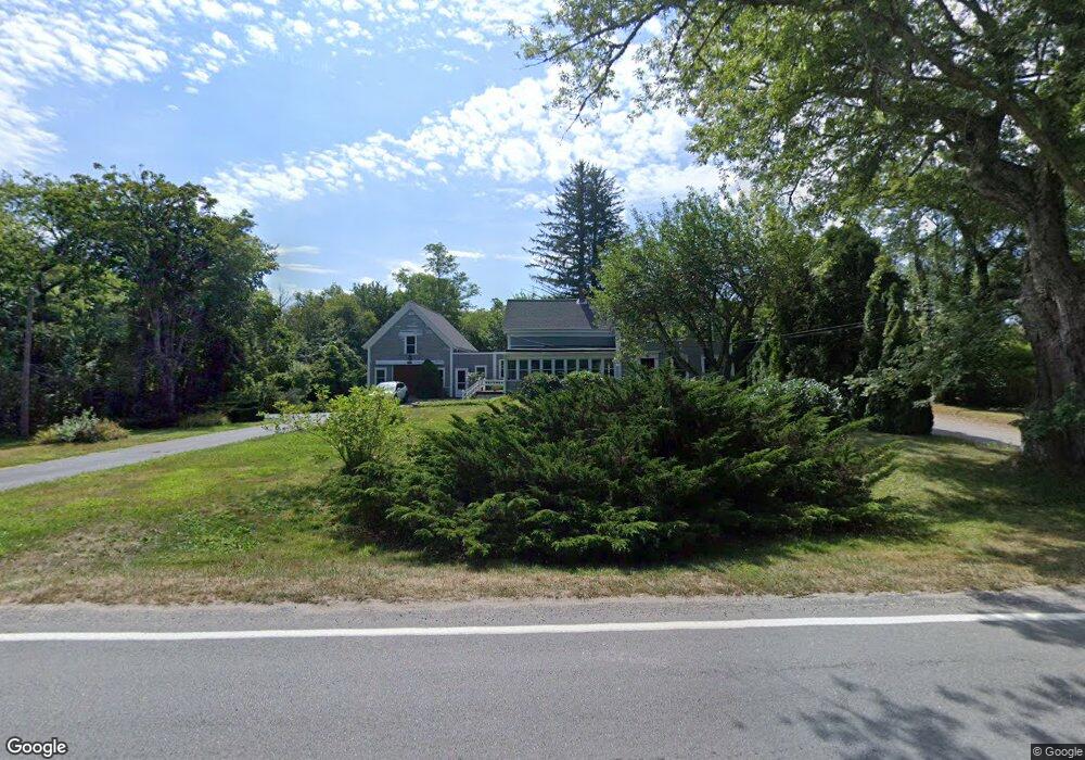
1186 Stony Brook Rd Brewster, MA 02631
Estimated Value: $713,000 - $1,193,000
4
Beds
3
Baths
2,467
Sq Ft
$429/Sq Ft
Est. Value
About This Home
This home is located at 1186 Stony Brook Rd, Brewster, MA 02631 and is currently estimated at $1,058,887, approximately $429 per square foot. 1186 Stony Brook Rd is a home located in Barnstable County with nearby schools including Nauset Regional Middle School, Nauset Regional High School, and The Family School.
Ownership History
Date
Name
Owned For
Owner Type
Purchase Details
Closed on
May 11, 1990
Sold by
Payne William F
Bought by
Bladen Christopher
Current Estimated Value
Home Financials for this Owner
Home Financials are based on the most recent Mortgage that was taken out on this home.
Original Mortgage
$95,000
Interest Rate
10.15%
Mortgage Type
Purchase Money Mortgage
Create a Home Valuation Report for This Property
The Home Valuation Report is an in-depth analysis detailing your home's value as well as a comparison with similar homes in the area
Home Values in the Area
Average Home Value in this Area
Purchase History
| Date | Buyer | Sale Price | Title Company |
|---|---|---|---|
| Bladen Christopher | $250,000 | -- |
Source: Public Records
Mortgage History
| Date | Status | Borrower | Loan Amount |
|---|---|---|---|
| Open | Bladen Christopher | $109,000 | |
| Closed | Bladen Christopher | $125,000 | |
| Closed | Bladen Christopher | $95,000 | |
| Closed | Bladen Christopher | $95,000 |
Source: Public Records
Tax History Compared to Growth
Tax History
| Year | Tax Paid | Tax Assessment Tax Assessment Total Assessment is a certain percentage of the fair market value that is determined by local assessors to be the total taxable value of land and additions on the property. | Land | Improvement |
|---|---|---|---|---|
| 2025 | $6,060 | $880,800 | $309,500 | $571,300 |
| 2024 | $5,663 | $831,500 | $292,000 | $539,500 |
| 2023 | $5,196 | $743,300 | $260,700 | $482,600 |
| 2022 | $4,702 | $599,000 | $195,400 | $403,600 |
| 2021 | $4,480 | $522,200 | $169,900 | $352,300 |
| 2020 | $4,359 | $505,700 | $169,900 | $335,800 |
| 2019 | $3,132 | $484,400 | $163,500 | $320,900 |
| 2018 | $4,000 | $484,300 | $163,500 | $320,800 |
| 2017 | $3,901 | $465,000 | $163,500 | $301,500 |
| 2016 | $3,740 | $443,700 | $160,400 | $283,300 |
| 2015 | $3,583 | $433,800 | $157,200 | $276,600 |
Source: Public Records
Map
Nearby Homes
- 1424 Main St
- 21 Sea Meadow Ln
- 20 Spring Ln
- 309 Great Fields Rd
- 1580 Main St
- 429 Paines Creek Rd
- 240 Robbins Hill Rd
- 597 Great Fields Rd
- 1861 Main St
- 30 Fox Crossing Rd
- 117 A p Newcomb Rd
- 0 Canoe Pond Dr
- 728 Great Fields Rd
- 120 Red Maple Rd
- 55 Leona Terrace
- 52 Bettys Ln
- 43 Billington Ln
- 43 Billington Ln Unit 43
- 1174 Stony Brook Rd
- 1179 Stony Brook Rd
- 1222 Stony Brook Rd
- 51 Great Fields Rd
- 169-179 Great Fields Rd
- 1211 Stony Brook Rd
- 42 Great Fields Rd
- 1284 Main St
- 1872 Main St
- 1741 Main St
- 1268 Main St
- 60 Great Fields Rd
- 1311 Main St
- 79 Great Fields Rd
- 1283 Main St
- 1139 Stony Brook Rd
- 1250 Main St
- 96 Great Fields Rd
- 1261 Main St
- 83 Fortunes Furrow Way