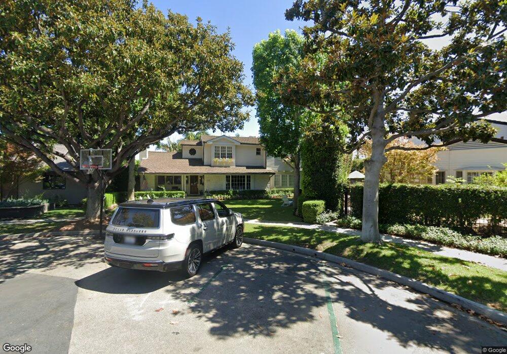
1188 Bryant Rd Long Beach, CA 90815
Park Estates NeighborhoodEstimated Value: $2,671,000 - $3,366,000
5
Beds
4
Baths
3,792
Sq Ft
$827/Sq Ft
Est. Value
About This Home
This home is located at 1188 Bryant Rd, Long Beach, CA 90815 and is currently estimated at $3,137,016, approximately $827 per square foot. 1188 Bryant Rd is a home located in Los Angeles County with nearby schools including Minnie Gant Elementary School, Stanford Middle School, and Woodrow Wilson High School.
Ownership History
Date
Name
Owned For
Owner Type
Purchase Details
Closed on
Jul 27, 2011
Sold by
Carr Janine
Bought by
Abdul Wahab Andrew and Abdul Wahab Shannon Sparling
Current Estimated Value
Home Financials for this Owner
Home Financials are based on the most recent Mortgage that was taken out on this home.
Original Mortgage
$1,040,000
Interest Rate
4.43%
Mortgage Type
New Conventional
Purchase Details
Closed on
Apr 15, 2003
Sold by
Carr Richard J
Bought by
Carr Richard J and Carr Janine
Home Financials for this Owner
Home Financials are based on the most recent Mortgage that was taken out on this home.
Original Mortgage
$501,000
Interest Rate
4.87%
Purchase Details
Closed on
Jun 18, 1997
Sold by
Carr Richard
Bought by
Carr Richard J and Carr Janine
Purchase Details
Closed on
Apr 9, 1997
Sold by
Galinsky Marvin D
Bought by
Carr Richard and Carr Janine
Home Financials for this Owner
Home Financials are based on the most recent Mortgage that was taken out on this home.
Original Mortgage
$448,000
Interest Rate
7.94%
Create a Home Valuation Report for This Property
The Home Valuation Report is an in-depth analysis detailing your home's value as well as a comparison with similar homes in the area
Home Values in the Area
Average Home Value in this Area
Purchase History
We collect this data history from publicly available records. To have your information removed, we recommend requesting removal directly through your county’s website.
| Date | Buyer | Sale Price | Title Company |
|---|---|---|---|
| Abdul Wahab Andrew | $1,600,000 | North American Title | |
| Carr Richard J | -- | North American Title Co | |
| Carr Richard J | -- | North American Title Co | |
| Carr Richard J | -- | North American Title Co | |
| Carr Richard J | -- | North American Title | |
| Carr Richard | $560,000 | North American Title Co |
Source: Public Records
Mortgage History
We collect this data history from publicly available records. To have your information removed, we recommend requesting removal directly through your county’s website.
| Date | Status | Borrower | Loan Amount |
|---|---|---|---|
| Closed | Abdul Wahab Andrew | $1,040,000 | |
| Previous Owner | Carr Richard J | $501,000 | |
| Previous Owner | Carr Richard J | $560,000 | |
| Previous Owner | Carr Richard | $448,000 |
Source: Public Records
Tax History
| Year | Tax Paid | Tax Assessment Tax Assessment Total Assessment is a certain percentage of the fair market value that is determined by local assessors to be the total taxable value of land and additions on the property. | Land | Improvement |
|---|---|---|---|---|
| 2025 | $34,216 | $2,759,140 | $1,666,096 | $1,093,044 |
| 2024 | $34,216 | $2,705,040 | $1,633,428 | $1,071,612 |
| 2023 | $33,657 | $2,652,000 | $1,601,400 | $1,050,600 |
| 2022 | $31,558 | $2,600,000 | $1,570,000 | $1,030,000 |
| 2021 | $23,271 | $1,903,053 | $1,160,399 | $742,654 |
| 2020 | $23,208 | $1,883,540 | $1,148,501 | $735,039 |
| 2019 | $22,938 | $1,846,609 | $1,125,982 | $720,627 |
| 2018 | $22,322 | $1,810,402 | $1,103,904 | $706,498 |
| 2016 | $20,520 | $1,740,104 | $1,061,039 | $679,065 |
| 2015 | $19,679 | $1,713,967 | $1,045,102 | $668,865 |
| 2014 | $19,515 | $1,680,393 | $1,024,630 | $655,763 |
Source: Public Records
Map
Nearby Homes
- 5360 E El Jardin St
- 5585 E Pacific Coast Hwy Unit 342
- 5585 E Pacific Coast Hwy Unit 171
- 5585 E Pacific Coast Hwy Unit 154
- 5585 E Pacific Coast Hwy Unit 132
- 5585 E Pacific Coast Hwy Unit 125
- 5585 E Pacific Coast Hwy Unit 230
- 5585 E Pacific Coast Hwy Unit 361
- 5401 E El Parque St
- 1470 Bryant Dr E
- 730 Santiago Ave
- 1507 Ramillo Ave
- 5411 E El Cedral St
- 5220 E El Roble St
- 5300 E Atherton St Unit 2F
- 5473 E 4th St
- 551 Milton Ct Unit 101
- 1817 Lave Ave
- 1901 N Bellflower Blvd
- 1873 Marber Ave
- 1170 Bryant Rd
- 1160 Bryant Rd
- 1180 Bryant Rd
- 1158 Bryant Rd
- 1151 Los Altos Ave
- 1161 Los Altos Ave
- 1141 Los Altos Ave
- 1171 Bryant Rd
- 1184 Bryant Rd
- 1171 Los Altos Ave
- 1161 Bryant Rd
- 1181 Bryant Rd
- 5565 E Anaheim Rd
- 1151 Bryant Rd
- 1181 Los Altos Ave
- 1131 Los Altos Ave
- 1191 Bryant Rd
- 1191 Los Altos Ave
- 5493 E Anaheim Rd
- 1192 Bryant Rd
Your Personal Tour Guide
Ask me questions while you tour the home.