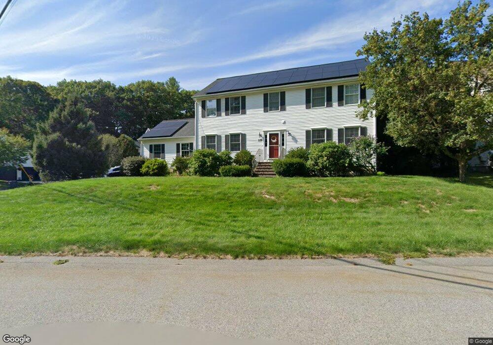
119 Conant Rd Nashua, NH 03062
Southwest Nashua NeighborhoodEstimated Value: $687,000 - $765,000
4
Beds
3
Baths
2,464
Sq Ft
$291/Sq Ft
Est. Value
About This Home
This home is located at 119 Conant Rd, Nashua, NH 03062 and is currently estimated at $718,055, approximately $291 per square foot. 119 Conant Rd is a home located in Hillsborough County with nearby schools including Main Dunstable School, Elm Street Middle School, and Nashua High School South.
Ownership History
Date
Name
Owned For
Owner Type
Purchase Details
Closed on
Aug 10, 2020
Sold by
Fournier Michael R
Bought by
Fournier Michael R and Fournier Jennifer M
Current Estimated Value
Home Financials for this Owner
Home Financials are based on the most recent Mortgage that was taken out on this home.
Original Mortgage
$330,000
Outstanding Balance
$232,627
Interest Rate
3%
Mortgage Type
VA
Estimated Equity
$485,428
Purchase Details
Closed on
Mar 31, 2003
Sold by
Amp Props Llc
Bought by
Fournier Michael R and Fournier Tracy A
Home Financials for this Owner
Home Financials are based on the most recent Mortgage that was taken out on this home.
Original Mortgage
$217,000
Interest Rate
5.91%
Mortgage Type
Purchase Money Mortgage
Create a Home Valuation Report for This Property
The Home Valuation Report is an in-depth analysis detailing your home's value as well as a comparison with similar homes in the area
Home Values in the Area
Average Home Value in this Area
Purchase History
| Date | Buyer | Sale Price | Title Company |
|---|---|---|---|
| Fournier Michael R | -- | None Available | |
| Fournier Michael R | $329,900 | -- |
Source: Public Records
Mortgage History
| Date | Status | Borrower | Loan Amount |
|---|---|---|---|
| Open | Fournier Michael R | $330,000 | |
| Previous Owner | Fournier Michael R | $295,000 | |
| Previous Owner | Fournier Michael R | $300,000 | |
| Previous Owner | Fournier Michael R | $217,000 |
Source: Public Records
Tax History Compared to Growth
Tax History
| Year | Tax Paid | Tax Assessment Tax Assessment Total Assessment is a certain percentage of the fair market value that is determined by local assessors to be the total taxable value of land and additions on the property. | Land | Improvement |
|---|---|---|---|---|
| 2024 | $10,604 | $666,900 | $161,100 | $505,800 |
| 2023 | $10,045 | $551,000 | $128,900 | $422,100 |
| 2022 | $9,957 | $551,000 | $128,900 | $422,100 |
| 2021 | $8,940 | $385,000 | $85,900 | $299,100 |
| 2020 | $8,705 | $385,000 | $85,900 | $299,100 |
| 2019 | $8,236 | $378,500 | $85,900 | $292,600 |
| 2018 | $7,998 | $377,100 | $84,500 | $292,600 |
| 2017 | $9,241 | $358,300 | $65,600 | $292,700 |
| 2016 | $8,983 | $358,300 | $65,600 | $292,700 |
| 2015 | $8,752 | $356,800 | $65,600 | $291,200 |
| 2014 | $8,581 | $356,800 | $65,600 | $291,200 |
Source: Public Records
Map
Nearby Homes
- 7 Roderick Cir
- 22 Newburgh Rd
- 5 Wilderness Dr
- 424 Main Dunstable Rd
- 2 Rene Dr
- 130 Searles Rd
- 42 Woodfield St
- 57 Wethersfield Rd
- 27 New Searles Rd
- 33 Cannon Dr
- 24 Yarmouth Dr
- 61 Wilderness Dr
- 7 Doucet Ave
- 59 Wilderness Dr
- 7 Wilderness Dr
- 25 Cortez Dr Unit U57
- 6 Wilderness Dr
- 57 Wilderness Dr
- 3 Wilderness Dr
- 4 Hikers Ln