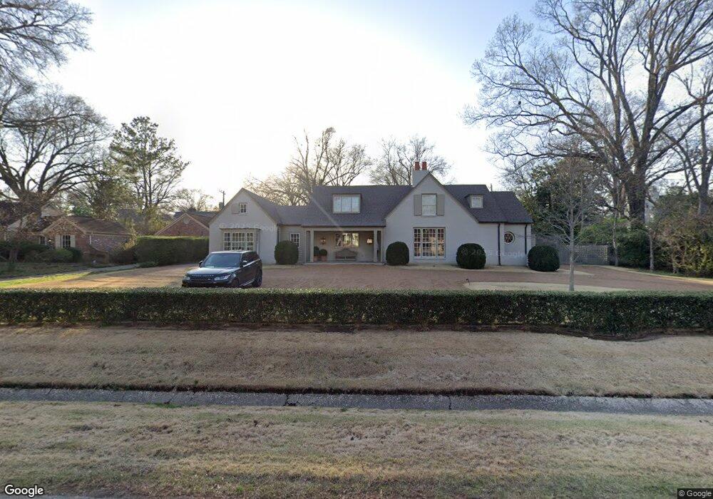
119 Devon Way Memphis, TN 38111
High Point Terrace NeighborhoodEstimated Value: $816,393 - $1,036,000
4
Beds
5
Baths
4,760
Sq Ft
$193/Sq Ft
Est. Value
About This Home
This home is located at 119 Devon Way, Memphis, TN 38111 and is currently estimated at $920,848, approximately $193 per square foot. 119 Devon Way is a home located in Shelby County with nearby schools including White Station Elementary School, White Station High, and White Station Middle.
Ownership History
Date
Name
Owned For
Owner Type
Purchase Details
Closed on
Nov 7, 2019
Sold by
Uhlhorn Brothers Construction Gp
Bought by
Anderson David W and Anderson Jessica T
Current Estimated Value
Home Financials for this Owner
Home Financials are based on the most recent Mortgage that was taken out on this home.
Original Mortgage
$880,000
Interest Rate
3.65%
Mortgage Type
Construction
Purchase Details
Closed on
Dec 14, 2018
Sold by
Scruggs Peggy Anne
Bought by
Uhihorn Brothers Construction Gp
Purchase Details
Closed on
May 16, 2002
Sold by
Scruggs John Perry
Bought by
Scruggs Peggy Anne Power
Home Financials for this Owner
Home Financials are based on the most recent Mortgage that was taken out on this home.
Original Mortgage
$140,800
Interest Rate
6.92%
Create a Home Valuation Report for This Property
The Home Valuation Report is an in-depth analysis detailing your home's value as well as a comparison with similar homes in the area
Home Values in the Area
Average Home Value in this Area
Purchase History
| Date | Buyer | Sale Price | Title Company |
|---|---|---|---|
| Anderson David W | $705,000 | Memphis Title Company | |
| Uhihorn Brothers Construction Gp | $350,000 | Memphis Title Co | |
| Scruggs Peggy Anne Power | -- | -- |
Source: Public Records
Mortgage History
| Date | Status | Borrower | Loan Amount |
|---|---|---|---|
| Closed | Anderson David W | $880,000 | |
| Previous Owner | Scruggs Peggy Anne Power | $140,800 |
Source: Public Records
Tax History Compared to Growth
Tax History
| Year | Tax Paid | Tax Assessment Tax Assessment Total Assessment is a certain percentage of the fair market value that is determined by local assessors to be the total taxable value of land and additions on the property. | Land | Improvement |
|---|---|---|---|---|
| 2025 | $6,561 | $210,725 | $62,300 | $148,425 |
| 2024 | $6,117 | $193,550 | $62,300 | $131,250 |
| 2023 | $10,992 | $180,450 | $62,300 | $118,150 |
| 2022 | $10,992 | $180,450 | $62,300 | $118,150 |
| 2021 | $13,065 | $180,450 | $62,300 | $118,150 |
| 2020 | $8,501 | $101,300 | $62,300 | $39,000 |
| 2019 | $3,238 | $101,300 | $62,300 | $39,000 |
| 2018 | $3,238 | $101,300 | $62,300 | $39,000 |
| 2017 | $3,529 | $107,875 | $62,300 | $45,575 |
| 2016 | $4,148 | $94,925 | $0 | $0 |
Source: Public Records
Map
Nearby Homes
- 59 Devon Way
- 55 Saint Andrews Fwy
- 3845 Cardinal Ave
- 219 N Rose Rd
- 4072 N Walnut Grove Cir
- 207 N Goodlett St
- 73 N Goodlett St
- 273 Saint Andrews Fairway
- 3811 S Montclair Dr
- 4015 N Galloway Dr
- 3815 Montclair Dr
- 194 Wallace Rd
- 3682 Oakley Ave
- 3659 Highland Park Place
- 4054 Saint Ann Cir
- 4023 Hilldale Ave
- 3787 S Swan Ridge Cir
- 294 Aurora Cir
- 4151 Barfield Rd
- 4152 Barfield Rd
- 105 Devon Way
- 131 Devon Way
- 120 Saint Albans Fwy
- 104 Saint Albans Fwy
- 116 Devon Way
- 93 Devon Way
- 140 Saint Albans Fwy
- 140 St Albans Fwy
- 140 Devon Way
- 100 Devon Way
- 94 Saint Albans Fwy
- 94 Saint Albans Fairway
- 147 Devon Way
- 81 Devon Way
- 95 Saint Albans Fwy
- 86 Devon Way
- 84 St Albans Fwy
- 84 Saint Albans Fwy
- 115 Saint Andrews Fwy
- 135 Saint Albans Fwy
