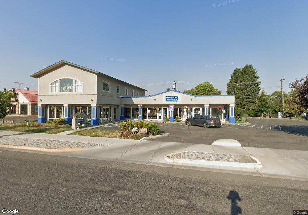
119 N 7th Ave Bozeman, MT 59715
Midtown NeighborhoodEstimated Value: $1,748,303
Studio
--
Bath
7,200
Sq Ft
$243/Sq Ft
Est. Value
About This Home
This home is located at 119 N 7th Ave, Bozeman, MT 59715 and is currently estimated at $1,748,303, approximately $242 per square foot. 119 N 7th Ave is a home located in Gallatin County with nearby schools including Whittier School, Chief Joseph Middle School, and Bozeman High School.
Ownership History
Date
Name
Owned For
Owner Type
Purchase Details
Closed on
Jan 31, 2007
Sold by
Lightfoot Harold
Bought by
Schwier Charles
Current Estimated Value
Home Financials for this Owner
Home Financials are based on the most recent Mortgage that was taken out on this home.
Original Mortgage
$340,000
Outstanding Balance
$203,079
Interest Rate
6.11%
Mortgage Type
Commercial
Estimated Equity
$1,545,224
Create a Home Valuation Report for This Property
The Home Valuation Report is an in-depth analysis detailing your home's value as well as a comparison with similar homes in the area
Home Values in the Area
Average Home Value in this Area
Purchase History
| Date | Buyer | Sale Price | Title Company |
|---|---|---|---|
| Schwier Charles | -- | American Land Title Company |
Source: Public Records
Mortgage History
| Date | Status | Borrower | Loan Amount |
|---|---|---|---|
| Open | Schwier Charles | $340,000 |
Source: Public Records
Tax History
| Year | Tax Paid | Tax Assessment Tax Assessment Total Assessment is a certain percentage of the fair market value that is determined by local assessors to be the total taxable value of land and additions on the property. | Land | Improvement |
|---|---|---|---|---|
| 2025 | $15,603 | $1,726,100 | $0 | $0 |
| 2024 | $14,543 | $1,560,500 | $0 | $0 |
| 2023 | $14,041 | $1,560,500 | $0 | $0 |
| 2022 | $15,322 | $1,427,300 | $0 | $0 |
| 2021 | $16,909 | $1,427,300 | $0 | $0 |
| 2020 | $14,600 | $1,224,000 | $0 | $0 |
| 2019 | $14,937 | $1,224,000 | $0 | $0 |
| 2018 | $14,700 | $1,116,500 | $0 | $0 |
| 2017 | $14,574 | $1,116,500 | $0 | $0 |
| 2016 | $14,308 | $1,086,400 | $0 | $0 |
| 2015 | $14,323 | $1,086,400 | $0 | $0 |
| 2014 | $11,303 | $706,421 | $0 | $0 |
Source: Public Records
Map
Nearby Homes
- 718 W Babcock St Unit 301
- 718 W Babcock St Unit 411
- 718 W Babcock St Unit 403
- 316 N 10th Ave
- 418 W Babcock St
- 516 W Olive St
- 209 S 8th Ave
- 300 W Main St Unit G
- 221 S 7th Ave
- 416 W Olive St
- 1120 W Babcock St Unit 16
- 526 N 10th Ave
- 37 W Main St Unit A
- 617 N 5th Ave Unit L
- 429 N Willson Ave
- 5 W Mendenhall St Unit 510
- 5 W Mendenhall St Unit 410
- 5 W Mendenhall St Unit 415
- 5 W Mendenhall St Unit 414
- 507 S 8th Ave
- 703 W Mendenhall St
- 23 N 7th Ave
- 107 N 7th Ave
- 719 W Mendenhall St
- 109 N 7th Ave Unit C
- 520 616-20 W Mendenhll
- 110 N 8th Ave
- 621 W Mendenhall St
- 701 W Main St Unit A-2
- 609 W Mendenhall St
- 14 N 7th Ave
- 122 N 8th Ave
- 811 W Mendenhall St
- 605 W Mendenhall St
- 109 N 8th Ave
- 614 W Lamme St
- 115 N 8th Ave
- 28 W Unit 7a and 7b
- 801 W Main St
- 1 N 8th Ave
Your Personal Tour Guide
Ask me questions while you tour the home.