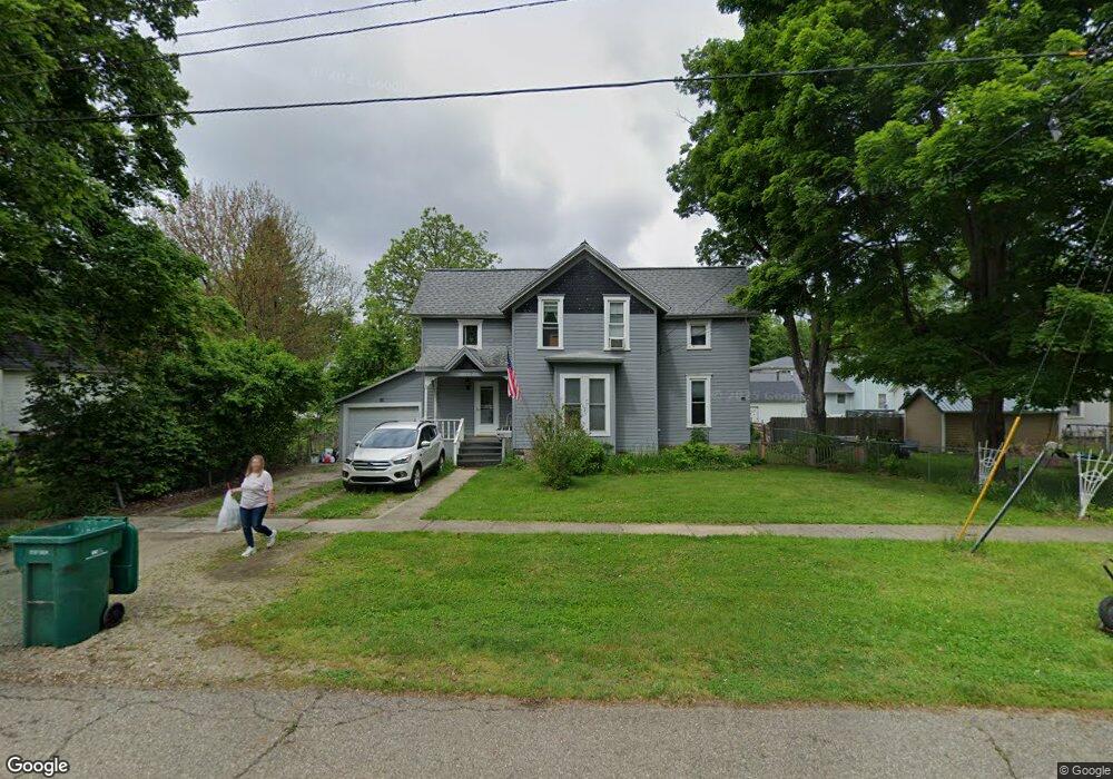
119 N Williams St Bellevue, MI 49021
Estimated Value: $130,000 - $164,000
3
Beds
1
Bath
1,440
Sq Ft
$104/Sq Ft
Est. Value
About This Home
This home is located at 119 N Williams St, Bellevue, MI 49021 and is currently estimated at $149,472, approximately $103 per square foot. 119 N Williams St is a home located in Eaton County with nearby schools including Bellevue Elementary School, Bellevue Junior/Senior High School, and Mt. Olivet Christian School.
Ownership History
Date
Name
Owned For
Owner Type
Purchase Details
Closed on
Mar 15, 2004
Sold by
Boyd Archie W and Bartlett Mary E
Bought by
Brown Rebecca
Current Estimated Value
Purchase Details
Closed on
Nov 7, 2002
Sold by
Little Tina G
Bought by
Boyd Archie W and Bartlett Mary E
Home Financials for this Owner
Home Financials are based on the most recent Mortgage that was taken out on this home.
Original Mortgage
$43,650
Interest Rate
5.62%
Create a Home Valuation Report for This Property
The Home Valuation Report is an in-depth analysis detailing your home's value as well as a comparison with similar homes in the area
Home Values in the Area
Average Home Value in this Area
Purchase History
| Date | Buyer | Sale Price | Title Company |
|---|---|---|---|
| Brown Rebecca | $45,000 | Independent Title Svcs Inc | |
| Boyd Archie W | $45,000 | Independent Title Svcs Inc |
Source: Public Records
Mortgage History
| Date | Status | Borrower | Loan Amount |
|---|---|---|---|
| Previous Owner | Boyd Archie W | $43,650 |
Source: Public Records
Tax History Compared to Growth
Tax History
| Year | Tax Paid | Tax Assessment Tax Assessment Total Assessment is a certain percentage of the fair market value that is determined by local assessors to be the total taxable value of land and additions on the property. | Land | Improvement |
|---|---|---|---|---|
| 2025 | $669 | $46,828 | $13,549 | $33,279 |
| 2024 | $237 | $42,748 | $0 | $0 |
| 2023 | $225 | $34,183 | $0 | $0 |
| 2022 | $607 | $32,780 | $0 | $0 |
| 2021 | $579 | $29,712 | $0 | $0 |
| 2020 | $801 | $27,882 | $0 | $0 |
| 2019 | $560 | $23,184 | $0 | $0 |
| 2018 | $547 | $21,042 | $0 | $0 |
| 2017 | $536 | $18,611 | $0 | $0 |
| 2016 | -- | $17,675 | $0 | $0 |
| 2015 | -- | $18,108 | $0 | $0 |
| 2014 | -- | $16,525 | $0 | $0 |
| 2013 | -- | $16,265 | $0 | $0 |
Source: Public Records
Map
Nearby Homes
- 314 W Jackson St
- 133 N Elizabeth St
- 623 N Main St
- 423 Sherwood Rd
- 729 N Main St
- 8590 Greenfield Hwy
- V L Burton Hwy
- V/L Burton Hwy
- 11371 Battle Creek Hwy
- 9206 Babcock Rd
- 9404 Babcock Rd
- 0 S Lacey Lake Rd Unit 289887
- 10122 E Jones Rd
- 11303 W Dr N
- 10950 W Dr N
- 12986 Bellevue Rd
- 5750 Messenger Hwy
- 0 Lynch Rd Unit 25041472
- 22485 Clear Lake Rd N
- 20900 14 Mile Rd
- 303 W Jackson St
- 309 W Jackson St
- 315 W Jackson St
- 304 W Capital Ave
- 318 W Capital Ave
- 323 W Jackson St
- 120 N Williams St
- 324 W Capital Ave
- 122 N Williams St
- 222 W Capital Ave
- 215 W Jackson St
- 304 W Jackson St
- 123 N Elizabeth St
- 405 W Jackson St
- 111 N Elizabeth St
- 404 W Capital Ave
- 224 W Jackson St
- 303 W Capital Ave
- 311 W Capital Ave