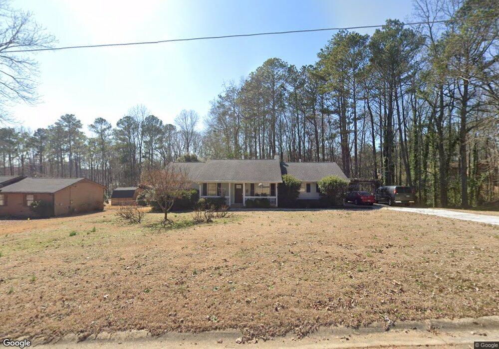
119 Old Lantern Ct Unit 6 Stockbridge, GA 30281
Estimated Value: $222,000 - $245,000
3
Beds
2
Baths
1,428
Sq Ft
$166/Sq Ft
Est. Value
About This Home
This home is located at 119 Old Lantern Ct Unit 6, Stockbridge, GA 30281 and is currently estimated at $236,466, approximately $165 per square foot. 119 Old Lantern Ct Unit 6 is a home located in Henry County with nearby schools including Cotton Indian Elementary School, Austin Road Middle School, and Stockbridge High School.
Ownership History
Date
Name
Owned For
Owner Type
Purchase Details
Closed on
Jul 27, 2004
Sold by
Cox Kelly A and Cox Stephen
Bought by
Nunn Clifford B and Nunn Donna
Current Estimated Value
Home Financials for this Owner
Home Financials are based on the most recent Mortgage that was taken out on this home.
Original Mortgage
$26,000
Outstanding Balance
$6,732
Interest Rate
6.22%
Mortgage Type
Unknown
Estimated Equity
$229,734
Create a Home Valuation Report for This Property
The Home Valuation Report is an in-depth analysis detailing your home's value as well as a comparison with similar homes in the area
Home Values in the Area
Average Home Value in this Area
Purchase History
| Date | Buyer | Sale Price | Title Company |
|---|---|---|---|
| Nunn Clifford B | $130,000 | -- |
Source: Public Records
Mortgage History
| Date | Status | Borrower | Loan Amount |
|---|---|---|---|
| Open | Nunn Clifford B | $26,000 | |
| Open | Nunn Clifford B | $104,000 |
Source: Public Records
Tax History Compared to Growth
Tax History
| Year | Tax Paid | Tax Assessment Tax Assessment Total Assessment is a certain percentage of the fair market value that is determined by local assessors to be the total taxable value of land and additions on the property. | Land | Improvement |
|---|---|---|---|---|
| 2025 | $654 | $91,876 | $14,000 | $77,876 |
| 2024 | $654 | $86,200 | $14,000 | $72,200 |
| 2023 | $417 | $87,040 | $14,000 | $73,040 |
| 2022 | $561 | $73,200 | $10,000 | $63,200 |
| 2021 | $558 | $56,520 | $10,000 | $46,520 |
| 2020 | $557 | $50,840 | $8,000 | $42,840 |
| 2019 | $1,138 | $45,920 | $8,000 | $37,920 |
| 2018 | $928 | $40,440 | $8,000 | $32,440 |
| 2016 | $1,176 | $36,680 | $6,000 | $30,680 |
| 2015 | $1,099 | $34,080 | $6,000 | $28,080 |
| 2014 | $970 | $30,600 | $4,800 | $25,800 |
Source: Public Records
Map
Nearby Homes
- 20 Lamp Post Ct
- 90 Country Roads Dr
- 230 Carriage Cir
- 20 Carriage Trace
- 219 Thorncrest
- 230 Flintlock Trail
- 0 E Atlanta Rd Unit @VALERIE CT 10464740
- 0 E Atlanta Rd Unit @KINSEY DR 10464743
- 1773 E Atlanta Rd
- 7031 Coatsworth Dr Unit 2
- 905 E Atlanta Rd
- 7001 Coatsworth Dr Unit LOT 1
- 145 Glenloch Pkwy
- 0 Stagecoach Rd Unit 20.17 ACRES 10455441
- 393 Young James Cir
- 389 Young James Cir
- 491 Thurman Rd Unit TRACT C
- 453 Azalea Dr
- 68 Pine Dr
- 20 King Place
- 109 Old Lantern Ct
- 129 Old Lantern Ct
- 170 Old Lantern Dr
- 120 Old Lantern Ct
- 110 Old Lantern Ct Unit 6
- 200 Country Roads Cir
- 130 Old Lantern Ct
- 165 Old Lantern Dr Unit 6
- 190 Country Roads Cir Unit 5
- 140 Old Lantern Ct
- 145 Old Lantern Dr
- 210 Country Roads Cir
- 155 Old Lantern Dr
- 125 Old Lantern Dr
- 135 Old Lantern Dr
- 220 Country Roads Cir
- 180 Country Roads Cir Unit 5
- 115 Old Lantern Dr
- 25 Lamp Post Ct
- 35 Lamp Post Ct