Estimated Value: $368,806 - $434,000
4
Beds
4
Baths
4,750
Sq Ft
$84/Sq Ft
Est. Value
About This Home
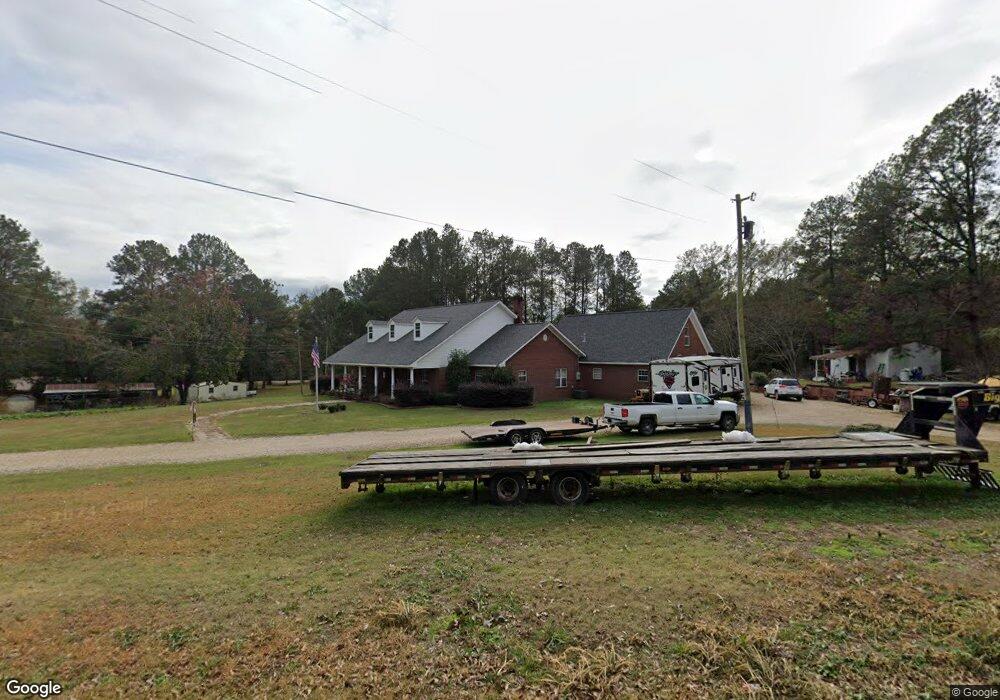
This home is located at 119 Scr 64, Mize, MS 39116 and is currently estimated at $398,452, approximately $83 per square foot. 119 Scr 64 is a home located in Smith County with nearby schools including Mize Attendance Center.
Ownership History
Date
Name
Owned For
Owner Type
Purchase Details
Closed on
Aug 6, 2021
Sold by
Mckissack Thomas N
Bought by
Norris Mary K
Current Estimated Value
Purchase Details
Closed on
Jun 25, 2021
Sold by
Mckissack Tabitha
Bought by
Mckissack Thomas N
Purchase Details
Closed on
Jun 11, 2018
Sold by
Mckissack Thomas N and Mckissack Tabitha
Bought by
Mckissack Thomas N and Norris Mary K
Create a Home Valuation Report for This Property
The Home Valuation Report is an in-depth analysis detailing your home's value as well as a comparison with similar homes in the area
Purchase History
| Date | Buyer | Sale Price | Title Company |
|---|---|---|---|
| Norris Mary K | -- | None Available | |
| Norris Mary K | -- | None Listed On Document | |
| Mckissack Thomas N | -- | None Available | |
| Mckissack Thomas N | -- | -- |
Source: Public Records
Tax History
| Year | Tax Paid | Tax Assessment Tax Assessment Total Assessment is a certain percentage of the fair market value that is determined by local assessors to be the total taxable value of land and additions on the property. | Land | Improvement |
|---|---|---|---|---|
| 2025 | $1,603 | $29,545 | $0 | $0 |
| 2024 | $1,603 | $23,147 | $0 | $0 |
| 2023 | $2,071 | $23,147 | $0 | $0 |
| 2022 | $2,071 | $23,147 | $0 | $0 |
| 2021 | $2,202 | $23,147 | $0 | $0 |
| 2020 | $1,989 | $21,443 | $0 | $0 |
| 2019 | $1,993 | $21,475 | $0 | $0 |
| 2018 | $3,190 | $21,475 | $0 | $0 |
| 2017 | $3,190 | $31,973 | $0 | $0 |
| 2016 | $3,076 | $31,278 | $0 | $0 |
| 2015 | -- | $32,004 | $0 | $0 |
| 2014 | -- | $32,004 | $0 | $0 |
Source: Public Records
Map
Nearby Homes
- 208 & 208B Cedar St
- 108 Brumley Ln
- 4603 Mississippi 28
- 8284 Mississippi 28
- 0 Mississippi 35
- 100 102 104 106 108 Oakview Ln
- 0 Highway 28 Unit 4124757
- 0 Highway 28 Unit 144030
- 0 County Road 77
- 0 Scr 73-A Unit 142818
- 33 Scr 50a1
- 02 Highway 28
- 0 County Road 63
- 391 Scr 62
- 3381 Scr 79
- 485 Scr 62
- 1055 Scr 62
- 1333 Scr 51
- 12168 Mississippi 28
- 188 E Cr 64
- 6313 Highway 28
- 6180 Highway 28
- 6075 Highway 28
- 718 Highway 28 W
- 473 Scr 35-5
- 718 Mississippi 28
- 6009 Highway 28
- Lot3 S C Rd #51
- 316 Scr 64
- 316 Scr 64
- 379 Scr 64
- 379 SCR 64 0 Unit SCR 64
- 711 Highway 28 W
- 430 Scr 39
- 832 Scr 54
- 398 Rose Hill Rd
- 0 Scr 54 Unit 1331249
- 0 Scr 54 Unit 331249
- 712 Highway 28 W
Your Personal Tour Guide
Ask me questions while you tour the home.