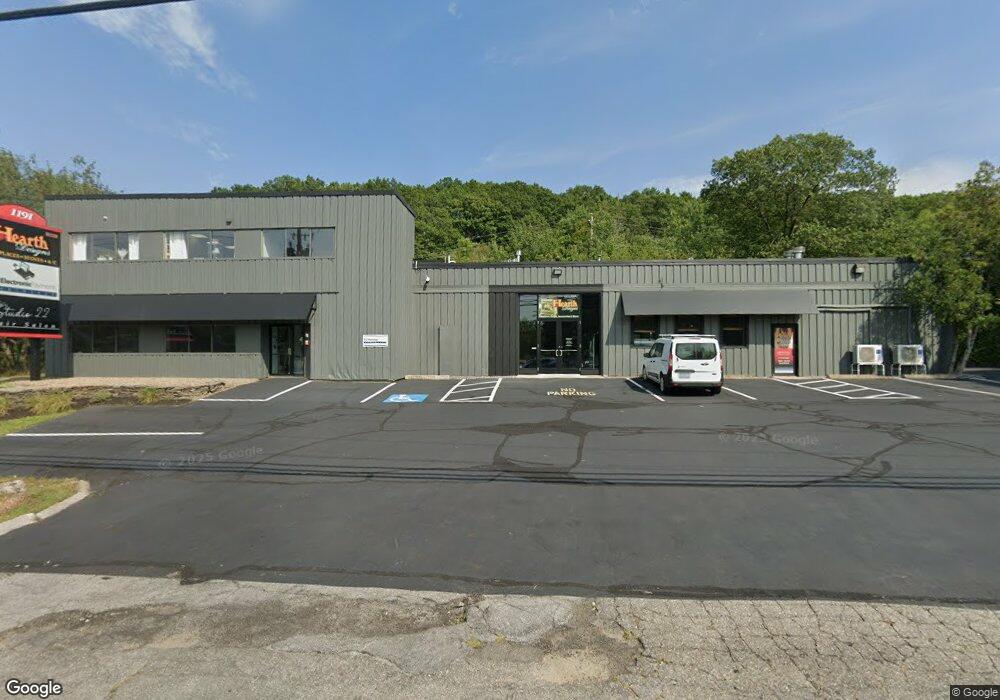
1191 Hooksett Rd Hooksett, NH 03106
Estimated Value: $1,158,222
Studio
--
Bath
8,640
Sq Ft
$134/Sq Ft
Est. Value
About This Home
This home is located at 1191 Hooksett Rd, Hooksett, NH 03106 and is currently estimated at $1,158,222, approximately $134 per square foot. 1191 Hooksett Rd is a home located in Merrimack County with nearby schools including Fred C. Underhill School, Hooksett Memorial School, and David R. Cawley Middle School.
Ownership History
Date
Name
Owned For
Owner Type
Purchase Details
Closed on
Nov 2, 2009
Sold by
1191 Hooksett Road Llc
Bought by
Labbe Realty Llc
Current Estimated Value
Purchase Details
Closed on
Aug 31, 2000
Sold by
Wright Clifford A and Wright Rose J
Bought by
1191 Hooksett Rd Llc
Create a Home Valuation Report for This Property
The Home Valuation Report is an in-depth analysis detailing your home's value as well as a comparison with similar homes in the area
Home Values in the Area
Average Home Value in this Area
Purchase History
| Date | Buyer | Sale Price | Title Company |
|---|---|---|---|
| Labbe Realty Llc | $530,000 | -- | |
| 1191 Hooksett Rd Llc | $445,000 | -- |
Source: Public Records
Mortgage History
| Date | Status | Borrower | Loan Amount |
|---|---|---|---|
| Open | 1191 Hooksett Rd Llc | $280,000 | |
| Closed | 1191 Hooksett Rd Llc | $224,000 | |
| Closed | 1191 Hooksett Rd Llc | $226,000 |
Source: Public Records
Tax History
| Year | Tax Paid | Tax Assessment Tax Assessment Total Assessment is a certain percentage of the fair market value that is determined by local assessors to be the total taxable value of land and additions on the property. | Land | Improvement |
|---|---|---|---|---|
| 2024 | $13,085 | $771,500 | $349,700 | $421,800 |
| 2023 | $12,329 | $771,500 | $349,700 | $421,800 |
| 2022 | $14,921 | $620,400 | $225,300 | $395,100 |
| 2021 | $13,785 | $620,400 | $225,300 | $395,100 |
| 2020 | $13,965 | $620,400 | $225,300 | $395,100 |
| 2019 | $13,370 | $620,400 | $225,300 | $395,100 |
| 2018 | $13,723 | $620,400 | $225,300 | $395,100 |
| 2017 | $15,028 | $562,000 | $199,900 | $362,100 |
| 2016 | $14,831 | $562,000 | $199,900 | $362,100 |
| 2015 | $3,437 | $562,000 | $199,900 | $362,100 |
| 2014 | $3,231 | $562,000 | $199,900 | $362,100 |
| 2013 | -- | $562,000 | $199,900 | $362,100 |
Source: Public Records
Map
Nearby Homes
- 9 Lancelot Dr
- 267 Londonderry Turnpike
- 1095 1097 1099 Hooksett Rd Unit 73, 74, 75
- 1099 Hooksett Rd Unit 73
- 1097 Hooksett Rd Unit 74
- 286 Londonderry Turnpike Unit A
- 1095 Hooksett Rd
- 286B Londonderry Turnpike Unit A
- 192 Londonderry Turnpike
- 36 Prescott Heights Rd
- 19 W Stearns Ave
- 13 Johns Dr
- 10 Dewberry Ln
- 9 Berry Hill Rd
- 41 Golden Gate Dr
- 190 Chase Way
- 6 Deerhead St
- 15 Joanne Dr
- 141 Chase Way
- 104 N Gate Rd
- 1160 Hooksett Rd
- 1160 Hooksett Rd Unit 1160 Hooksett Rd Apt 1
- 1160 Hooksett Rd Unit 4
- 1160 Hooksett Rd Unit Lower Level Unit, Wi
- 1160 Hooksett Rd Unit A
- 1160 Hooksett Rd
- 1193 Hooksett Rd
- 0 Autumn Run
- 0 Autumn Run
- 1181 Hooksett Rd
- 1181 Hooksett Rd Unit Warehouse 2
- 147 Mammoth Rd
- 1194 Hooksett Rd
- 145 Mammoth Rd
- 1176 Hooksett Rd
- 5 Atlas Ave
- 6 Frost Ave
- 10 Frost Ave
- 1 Autumn Run
- 1 Atlas Ave
Your Personal Tour Guide
Ask me questions while you tour the home.