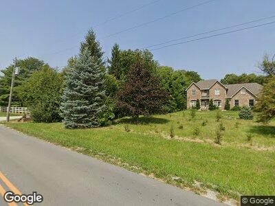
11911 Atlantic Rd Fortville, IN 46040
Olio NeighborhoodEstimated Value: $499,000 - $626,000
3
Beds
3
Baths
2,712
Sq Ft
$212/Sq Ft
Est. Value
About This Home
This home is located at 11911 Atlantic Rd, Fortville, IN 46040 and is currently estimated at $575,250, approximately $212 per square foot. 11911 Atlantic Rd is a home located in Hamilton County with nearby schools including Southeastern Elementary School, Hamilton Southeastern Intermediate / Junior High, and Hamilton Southeastern High School.
Ownership History
Date
Name
Owned For
Owner Type
Purchase Details
Closed on
Apr 16, 2001
Sold by
Vanrenterghem Jo and Deer Jo
Bought by
Jenniges Timothy D and Jenniges Lori A
Current Estimated Value
Home Financials for this Owner
Home Financials are based on the most recent Mortgage that was taken out on this home.
Original Mortgage
$158,300
Interest Rate
7.03%
Create a Home Valuation Report for This Property
The Home Valuation Report is an in-depth analysis detailing your home's value as well as a comparison with similar homes in the area
Home Values in the Area
Average Home Value in this Area
Purchase History
| Date | Buyer | Sale Price | Title Company |
|---|---|---|---|
| Jenniges Timothy D | -- | First American Title Ins Co |
Source: Public Records
Mortgage History
| Date | Status | Borrower | Loan Amount |
|---|---|---|---|
| Open | Jenniges Timothy D | $198,000 | |
| Closed | Jenniges Timothy D | $125,000 | |
| Closed | Jenniges Timothy D | $62,500 | |
| Closed | Jenniges Timothy D | $207,000 | |
| Closed | Jenniges Timothy D | $158,300 | |
| Closed | Jenniges Timothy D | $19,750 |
Source: Public Records
Tax History Compared to Growth
Tax History
| Year | Tax Paid | Tax Assessment Tax Assessment Total Assessment is a certain percentage of the fair market value that is determined by local assessors to be the total taxable value of land and additions on the property. | Land | Improvement |
|---|---|---|---|---|
| 2024 | $4,225 | $420,900 | $112,700 | $308,200 |
| 2023 | $4,225 | $416,300 | $112,700 | $303,600 |
| 2022 | $4,333 | $389,300 | $112,700 | $276,600 |
| 2021 | $3,497 | $308,600 | $112,700 | $195,900 |
| 2020 | $3,536 | $309,800 | $112,700 | $197,100 |
| 2019 | $3,137 | $283,400 | $86,100 | $197,300 |
| 2018 | $3,351 | $283,800 | $86,100 | $197,700 |
| 2017 | $2,998 | $266,900 | $86,100 | $180,800 |
| 2016 | $2,879 | $257,500 | $86,100 | $171,400 |
| 2014 | $2,374 | $230,800 | $61,500 | $169,300 |
| 2013 | $2,374 | $234,200 | $61,500 | $172,700 |
Source: Public Records
Map
Nearby Homes
- 16870 Imperial Ct
- 16719 Sunland Farm Dr
- 16719 Sunland Farm Dr
- 16719 Sunland Farm Dr
- 16719 Sunland Farm Dr
- 12535 Tidecrest Dr
- 11419 Neptune Dr
- 15882 Vitalize Run
- 15835 Vitalize Run
- 12057 Gray Ghost Way
- 12057 Gray Ghost Way
- 12057 Gray Ghost Way
- 12057 Gray Ghost Way
- 12057 Gray Ghost Way
- 12057 Gray Ghost Way
- 15846 Vitalize Run
- 15786 Vitalize Run
- 15871 Vitalize Run
- 12536 Lowery Way
- 12594 Tidecrest Dr
- 11911 Atlantic Rd
- 11959 Atlantic Rd
- 11825 Atlantic Rd
- 12283 Tidecrest Dr
- 12297 Tidecrest Dr
- 12255 Tidecrest Dr
- 16478 Southeastern Pkwy
- 12213 Tidecrest Dr
- 12089 Atlantic Rd
- 12282 Tidecrest Dr
- 12199 Tidecrest Dr
- 12198 Tidecrest Dr
- 12324 Tidecrest Dr
- 12227 Tidecrest Dr
- 11675 Atlantic Rd
- 12185 Tidecrest Dr
- 1000 S Watt Landing
- 1 S Watt Landing
- 12338 Tidecrest Dr