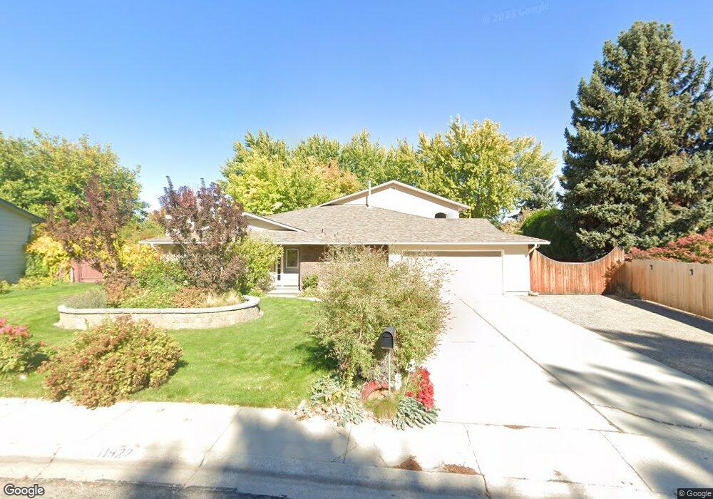
11922 La Pan Dr Boise, ID 83709
Southwest Boise NeighborhoodEstimated Value: $724,000 - $823,000
3
Beds
2
Baths
3,499
Sq Ft
$215/Sq Ft
Est. Value
About This Home
This home is located at 11922 La Pan Dr, Boise, ID 83709 and is currently estimated at $750,799, approximately $214 per square foot. 11922 La Pan Dr is a home located in Ada County with nearby schools including Pepper Ridge Elementary, Lewis & Clark Middle School, and Centennial High School.
Ownership History
Date
Name
Owned For
Owner Type
Purchase Details
Closed on
Jul 25, 2014
Sold by
Mason Cynthia J
Bought by
Mason Ted E and Mason Cynthia J
Current Estimated Value
Home Financials for this Owner
Home Financials are based on the most recent Mortgage that was taken out on this home.
Original Mortgage
$81,500
Outstanding Balance
$62,009
Interest Rate
4.13%
Mortgage Type
Credit Line Revolving
Estimated Equity
$688,790
Purchase Details
Closed on
May 5, 2011
Sold by
Mason Cynthia J and Langston Cynthia J
Bought by
Mason Cynthia J
Home Financials for this Owner
Home Financials are based on the most recent Mortgage that was taken out on this home.
Original Mortgage
$76,600
Interest Rate
4.05%
Mortgage Type
New Conventional
Purchase Details
Closed on
Jun 27, 1997
Sold by
Zemaitis Michelle and Edmonds James Arthur John
Bought by
Langston Cynthia J
Home Financials for this Owner
Home Financials are based on the most recent Mortgage that was taken out on this home.
Original Mortgage
$93,950
Interest Rate
7.91%
Mortgage Type
Purchase Money Mortgage
Purchase Details
Closed on
May 27, 1997
Sold by
Zemaitis Phillip P and Zemaitis Michelle
Bought by
Zemaitis Michelle and Edmonds Ivy Hilda
Home Financials for this Owner
Home Financials are based on the most recent Mortgage that was taken out on this home.
Original Mortgage
$93,950
Interest Rate
7.91%
Mortgage Type
Purchase Money Mortgage
Purchase Details
Closed on
May 13, 1997
Sold by
Edmonds James
Bought by
Zemaitis Phillip P and Zemaitis Michelle
Home Financials for this Owner
Home Financials are based on the most recent Mortgage that was taken out on this home.
Original Mortgage
$93,950
Interest Rate
7.91%
Mortgage Type
Purchase Money Mortgage
Purchase Details
Closed on
May 2, 1997
Sold by
Kitazumi Denise
Bought by
Zemaitis Phillip P and Zemaitis Michelle
Home Financials for this Owner
Home Financials are based on the most recent Mortgage that was taken out on this home.
Original Mortgage
$93,950
Interest Rate
7.91%
Mortgage Type
Purchase Money Mortgage
Purchase Details
Closed on
Apr 28, 1997
Sold by
Zemaitis Michelle and Edmonds James Arthur John
Bought by
Zemaitis Michelle and Edmonds James
Home Financials for this Owner
Home Financials are based on the most recent Mortgage that was taken out on this home.
Original Mortgage
$93,950
Interest Rate
7.91%
Mortgage Type
Purchase Money Mortgage
Purchase Details
Closed on
Apr 20, 1997
Sold by
Zemaitis Michelle
Bought by
Zemaitis Phillip P and Zemaitis Michelle
Create a Home Valuation Report for This Property
The Home Valuation Report is an in-depth analysis detailing your home's value as well as a comparison with similar homes in the area
Home Values in the Area
Average Home Value in this Area
Purchase History
| Date | Buyer | Sale Price | Title Company |
|---|---|---|---|
| Mason Ted E | -- | Pioneer Title Company | |
| Mason Cynthia J | -- | Alliance Title Production Ce | |
| Langston Cynthia J | -- | Pioneer Title Company | |
| Zemaitis Michelle | -- | -- | |
| Zemaitis Phillip P | -- | -- | |
| Zemaitis Phillip P | -- | -- | |
| Zemaitis Michelle | -- | -- | |
| Zemaitis Phillip P | -- | -- |
Source: Public Records
Mortgage History
| Date | Status | Borrower | Loan Amount |
|---|---|---|---|
| Open | Mason Ted E | $81,500 | |
| Closed | Mason Cynthia J | $76,600 | |
| Closed | Langston Cynthia J | $93,950 |
Source: Public Records
Tax History Compared to Growth
Tax History
| Year | Tax Paid | Tax Assessment Tax Assessment Total Assessment is a certain percentage of the fair market value that is determined by local assessors to be the total taxable value of land and additions on the property. | Land | Improvement |
|---|---|---|---|---|
| 2025 | $3,681 | $741,700 | -- | -- |
| 2024 | $3,155 | $682,000 | -- | -- |
| 2023 | $3,155 | $578,300 | $0 | $0 |
| 2022 | $4,345 | $769,000 | $0 | $0 |
| 2021 | $4,151 | $598,700 | $0 | $0 |
| 2020 | $3,579 | $459,300 | $0 | $0 |
| 2019 | $4,421 | $445,400 | $0 | $0 |
| 2018 | $3,720 | $362,000 | $0 | $0 |
| 2017 | $1,548 | $202,000 | $0 | $0 |
| 2016 | $1,561 | $195,100 | $0 | $0 |
| 2015 | $1,316 | $174,200 | $0 | $0 |
| 2012 | -- | $123,400 | $0 | $0 |
Source: Public Records
Map
Nearby Homes
- 11829 W Camas St
- 12152 W Lewisburg Ct
- 12410 W Lewisburg Dr
- 11899 W Blueberry Ct
- 11683 W Aldershot St
- 12158 W Silverking Ct
- 1132 S Amaya Ave
- 11225 W Camas St
- 681 S Kiser Ave
- 704 S Kiser Ave
- 4216 Woodmurra St
- 4202 Woodmurra St
- 4187 E Blueberry St
- 4498 E Goldstone Dr
- 4132 E Silverking Ln
- 10776 W Smoke Ranch Dr
- 2029 S Wilde Creek Way
- 3970 E Overland Rd
- 937 S Nautilus Ave
- 11085 W Bridgetower Dr
- 11954 La Pan Dr
- 11898 La Pan Dr
- 11898 W La Pan Dr
- 11894 La Pan Dr
- 11935 W Lewisburg Ct
- 11917 W Lewisburg Ct
- 11953 W Lewisburg Ct
- 11986 La Pan Dr
- 11879 W Lewisburg Ct
- 11971 W Lewisburg Ct
- 11923 La Pan Dr
- 11855 W Lewisburg Ct
- 11885 La Pan Dr
- 11885 W La Pan Dr
- 11999 W Lewisburg Ct
- 11890 La Pan Dr
- 11876 La Pan Dr
- 11981 La Pan Dr
- 12002 La Pan Dr
- 12007 W Lewisburg Ct