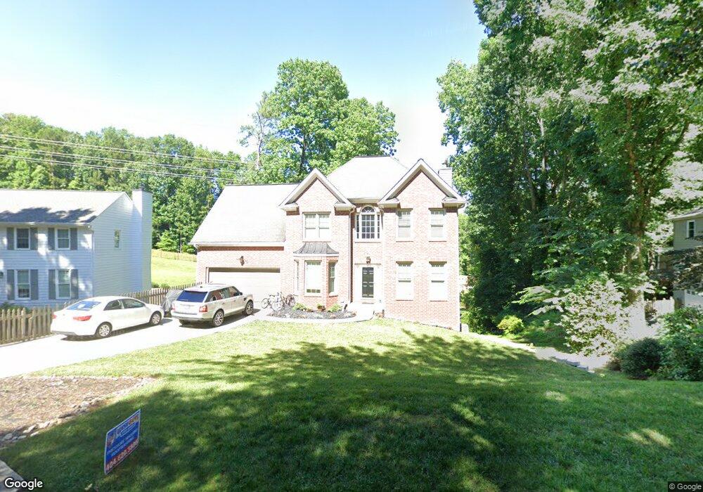
1196 Colony Cir Unit 2 Marietta, GA 30068
East Cobb NeighborhoodEstimated Value: $569,000 - $663,000
4
Beds
3
Baths
2,364
Sq Ft
$267/Sq Ft
Est. Value
About This Home
This home is located at 1196 Colony Cir Unit 2, Marietta, GA 30068 and is currently estimated at $631,680, approximately $267 per square foot. 1196 Colony Cir Unit 2 is a home located in Cobb County with nearby schools including Mount Bethel Elementary School, Dickerson Middle School, and Walton High School.
Ownership History
Date
Name
Owned For
Owner Type
Purchase Details
Closed on
Dec 10, 2007
Sold by
Hobgood Hurricane Land Trust
Bought by
Blount Jaredd E and Hunter Renee
Current Estimated Value
Home Financials for this Owner
Home Financials are based on the most recent Mortgage that was taken out on this home.
Original Mortgage
$303,000
Outstanding Balance
$190,122
Interest Rate
6.22%
Mortgage Type
New Conventional
Estimated Equity
$441,558
Purchase Details
Closed on
Jul 25, 2007
Sold by
Jackson Walter W
Bought by
Hobgood Hurricane Land Trust
Purchase Details
Closed on
Aug 19, 2003
Sold by
Huber Daniel R and Huber Christy L
Bought by
Jackson Walter W
Home Financials for this Owner
Home Financials are based on the most recent Mortgage that was taken out on this home.
Original Mortgage
$261,250
Interest Rate
8.49%
Mortgage Type
New Conventional
Create a Home Valuation Report for This Property
The Home Valuation Report is an in-depth analysis detailing your home's value as well as a comparison with similar homes in the area
Home Values in the Area
Average Home Value in this Area
Purchase History
| Date | Buyer | Sale Price | Title Company |
|---|---|---|---|
| Blount Jaredd E | $319,000 | -- | |
| Hobgood Hurricane Land Trust | $210,000 | -- | |
| Jackson Walter W | $275,100 | -- |
Source: Public Records
Mortgage History
| Date | Status | Borrower | Loan Amount |
|---|---|---|---|
| Open | Blount Jaredd E | $303,000 | |
| Previous Owner | Jackson Walter W | $261,250 |
Source: Public Records
Tax History Compared to Growth
Tax History
| Year | Tax Paid | Tax Assessment Tax Assessment Total Assessment is a certain percentage of the fair market value that is determined by local assessors to be the total taxable value of land and additions on the property. | Land | Improvement |
|---|---|---|---|---|
| 2025 | $380 | $245,216 | $48,000 | $197,216 |
| 2024 | $367 | $221,612 | $38,400 | $183,212 |
| 2023 | $214 | $199,568 | $38,400 | $161,168 |
| 2022 | $1,961 | $182,948 | $30,400 | $152,548 |
| 2021 | $1,987 | $182,948 | $30,400 | $152,548 |
| 2020 | $1,395 | $141,316 | $25,600 | $115,716 |
| 2019 | $1,539 | $141,316 | $25,600 | $115,716 |
| 2018 | $1,677 | $141,316 | $25,600 | $115,716 |
| 2017 | $3,686 | $141,316 | $25,600 | $115,716 |
| 2016 | $3,504 | $132,952 | $25,600 | $107,352 |
| 2015 | $3,131 | $115,124 | $25,600 | $89,524 |
| 2014 | $3,158 | $115,124 | $0 | $0 |
Source: Public Records
Map
Nearby Homes
- 5197 Forest Brook Pkwy
- 5000 Lakeland Dr
- 5157 Forest Brook Pkwy
- 1420 Lafayette Ln
- 1382 Huntingford Dr Unit 2
- 931 New Bedford Dr
- 5184 Deering Trail Unit 2
- 1044 Little Willeo Rd Unit 1
- 748 Olde Towne Ln
- 742 Olde Towne Ln
- 748 Noble Oak Dr
- 1129 Topaz Way
- 5122 Sapphire Dr
- 5290 Lower Roswell Rd
- 5473 Heyward Square Place
- 1525 Huntingford Dr
- 4831 Emmitt Point NE
- 1190 Colony Cir
- 1200 Colony Cir
- 1189 Forest Brook Ct
- 1170 Colony Cir
- 1210 Colony Cir Unit 2
- 1193 Forest Brook Ct
- 1185 Forest Brook Ct
- 1189 Colony Cir
- 0 Colony Cir Unit 8376895
- 1160 Colony Cir
- 1220 Colony Cir
- 1179 Colony Cir
- 1197 Forest Brook Ct
- 1181 Forest Brook Ct
- 1230 Colony Cir
- 1186 Forest Brook Ct
- 1150 Colony Cir
- 1159 Colony Cir
- 1176 Lake Colony Dr
- 1239 Colony Cir Unit 3