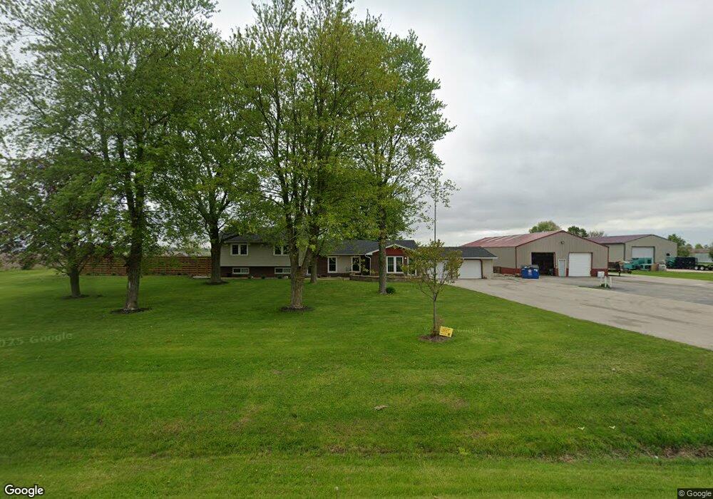
11980 Grove Rd Minooka, IL 60447
North Minooka NeighborhoodEstimated Value: $412,983 - $565,000
4
Beds
2
Baths
1,632
Sq Ft
$283/Sq Ft
Est. Value
About This Home
This home is located at 11980 Grove Rd, Minooka, IL 60447 and is currently estimated at $461,996, approximately $283 per square foot. 11980 Grove Rd is a home located in Kendall County with nearby schools including Hunt Club Elementary School, Traughber Junior High School, and Oswego High School.
Ownership History
Date
Name
Owned For
Owner Type
Purchase Details
Closed on
May 29, 2013
Sold by
Seaborg Thomas and Seaborg Elizabeth
Bought by
Schuda Edmund
Current Estimated Value
Purchase Details
Closed on
Apr 10, 2008
Sold by
Wyncott Dean A and Wyncott Colleen A
Bought by
Seaborg Thomas and Seaborg Elizabeth
Home Financials for this Owner
Home Financials are based on the most recent Mortgage that was taken out on this home.
Original Mortgage
$250,400
Interest Rate
5.93%
Mortgage Type
Purchase Money Mortgage
Purchase Details
Closed on
Jul 1, 1994
Bought by
Wyncott Dean A and Wyncott Colleen A
Create a Home Valuation Report for This Property
The Home Valuation Report is an in-depth analysis detailing your home's value as well as a comparison with similar homes in the area
Home Values in the Area
Average Home Value in this Area
Purchase History
| Date | Buyer | Sale Price | Title Company |
|---|---|---|---|
| Schuda Edmund | $3,500 | First American Title Insuran | |
| Seaborg Thomas | $313,000 | Chicago Title Insurance Co | |
| Wyncott Dean A | $134,000 | -- |
Source: Public Records
Mortgage History
| Date | Status | Borrower | Loan Amount |
|---|---|---|---|
| Previous Owner | Seaborg Thomas | $250,400 | |
| Closed | Wyncott Dean A | -- |
Source: Public Records
Tax History Compared to Growth
Tax History
| Year | Tax Paid | Tax Assessment Tax Assessment Total Assessment is a certain percentage of the fair market value that is determined by local assessors to be the total taxable value of land and additions on the property. | Land | Improvement |
|---|---|---|---|---|
| 2024 | $6,851 | $108,343 | $12,737 | $95,606 |
| 2023 | $6,470 | $97,975 | $12,130 | $85,845 |
| 2022 | $6,470 | $90,897 | $10,925 | $79,972 |
| 2021 | $6,016 | $86,267 | $11,091 | $75,176 |
| 2020 | $5,739 | $81,148 | $10,433 | $70,715 |
| 2019 | $5,492 | $77,639 | $9,982 | $67,657 |
| 2018 | $5,349 | $74,191 | $9,982 | $64,209 |
| 2017 | $5,258 | $66,516 | $9,982 | $56,534 |
| 2016 | $4,912 | $61,626 | $9,859 | $51,767 |
| 2015 | $4,850 | $58,486 | $9,859 | $48,627 |
| 2014 | $2,572 | $58,486 | $9,859 | $48,627 |
| 2013 | $2,572 | $58,486 | $9,859 | $48,627 |
Source: Public Records
Map
Nearby Homes
- 2106 Rosehall Dr
- 2305 Rosehall Dr
- 8513 Sawyer Ct
- 8508 Sawyer Ct
- 8413 Eva Ave
- 2211 Providence Way
- 901 Sable Ridge Dr
- 8313 Wildspring Pkwy
- 8317 Pembridge Ct
- 8208 Onyx Ln
- 8307 Greenbridge Ct
- 1810 Wildspring Pkwy
- 2147 Pembridge Ln
- 15771 Brisbin Rd
- 8115 Settlers Pond Way
- 8104 Arlington Ln
- 8109 Tremont Ln
- 1045 Heron Cir
- 1047 Heron Cir
- 1028 Heron Cir
- 11980 Grove Rd
- 12026 Grove Rd
- 12030 Grove Rd
- 12090 Grove Rd
- 12232 Grove Rd
- 000 Helmar Rd
- 1802 Grove Rd
- 4728 Chicago Rd
- 11381 Grove Rd
- 5165 Chicago Rd
- 12495 Grove Rd
- 5247 Chicago Rd
- 4405 Chicago Rd
- 5276 Chicago Rd
- 4358 Chicago Rd
- 2101 Grove Rd
- 4275 Chicago Rd
- 0 Grove Rd
- 0 Grove Rd Unit MRD07121509
- 11900 Brisbin Rd