Estimated Value: $341,000 - $380,222
3
Beds
2
Baths
1,716
Sq Ft
$212/Sq Ft
Est. Value
About This Home
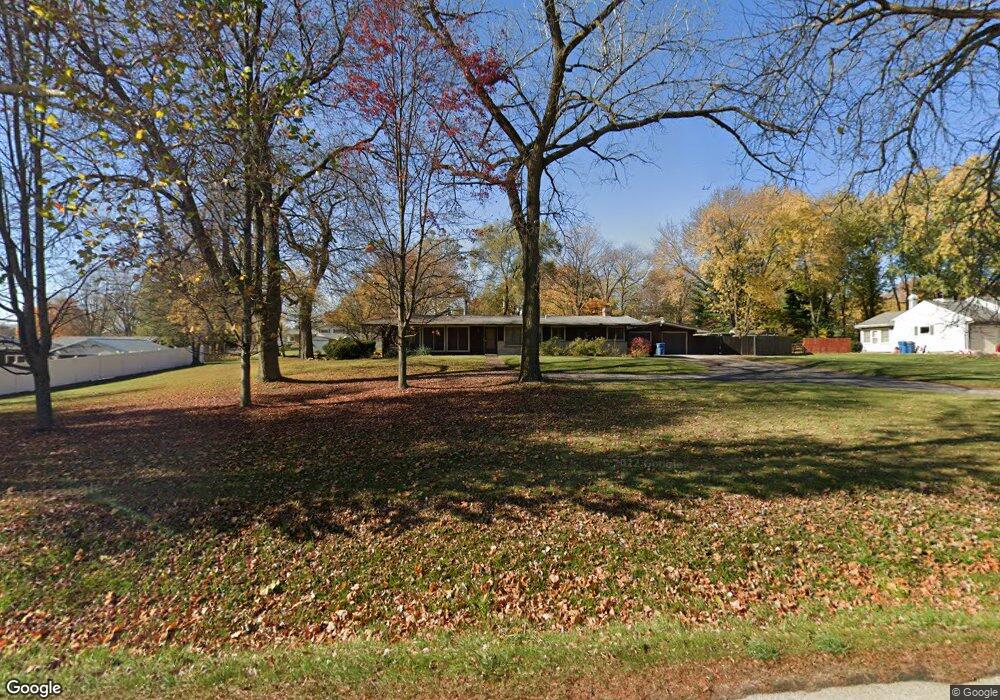
This home is located at 11N936 Randall Rd, Elgin, IL 60123 and is currently estimated at $364,556, approximately $212 per square foot. 11N936 Randall Rd is a home located in Kane County with nearby schools including Hillcrest Elementary School, Kimball Middle School, and Larkin High School.
Ownership History
Date
Name
Owned For
Owner Type
Purchase Details
Closed on
Jun 26, 2017
Sold by
Sommers Dennis R and Sommers Christine M
Bought by
Sommers Dennis R and Sommers Christine M
Current Estimated Value
Purchase Details
Closed on
Aug 16, 1994
Sold by
Orstrom Violet M and Zabilka Linda
Bought by
Sommers Dennis R and Sommers Christine M
Home Financials for this Owner
Home Financials are based on the most recent Mortgage that was taken out on this home.
Original Mortgage
$66,720
Interest Rate
8.72%
Mortgage Type
Purchase Money Mortgage
Create a Home Valuation Report for This Property
The Home Valuation Report is an in-depth analysis detailing your home's value as well as a comparison with similar homes in the area
Home Values in the Area
Average Home Value in this Area
Purchase History
| Date | Buyer | Sale Price | Title Company |
|---|---|---|---|
| Sommers Dennis R | -- | None Available | |
| Sommers Dennis R | -- | None Available |
Source: Public Records
Mortgage History
| Date | Status | Borrower | Loan Amount |
|---|---|---|---|
| Closed | Sommers Dennis R | $66,720 |
Source: Public Records
Tax History Compared to Growth
Tax History
| Year | Tax Paid | Tax Assessment Tax Assessment Total Assessment is a certain percentage of the fair market value that is determined by local assessors to be the total taxable value of land and additions on the property. | Land | Improvement |
|---|---|---|---|---|
| 2024 | $3,011 | $103,334 | $27,226 | $76,108 |
| 2023 | $3,193 | $93,355 | $24,597 | $68,758 |
| 2022 | $3,664 | $85,123 | $22,428 | $62,695 |
| 2021 | $3,710 | $79,584 | $20,969 | $58,615 |
| 2020 | $3,777 | $75,975 | $20,018 | $55,957 |
| 2019 | $3,829 | $72,371 | $19,068 | $53,303 |
| 2018 | $4,021 | $75,365 | $17,963 | $57,402 |
| 2017 | $4,155 | $71,246 | $16,981 | $54,265 |
| 2016 | $4,301 | $66,097 | $15,754 | $50,343 |
| 2015 | -- | $60,584 | $14,440 | $46,144 |
| 2014 | -- | $57,916 | $14,262 | $43,654 |
| 2013 | -- | $59,444 | $14,638 | $44,806 |
Source: Public Records
Map
Nearby Homes
- 2461 Tall Oaks Dr
- 219 Brookside Dr
- 12N309 Hilltop Rd
- 514 Shagbark Dr
- 519 Shagbark Dr
- 640 Highland Springs Dr
- Lot 1 Highland Springs Dr
- 514 Madison Ln
- 2705 Colonial Dr
- 515 Madison Ln
- 40 Acres Randall Rd
- 2817 Weld Rd
- 2022 Torino Dr
- 2214 Colorado Ave Unit 4
- 2206 Colorado Ave Unit 3
- 2960 Marshfield Dr
- 11N312 Gale St
- 2181 Colorado Ave Unit 3
- 2141 Colorado Ave Unit 3
- 92 N Airlite St
- 11N964 Randall Rd
- 37W038 Brookside Dr
- 11N935 Hilltop Rd
- Lot 5 Tall Oaks Ct
- 11N959 Hilltop Rd
- 11N984 Randall Rd
- 11N323 Brookside Dr
- 11N911 Hilltop Rd
- 405 Tall Oaks Ct
- 403 Tall Oaks Ct
- 403 Tall Oaks Ct Unit 403
- 11N981 Hilltop Rd
- 401 Tall Oaks Ct
- 413 Tall Oaks Ct
- 12N004 Randall Rd
- 411 Tall Oaks Ct
- 37W055 Brookside Dr
- 37W075 Brookside Dr
- 12N003 Hilltop Rd
- 12N020 Randall Rd