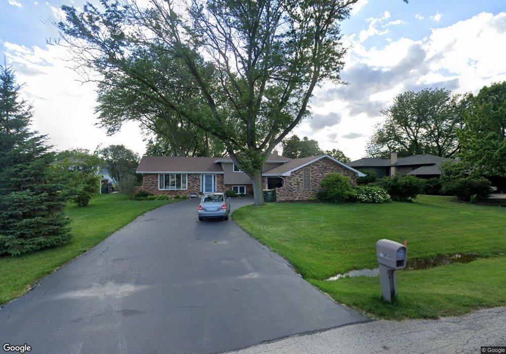
11S664 Mcgrath Ln Naperville, IL 60564
Wheatland South NeighborhoodEstimated Value: $482,654 - $577,000
3
Beds
3
Baths
1,482
Sq Ft
$348/Sq Ft
Est. Value
About This Home
This home is located at 11S664 Mcgrath Ln, Naperville, IL 60564 and is currently estimated at $515,914, approximately $348 per square foot. 11S664 Mcgrath Ln is a home with nearby schools including Clifford Crone Middle School, Neuqua Valley High School, and Covenant Classical School.
Ownership History
Date
Name
Owned For
Owner Type
Purchase Details
Closed on
Nov 8, 2023
Sold by
Schoeck Jennifer Lynn
Bought by
Schoeck Kevin E
Current Estimated Value
Purchase Details
Closed on
Apr 20, 2015
Sold by
Schoeck Kevin E
Bought by
Schoeck Kevin E and Schoeck Jennifer Lynn
Purchase Details
Closed on
May 13, 2004
Sold by
Artos Eugene R and Artos Peggy G
Bought by
Schoeck Kevin E
Home Financials for this Owner
Home Financials are based on the most recent Mortgage that was taken out on this home.
Original Mortgage
$234,000
Interest Rate
5.85%
Mortgage Type
Purchase Money Mortgage
Create a Home Valuation Report for This Property
The Home Valuation Report is an in-depth analysis detailing your home's value as well as a comparison with similar homes in the area
Home Values in the Area
Average Home Value in this Area
Purchase History
| Date | Buyer | Sale Price | Title Company |
|---|---|---|---|
| Schoeck Kevin E | $10,000 | None Listed On Document | |
| Schoeck Kevin E | -- | Attorney | |
| Schoeck Kevin E | $260,000 | Chicago Title Insurance Co |
Source: Public Records
Mortgage History
| Date | Status | Borrower | Loan Amount |
|---|---|---|---|
| Previous Owner | Schoeck Kevin E | $234,000 |
Source: Public Records
Tax History
| Year | Tax Paid | Tax Assessment Tax Assessment Total Assessment is a certain percentage of the fair market value that is determined by local assessors to be the total taxable value of land and additions on the property. | Land | Improvement |
|---|---|---|---|---|
| 2024 | $8,144 | $144,215 | $25,941 | $118,274 |
| 2023 | $8,144 | $127,398 | $22,916 | $104,482 |
| 2022 | $6,849 | $109,550 | $21,679 | $87,871 |
| 2021 | $6,516 | $104,334 | $20,647 | $83,687 |
| 2020 | $6,394 | $102,681 | $20,320 | $82,361 |
| 2019 | $6,282 | $99,787 | $19,747 | $80,040 |
| 2018 | $5,791 | $90,668 | $19,312 | $71,356 |
| 2017 | $5,710 | $88,327 | $18,813 | $69,514 |
| 2016 | $5,693 | $86,426 | $18,408 | $68,018 |
| 2015 | -- | $83,102 | $17,700 | $65,402 |
| 2014 | -- | $72,420 | $17,700 | $54,720 |
| 2013 | -- | $72,420 | $17,700 | $54,720 |
Source: Public Records
Map
Nearby Homes
- 2344 Corn Lily Rd
- 29W376 Wagner Rd
- 2255 Wendt Cir
- 3847 Gold Cup Ln
- 3021 Saganashkee Ln
- 4507 Barr Creek Ln
- 1364 Saxon Ln
- 3307 Danlaur Ct Unit 6
- 3281 Cool Springs Ct
- 1367 Saxon Ln
- 3060 Crystal Rock Rd
- 4711 Snapjack Cir
- 3027 Brossman St
- 2703 Wait Rd Unit 3
- 4204 Falkner Dr Unit 3
- 3432 Redwing Dr Unit 2
- 2423 Durango Ln
- 3740 Caine Dr
- 3415 Minito Ct
- 1244 Hollingswood Ave
- 11S650 Mcgrath Ln
- 11S678 Mcgrath Ln
- 11S671 Mcgrath Ln
- 3812 Mallard Ln
- 11S634 Mcgrath Ln
- 3820 Mallard Ln
- 3808 Mallard Ln
- 11S639 Mcgrath Ln
- 3824 Mallard Ln
- 29W331 Andermann Dr
- lot Mc Grath Ln
- Lot 274 Mcgrath Ln
- 11S716 Mcgrath Ln
- 29W344 Mark Dr
- 29W332 Andermann Dr
- 29W332 Mark Dr
- 3828 Mallard Ln
- 29W317 Andermann Dr
- 11S612 Mcgrath Ln
- 3815 Mallard Ln
Your Personal Tour Guide
Ask me questions while you tour the home.