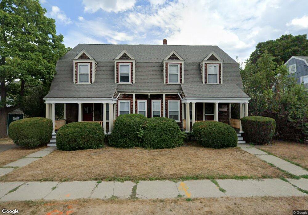
12-14 Grafton Ave Unit 12 Milton, MA 02186
Estimated Value: $1,247,000 - $1,515,155
3
Beds
1
Bath
1,688
Sq Ft
$800/Sq Ft
Est. Value
About This Home
This home is located at 12-14 Grafton Ave Unit 12, Milton, MA 02186 and is currently estimated at $1,351,039, approximately $800 per square foot. 12-14 Grafton Ave Unit 12 is a home located in Norfolk County with nearby schools including Milton High School, St. Agatha School, and Milton Academy.
Ownership History
Date
Name
Owned For
Owner Type
Purchase Details
Closed on
Sep 19, 2013
Sold by
Cook Caroline A
Bought by
Griffin Catherine
Current Estimated Value
Home Financials for this Owner
Home Financials are based on the most recent Mortgage that was taken out on this home.
Original Mortgage
$420,000
Outstanding Balance
$306,432
Interest Rate
4%
Mortgage Type
Adjustable Rate Mortgage/ARM
Estimated Equity
$1,044,607
Create a Home Valuation Report for This Property
The Home Valuation Report is an in-depth analysis detailing your home's value as well as a comparison with similar homes in the area
Home Values in the Area
Average Home Value in this Area
Purchase History
| Date | Buyer | Sale Price | Title Company |
|---|---|---|---|
| Griffin Catherine | $625,000 | -- |
Source: Public Records
Mortgage History
| Date | Status | Borrower | Loan Amount |
|---|---|---|---|
| Open | Griffin Catherine | $420,000 |
Source: Public Records
Tax History Compared to Growth
Tax History
| Year | Tax Paid | Tax Assessment Tax Assessment Total Assessment is a certain percentage of the fair market value that is determined by local assessors to be the total taxable value of land and additions on the property. | Land | Improvement |
|---|---|---|---|---|
| 2025 | $13,019 | $1,173,900 | $511,100 | $662,800 |
| 2024 | $12,756 | $1,168,100 | $486,700 | $681,400 |
| 2023 | $12,638 | $1,108,600 | $463,600 | $645,000 |
| 2022 | $11,530 | $924,600 | $463,600 | $461,000 |
| 2021 | $11,112 | $846,300 | $407,200 | $439,100 |
| 2020 | $10,470 | $798,000 | $399,500 | $398,500 |
| 2019 | $9,690 | $735,200 | $387,900 | $347,300 |
| 2018 | $9,736 | $705,000 | $342,900 | $362,100 |
| 2017 | $9,388 | $692,300 | $326,600 | $365,700 |
| 2016 | $8,423 | $623,900 | $285,800 | $338,100 |
| 2015 | $8,180 | $586,800 | $265,300 | $321,500 |
Source: Public Records
Map
Nearby Homes
- 60 Pond St
- 41 Wallace Rd
- 66 Unity St
- 397 Adams St
- 400 Adams St Unit A
- 400 Adams St Unit B
- 11 Rockwell Ave
- 46 Century Ln
- 639 Pleasant St Unit 639
- 639 Pleasant St
- 64 Shawmut St
- 55 Christopher Dr
- 51 Denmark Ave
- 171 Milton St
- 71 Cabot St
- 111 Shawmut St
- 73 Connell St
- 10 White St
- 121 Hillside Ave
- 29 Oconnell Ave
- 12 Grafton Ave Unit 14
- 18 Grafton Ave
- 6 Martin Terrace
- 2 Grafton Ave
- 2 Grafton Ave Unit 1
- 24 Grafton Ave
- 9 Grafton Ave
- 28 Grafton Ave Unit 30
- 307 Edge Hill Rd
- 15 Grafton Ave
- 3 Boulevard St
- 4 Martin Terrace
- 2 Martin Terrace
- 37 Bryant Ave
- 305 Edge Hill Rd
- 21 Grafton Ave
- 25 Bryant Ave
- 301 Edge Hill Rd
- 27 Grafton Ave
- 20 Plymouth Ave