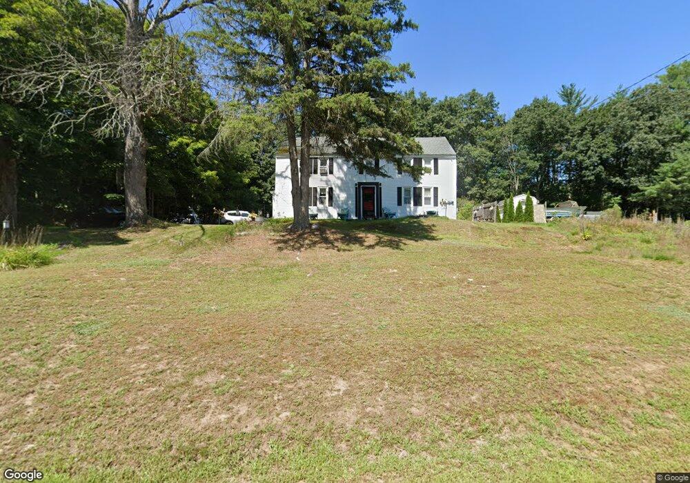
12 Blake Rd Epping, NH 03042
Estimated Value: $370,000 - $588,000
2
Beds
1
Bath
1,800
Sq Ft
$253/Sq Ft
Est. Value
About This Home
This home is located at 12 Blake Rd, Epping, NH 03042 and is currently estimated at $455,013, approximately $252 per square foot. 12 Blake Rd is a home located in Rockingham County with nearby schools including Epping Elementary School, Epping Middle School, and Epping High School.
Ownership History
Date
Name
Owned For
Owner Type
Purchase Details
Closed on
Jul 23, 2013
Sold by
Kelly James and Kelly Julie
Bought by
Patey Christopher G and Patey Sarah I M
Current Estimated Value
Purchase Details
Closed on
Feb 28, 2003
Sold by
Perreault Carl
Bought by
Kelly James and Kelly Julie
Purchase Details
Closed on
Sep 22, 2000
Sold by
Purington Gerald
Bought by
Perreault Carl
Home Financials for this Owner
Home Financials are based on the most recent Mortgage that was taken out on this home.
Original Mortgage
$113,130
Interest Rate
8%
Mortgage Type
Purchase Money Mortgage
Create a Home Valuation Report for This Property
The Home Valuation Report is an in-depth analysis detailing your home's value as well as a comparison with similar homes in the area
Home Values in the Area
Average Home Value in this Area
Purchase History
| Date | Buyer | Sale Price | Title Company |
|---|---|---|---|
| Patey Christopher G | $210,000 | -- | |
| Patey Christopher G | $210,000 | -- | |
| Kelly James | $169,900 | -- | |
| Kelly James | $169,900 | -- | |
| Perreault Carl | $119,100 | -- | |
| Perreault Carl | $119,100 | -- |
Source: Public Records
Mortgage History
| Date | Status | Borrower | Loan Amount |
|---|---|---|---|
| Previous Owner | Perreault Carl | $113,130 | |
| Closed | Perreault Carl | $0 |
Source: Public Records
Tax History
| Year | Tax Paid | Tax Assessment Tax Assessment Total Assessment is a certain percentage of the fair market value that is determined by local assessors to be the total taxable value of land and additions on the property. | Land | Improvement |
|---|---|---|---|---|
| 2024 | $6,424 | $254,600 | $94,000 | $160,600 |
| 2023 | $5,958 | $254,600 | $94,000 | $160,600 |
| 2022 | $5,726 | $254,600 | $94,000 | $160,600 |
| 2021 | $5,652 | $252,100 | $94,000 | $158,100 |
| 2020 | $5,960 | $252,100 | $94,000 | $158,100 |
| 2019 | $5,193 | $206,100 | $77,800 | $128,300 |
| 2018 | $5,346 | $206,100 | $77,800 | $128,300 |
| 2017 | $4,941 | $206,100 | $77,800 | $128,300 |
| 2016 | $5,346 | $206,100 | $77,800 | $128,300 |
| 2015 | $5,346 | $206,100 | $77,800 | $128,300 |
| 2014 | $4,640 | $190,000 | $77,800 | $112,200 |
| 2013 | $4,611 | $190,000 | $77,800 | $112,200 |
Source: Public Records
Map
Nearby Homes
- 27 Old State Rd
- 16 Molly Way
- 3B Connor Ct Unit 3B
- 55 Sunset Ridge Rd Unit 55A
- 55 Sunset Ridge Rd Unit 55B
- 54 Sunset Ridge Rd Unit 54B
- 3A Connor Ct Unit 3A
- 1A Connor Ct Unit 1A
- 1 Olde Bridge Ln
- 1B Connor Ct Unit 1B
- 65 Sunset Ridge Rd Unit 65A
- 65 Sunset Ridge Rd Unit 65B
- 63 Sunset Ridge Rd Unit 63A
- 63 Sunset Ridge Rd Unit 63B
- 7 Boulder Ct
- 39 Hunter Dr
- 20 Locksley Ln
- 11 Royal Ln
- 26 Barrell Run Rd
- 41 Midnight Sun Dr
Your Personal Tour Guide
Ask me questions while you tour the home.