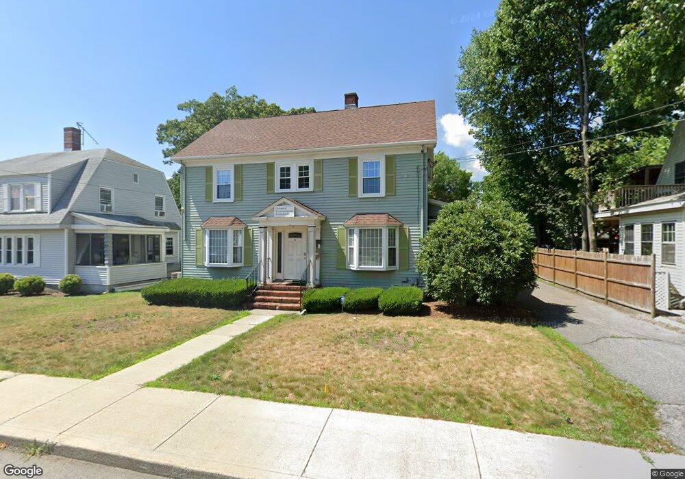
12 Brewster Rd Framingham, MA 01702
Estimated Value: $739,466
Studio
1
Bath
2,145
Sq Ft
$345/Sq Ft
Est. Value
About This Home
This home is located at 12 Brewster Rd, Framingham, MA 01702 and is currently estimated at $739,466, approximately $344 per square foot. 12 Brewster Rd is a home located in Middlesex County with nearby schools including Framingham High School, Happy Hollow School, and Saint Bridget School.
Ownership History
Date
Name
Owned For
Owner Type
Purchase Details
Closed on
Oct 18, 2005
Sold by
Gilmore Brothers Rt and Gilmore
Bought by
Jasminora Prop Llc
Current Estimated Value
Purchase Details
Closed on
Oct 16, 1992
Sold by
Admiral Properties
Bought by
Gilmore Bros Rt
Home Financials for this Owner
Home Financials are based on the most recent Mortgage that was taken out on this home.
Original Mortgage
$100,000
Interest Rate
7.93%
Mortgage Type
Commercial
Purchase Details
Closed on
May 22, 1992
Sold by
Admiral Prop Inc
Bought by
Admiral Prop Inc
Create a Home Valuation Report for This Property
The Home Valuation Report is an in-depth analysis detailing your home's value as well as a comparison with similar homes in the area
Home Values in the Area
Average Home Value in this Area
Purchase History
| Date | Buyer | Sale Price | Title Company |
|---|---|---|---|
| Jasminora Prop Llc | $380,000 | -- | |
| Jasminora Prop Llc | $380,000 | -- | |
| Gilmore Bros Rt | $125,000 | -- | |
| Gilmore Bros Rt | $125,000 | -- | |
| Admiral Prop Inc | $94,000 | -- | |
| Admiral Prop Inc | $94,000 | -- |
Source: Public Records
Mortgage History
| Date | Status | Borrower | Loan Amount |
|---|---|---|---|
| Previous Owner | Admiral Prop Inc | $100,000 | |
| Previous Owner | Admiral Prop Inc | $35,000 |
Source: Public Records
Tax History
| Year | Tax Paid | Tax Assessment Tax Assessment Total Assessment is a certain percentage of the fair market value that is determined by local assessors to be the total taxable value of land and additions on the property. | Land | Improvement |
|---|---|---|---|---|
| 2025 | $12,854 | $529,400 | $144,600 | $384,800 |
| 2024 | $12,845 | $505,500 | $132,200 | $373,300 |
| 2023 | $10,933 | $400,900 | $132,200 | $268,700 |
| 2022 | $11,562 | $398,700 | $120,100 | $278,600 |
| 2021 | $11,744 | $390,300 | $120,100 | $270,200 |
| 2020 | $12,571 | $389,200 | $120,100 | $269,100 |
| 2019 | $13,007 | $387,000 | $114,900 | $272,100 |
| 2018 | $12,769 | $360,800 | $130,100 | $230,700 |
| 2017 | $12,483 | $341,800 | $130,100 | $211,700 |
| 2016 | $10,415 | $274,215 | $99,384 | $174,831 |
| 2015 | $10,582 | $271,400 | $94,700 | $176,700 |
Source: Public Records
Map
Nearby Homes
- 120 Franklin St
- 33 Stevens Rd
- 20 Buckminster St
- 50 Kittredge Rd
- 12 & 14 Waverly St
- 27 Gordon St Unit 305
- 96 Mansfield St
- 260 Grant St
- 18 Beaver Ct
- 10 Rhubena St
- 575 Union Ave Unit 1
- 25 Eames St
- 47 Bishop Dr
- 768 Waverley St
- 65 Bishop Dr
- 92 Alexander St
- 51 Crest Rd
- 131 Mellen St Unit 3B
- 45 Daytona Ave
- 16 Grant Street Extension
- 8 Brewster Rd
- 16 Brewster Rd
- 16 Brewster Rd Unit A
- 22 Brewster Rd
- 15 Brewster Rd
- 9 Brewster Rd
- 5 Brewster Rd
- 21 Brewster Rd
- 15 Deloss St
- 21 Deloss St
- 16 Beech St
- 6 Beech St
- 7 Deloss St Unit 2R
- 7 Deloss St Unit 1R
- 7 Deloss St Unit 7
- 7 Deloss St
- 25 Deloss St Unit 2
- 25 Deloss St Unit 1
- 27 Deloss St Unit 2
- 20 Beech St
Your Personal Tour Guide
Ask me questions while you tour the home.