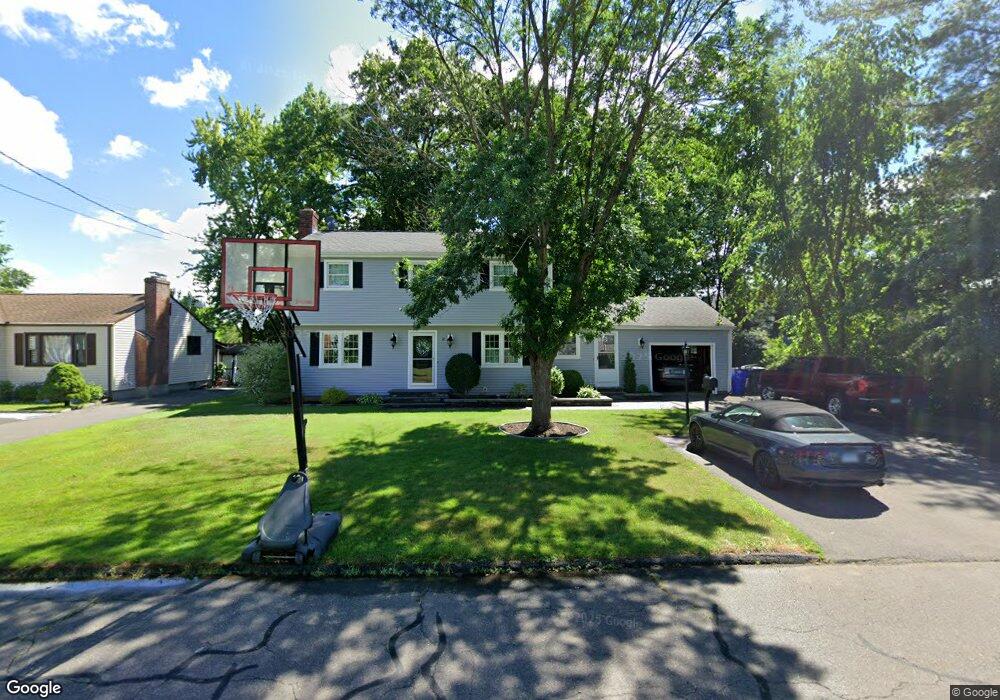
12 Carson Ave Wethersfield, CT 06109
Estimated Value: $398,000 - $443,000
3
Beds
2
Baths
1,893
Sq Ft
$226/Sq Ft
Est. Value
About This Home
This home is located at 12 Carson Ave, Wethersfield, CT 06109 and is currently estimated at $426,889, approximately $225 per square foot. 12 Carson Ave is a home located in Hartford County with nearby schools including Emerson-Williams School, Silas Deane Middle School, and Wethersfield High School.
Ownership History
Date
Name
Owned For
Owner Type
Purchase Details
Closed on
Sep 1, 1999
Sold by
Est Livingstone Jp and Livingstone John P
Bought by
Grtell Ernest M and Grtell Ursula
Current Estimated Value
Create a Home Valuation Report for This Property
The Home Valuation Report is an in-depth analysis detailing your home's value as well as a comparison with similar homes in the area
Home Values in the Area
Average Home Value in this Area
Purchase History
| Date | Buyer | Sale Price | Title Company |
|---|---|---|---|
| Grtell Ernest M | $151,000 | -- |
Source: Public Records
Mortgage History
| Date | Status | Borrower | Loan Amount |
|---|---|---|---|
| Open | Grtell Ernest M | $195,000 | |
| Closed | Grtell Ernest M | $183,000 | |
| Closed | Grtell Ernest M | $35,000 | |
| Closed | Grtell Ernest M | $151,000 |
Source: Public Records
Tax History
| Year | Tax Paid | Tax Assessment Tax Assessment Total Assessment is a certain percentage of the fair market value that is determined by local assessors to be the total taxable value of land and additions on the property. | Land | Improvement |
|---|---|---|---|---|
| 2025 | $11,421 | $277,080 | $69,970 | $207,110 |
| 2024 | $7,919 | $183,230 | $72,100 | $111,130 |
| 2023 | $7,655 | $183,230 | $72,100 | $111,130 |
| 2022 | $7,527 | $183,230 | $72,100 | $111,130 |
| 2021 | $7,452 | $183,230 | $72,100 | $111,130 |
| 2020 | $7,635 | $187,630 | $72,100 | $115,530 |
| 2019 | $7,420 | $182,130 | $72,100 | $110,030 |
| 2018 | $7,365 | $180,600 | $69,900 | $110,700 |
| 2017 | $7,182 | $180,600 | $69,900 | $110,700 |
| 2016 | $6,960 | $180,600 | $69,900 | $110,700 |
| 2015 | $6,897 | $180,600 | $69,900 | $110,700 |
| 2014 | $6,635 | $180,600 | $69,900 | $110,700 |
Source: Public Records
Map
Nearby Homes
- 1 Bristol St
- 19 Albert Ave
- 295 Ridge Rd Unit 8
- 192 Wolcott Hill Rd
- 219-221 Jordan Ln
- 273 Forest Dr
- 173 Timber Trail
- 20 Forest Dr
- 23 Hillcrest Ave
- 764 Ridge Rd
- 129 Goff Rd
- 18 Avalon Place
- 158 Dix Rd
- 107 Harmund Place
- 87 Somerset St
- 91 Somerset St
- 1 Fernwood St
- 317-319 Garden St
- 62 Schoolhouse Crossing
- 15 Potter Crossing
Your Personal Tour Guide
Ask me questions while you tour the home.