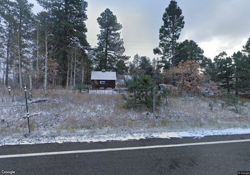
12 Chris Park Rd Durango, CO 81301
Estimated Value: $307,000 - $657,000
--
Bed
--
Bath
279
Sq Ft
$1,640/Sq Ft
Est. Value
About This Home
This home is located at 12 Chris Park Rd, Durango, CO 81301 and is currently estimated at $457,589, approximately $1,640 per square foot. 12 Chris Park Rd is a home located in La Plata County with nearby schools including Animas Valley Elementary School, Miller Middle School, and Durango High School.
Ownership History
Date
Name
Owned For
Owner Type
Purchase Details
Closed on
Dec 21, 2020
Sold by
Wheeldon Jean B and Wheeldon Stephen G
Bought by
The Nnkk Trust
Current Estimated Value
Purchase Details
Closed on
Oct 24, 2017
Sold by
Jean B Wheeldon Trust
Bought by
Wheeldon Jean B and Stephen Wheeldon G
Purchase Details
Closed on
Jun 18, 2012
Sold by
Marion H Jarvis Trust
Bought by
Jean B Wheeldon Trust
Purchase Details
Closed on
Aug 1, 2011
Sold by
Jarvis Preservation Partners Llc
Bought by
Marion H Jarvis Trust
Create a Home Valuation Report for This Property
The Home Valuation Report is an in-depth analysis detailing your home's value as well as a comparison with similar homes in the area
Home Values in the Area
Average Home Value in this Area
Purchase History
| Date | Buyer | Sale Price | Title Company |
|---|---|---|---|
| The Nnkk Trust | -- | None Available | |
| Jean B Wheeldon Trust | $180,000 | None Listed On Document | |
| Wheeldon Jean B | -- | None Available | |
| Jean B Wheeldon Trust | -- | None Available | |
| Marion H Jarvis Trust | -- | None Available |
Source: Public Records
Tax History Compared to Growth
Tax History
| Year | Tax Paid | Tax Assessment Tax Assessment Total Assessment is a certain percentage of the fair market value that is determined by local assessors to be the total taxable value of land and additions on the property. | Land | Improvement |
|---|---|---|---|---|
| 2025 | $376 | $11,150 | $9,690 | $1,460 |
| 2024 | $322 | $7,670 | $6,900 | $770 |
| 2023 | $322 | $10,450 | $9,400 | $1,050 |
| 2022 | $397 | $11,790 | $10,600 | $1,190 |
| 2021 | $398 | $9,600 | $8,400 | $1,200 |
| 2020 | $368 | $9,150 | $8,040 | $1,110 |
| 2019 | $0 | $9,150 | $8,040 | $1,110 |
| 2018 | $271 | $7,030 | $4,990 | $2,040 |
| 2017 | $265 | $7,030 | $4,990 | $2,040 |
| 2016 | $249 | $7,160 | $4,990 | $2,170 |
| 2015 | $234 | $7,160 | $4,990 | $2,170 |
| 2014 | -- | $6,830 | $5,120 | $1,710 |
| 2013 | -- | $6,830 | $5,120 | $1,710 |
Source: Public Records
Map
Nearby Homes
- 42574 U S 550
- 41563 N Us Hwy 550
- 41563 N U S Hwy 550
- 961 N Tamarron Dr Unit 617
- 961 N Tamarron Dr Unit 555
- 961 N Tamarron Dr Unit 633
- 163 Peregrine Dr
- 190 Outlaw Dr Unit 3B
- 104 Outlaw Dr Unit 2A
- 516 Glacier Cliff Dr
- 444 Glacier Cliff Dr
- 490 Glacier Cliff Dr
- 80 Royal Elk Trail
- 539 Glacier Cliff Dr
- 314 N Tamarron Dr Unit 508
- 314 N Tamarron Dr Unit 506
- 314 N Tamarron Dr Unit 412
- 314 N Tamarron Dr Unit 312
- 314 N Tamarron Dr Unit 207
- 314 N Tamarron Dr Unit 315
- 12 Haviland Lake Rd
- 0 Haviland Lake Rd Unit Haviland Lake 670887
- 0 Haviland Lake Rd Unit Haviland Lake 676804
- 0 Haviland Lake Rd
- 51 Haviland Lake Rd
- 42325 Highway 550
- 42209 Highway 550
- 444 Haviland Lake Rd
- 444 Haviland Lake Rd Unit Haviland Lake
- 450 Haviland Lake Rd
- 42335 Highway 550
- 457 Haviland Lake Rd
- 42574 Highway 550
- 535 Haviland Lake Rd
- 42570 Highway 550
- 42570 Highway 550 Unit E
- 42570 Highway 550 Unit H
- 42570 Highway 550 Unit G
- 42570 Highway 550 Unit F
- 42570 Highway 550