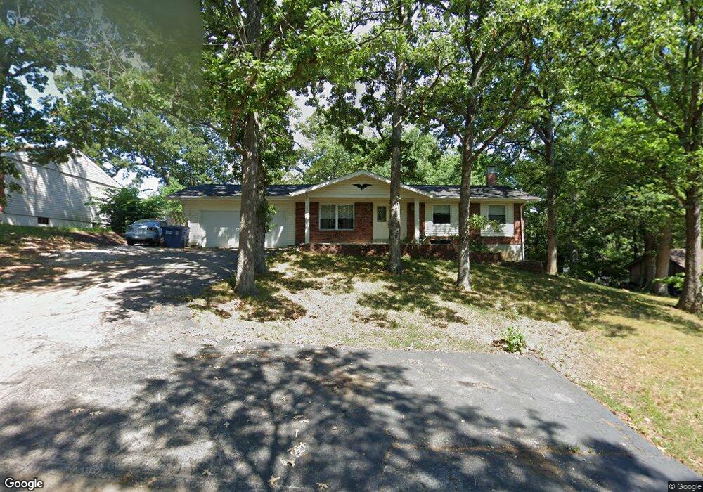
12 Colgate Cir O Fallon, MO 63366
Estimated Value: $254,000 - $294,000
3
Beds
2
Baths
1,032
Sq Ft
$264/Sq Ft
Est. Value
About This Home
This home is located at 12 Colgate Cir, O Fallon, MO 63366 and is currently estimated at $272,799, approximately $264 per square foot. 12 Colgate Cir is a home located in St. Charles County with nearby schools including Green Tree Elementary School, Wentzville South Middle School, and Timberland High School.
Ownership History
Date
Name
Owned For
Owner Type
Purchase Details
Closed on
Jun 9, 2016
Sold by
Knaust Brittany R and Knaust Andrew N
Bought by
Knaust Andrew N and Knaust Brittany R
Current Estimated Value
Home Financials for this Owner
Home Financials are based on the most recent Mortgage that was taken out on this home.
Original Mortgage
$106,500
Outstanding Balance
$46,409
Interest Rate
3.57%
Mortgage Type
New Conventional
Estimated Equity
$226,390
Purchase Details
Closed on
May 18, 2006
Sold by
Wheeler John P and Wheeler Alice F
Bought by
Grivett Brittany R
Home Financials for this Owner
Home Financials are based on the most recent Mortgage that was taken out on this home.
Original Mortgage
$109,610
Interest Rate
6.4%
Mortgage Type
Fannie Mae Freddie Mac
Create a Home Valuation Report for This Property
The Home Valuation Report is an in-depth analysis detailing your home's value as well as a comparison with similar homes in the area
Home Values in the Area
Average Home Value in this Area
Purchase History
| Date | Buyer | Sale Price | Title Company |
|---|---|---|---|
| Knaust Andrew N | -- | None Available | |
| Grivett Brittany R | $113,000 | Ort |
Source: Public Records
Mortgage History
| Date | Status | Borrower | Loan Amount |
|---|---|---|---|
| Open | Knaust Andrew N | $106,500 | |
| Closed | Grivett Brittany R | $109,610 |
Source: Public Records
Tax History
| Year | Tax Paid | Tax Assessment Tax Assessment Total Assessment is a certain percentage of the fair market value that is determined by local assessors to be the total taxable value of land and additions on the property. | Land | Improvement |
|---|---|---|---|---|
| 2025 | $2,454 | $41,613 | -- | -- |
| 2023 | $2,453 | $37,196 | $0 | $0 |
| 2022 | $2,173 | $30,620 | $0 | $0 |
| 2021 | $2,171 | $30,620 | $0 | $0 |
| 2020 | $2,121 | $29,164 | $0 | $0 |
| 2019 | $1,969 | $29,164 | $0 | $0 |
| 2018 | $1,748 | $24,616 | $0 | $0 |
| 2017 | $1,739 | $24,616 | $0 | $0 |
| 2016 | $1,408 | $19,727 | $0 | $0 |
| 2015 | $1,377 | $19,727 | $0 | $0 |
| 2014 | $1,370 | $20,095 | $0 | $0 |
Source: Public Records
Map
Nearby Homes
- 703 Norwood Terrace
- 680 Lakewood Dr
- 655 Lakewood Dr
- 617 Lakeview Rd
- 2 Royal Dr
- 903 Palmer Ct Unit 3
- 7 King Cir
- 22 Holloway Dr
- 1012 Delmar Dr
- 1011 Fairways Dr
- 1015 Fairways Dr
- 35 Monterey Cypress Dr Unit 2
- 9 Woodview Dr
- 263 Tyndale Dr
- 410 Charlemagne Dr
- 1382 Apple Valley Dr
- 15 Eagles Way Ln
- 1104 S Charlemagne Dr
- 856 Brookmead Dr
- 1373 Sunburst Dr
Your Personal Tour Guide
Ask me questions while you tour the home.