
12 Dunham Rd Edgartown, MA 02539
Edgartown NeighborhoodEstimated Value: $3,180,622 - $4,605,000
5
Beds
2
Baths
1,631
Sq Ft
$2,294/Sq Ft
Est. Value
About This Home
As of September 2018Not Listed in LINK
Last Agent to Sell the Property
LINK Email Cache
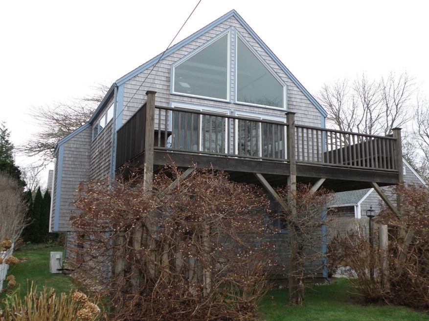
LINK Listed on: 09/19/2018
Ownership History
Date
Name
Owned For
Owner Type
Purchase Details
Listed on
Sep 19, 2018
Closed on
Sep 19, 2018
Sold by
12 Dunham Road Llc
Bought by
Dunham Road Properties
Seller's Agent
LINK Email Cache
LINK
Sold Price
$1,850,000
Current Estimated Value
Home Financials for this Owner
Home Financials are based on the most recent Mortgage that was taken out on this home.
Estimated Appreciation
$1,891,406
Avg. Annual Appreciation
11.01%
Original Mortgage
$925,000
Outstanding Balance
$811,604
Interest Rate
4.5%
Mortgage Type
Unknown
Estimated Equity
$2,932,403
Purchase Details
Closed on
Jul 29, 2010
Sold by
Anderson Elizabeth R
Bought by
12 Dunham Road Llc
Purchase Details
Closed on
Oct 31, 1980
Bought by
12 Dunham Rd Llc
Similar Homes in Edgartown, MA
Create a Home Valuation Report for This Property
The Home Valuation Report is an in-depth analysis detailing your home's value as well as a comparison with similar homes in the area
Home Values in the Area
Average Home Value in this Area
Purchase History
Date | Buyer | Sale Price | Title Company |
---|---|---|---|
Dunham Road Properties | $1,850,000 | -- | |
12 Dunham Road Llc | -- | -- | |
12 Dunham Rd Llc | $150,000 | -- |
Source: Public Records
Mortgage History
Date | Status | Borrower | Loan Amount |
---|---|---|---|
Open | Dunham Road Properties | $925,000 | |
Previous Owner | 12 Dunham Road Llc | $450,000 | |
Previous Owner | 12 Dunham Road Llc | $300,000 | |
Previous Owner | 12 Dunham Road Llc | $200,000 |
Source: Public Records
Property History
Date | Event | Price | Change | Sq Ft Price |
---|---|---|---|---|
09/19/2018 09/19/18 | Sold | $1,850,000 | -- | $1,134 / Sq Ft |
Source: LINK (Vineyard)
Tax History Compared to Growth
Tax History
Year | Tax Paid | Tax Assessment Tax Assessment Total Assessment is a certain percentage of the fair market value that is determined by local assessors to be the total taxable value of land and additions on the property. | Land | Improvement |
---|---|---|---|---|
2025 | $7,106 | $2,681,500 | $2,088,500 | $593,000 |
2024 | $6,489 | $2,544,600 | $2,088,500 | $456,100 |
2023 | $6,610 | $2,623,200 | $2,122,100 | $501,100 |
2022 | $7,909 | $2,610,196 | $2,271,296 | $338,900 |
2021 | $7,222 | $2,201,707 | $1,898,807 | $302,900 |
2020 | $7,193 | $2,147,288 | $1,808,388 | $338,900 |
2019 | $8,310 | $2,147,300 | $1,808,400 | $338,900 |
2018 | $6,078 | $1,867,600 | $1,621,600 | $246,000 |
2017 | $5,978 | $1,684,000 | $1,427,000 | $257,000 |
2016 | $6,247 | $1,725,600 | $1,427,000 | $298,600 |
2015 | $5,520 | $1,590,700 | $1,376,100 | $214,600 |
Source: Public Records
Agents Affiliated with this Home
-
L
Seller's Agent in 2018
LINK Email Cache
LINK
Map
Source: LINK (Vineyard)
MLS Number: 34364
APN: EDGA-000029B-000062
Nearby Homes
- 8 High St
- 170 Katama Rd
- 11 Norton St
- 43 Peases Point Way S
- 26 Mill Hill Rd
- 25 Dock St
- 10 Tilton Way
- 68 Winter St
- 10 Peases Point Way N
- 62 N Summer St
- 68 N Water St
- 56 Robinson Rd
- 32 Norton Orchard Rd
- 114 N Water St
- 23 Pinehurst Rd
- 117 N Water St
- 26 Curtis Ln
- 131 N Water St Unit 96
- 52 Fuller St
- 54 Fuller St