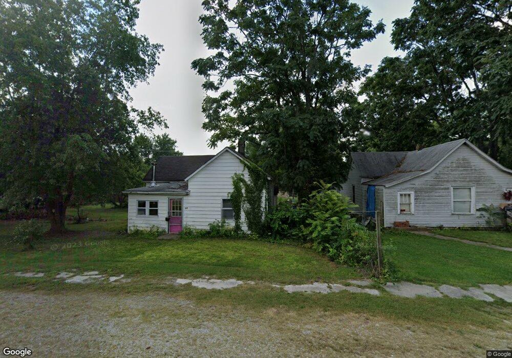
12 E Myrtle St Aurora, MO 65605
Estimated Value: $70,373 - $138,000
2
Beds
1
Bath
686
Sq Ft
$152/Sq Ft
Est. Value
About This Home
This home is located at 12 E Myrtle St, Aurora, MO 65605 and is currently estimated at $104,593, approximately $152 per square foot. 12 E Myrtle St is a home located in Lawrence County with nearby schools including Pate Early Childhood Center, Robinson Intermediate School, and Robinson Elementary School.
Ownership History
Date
Name
Owned For
Owner Type
Purchase Details
Closed on
Oct 8, 2025
Sold by
Reyes Israel and Reyes Celia
Bought by
Reyes Rentals Llc
Current Estimated Value
Purchase Details
Closed on
Jul 16, 2024
Sold by
Brown Nancy Sue
Bought by
Reyes Israel
Purchase Details
Closed on
Jan 10, 2024
Sold by
City Of Aurora
Bought by
Brown Nancy
Purchase Details
Closed on
Sep 13, 2021
Sold by
Moore Richard E and Moore Amie
Bought by
City Of Aurora
Purchase Details
Closed on
Jan 16, 2013
Sold by
Woods Sherri
Bought by
Eugene Richard and Moore Amie
Purchase Details
Closed on
Jun 7, 2006
Sold by
Mcgruder Demetria A
Bought by
Brightwell Mary
Create a Home Valuation Report for This Property
The Home Valuation Report is an in-depth analysis detailing your home's value as well as a comparison with similar homes in the area
Home Values in the Area
Average Home Value in this Area
Purchase History
| Date | Buyer | Sale Price | Title Company |
|---|---|---|---|
| Reyes Rentals Llc | -- | None Listed On Document | |
| Reyes Israel | -- | None Listed On Document | |
| Brown Nancy | -- | None Listed On Document | |
| City Of Aurora | -- | None Available | |
| Eugene Richard | $711 | None Available | |
| Brightwell Mary | -- | Barry County Abstract & Titl |
Source: Public Records
Tax History
| Year | Tax Paid | Tax Assessment Tax Assessment Total Assessment is a certain percentage of the fair market value that is determined by local assessors to be the total taxable value of land and additions on the property. | Land | Improvement |
|---|---|---|---|---|
| 2025 | $51 | $1,010 | $1,010 | $0 |
| 2024 | $51 | $1,010 | $1,010 | $0 |
| 2023 | $0 | $0 | $0 | $0 |
| 2022 | $0 | $0 | $0 | $0 |
| 2021 | $0 | $1,730 | $970 | $760 |
| 2020 | $218 | $1,350 | $590 | $760 |
| 2019 | $87 | $1,350 | $590 | $760 |
| 2018 | $378 | $4,560 | $590 | $3,970 |
| 2017 | $226 | $4,560 | $590 | $3,970 |
| 2016 | -- | $4,160 | $590 | $3,570 |
| 2015 | -- | $4,160 | $590 | $3,570 |
| 2014 | -- | $4,160 | $590 | $3,570 |
Source: Public Records
Map
Nearby Homes
- 111 W Cofield St
- 503 Mcnatt Ave
- 123 Cofield St
- 225 Morgan Ave
- 111 W Lee St
- 722 Wilson Ave
- 000 Crescent St
- 427 N Harrison Ave
- 216 S Elliott Ave
- 220 S Park Ave
- 141 W Pleasant St
- 303 N Hudson Ave
- 312 S Oak Ave
- 114 E College St
- 311 W Pleasant St
- 330 W Summit St
- 213 W College St
- 405 W Summit St
- 407 W Summit St Unit A & B
- 421 W College St
- 4 Myrtle St
- 22 E Myrtle St
- 417 Windsor Ave
- 19 E Tyndall St
- 21 E Tyndal St
- 2 W Myrtle St
- 100 Myrtle St
- 510 Mc Natt Ave
- 21 E Tyndall St
- 511 Mcnatt Ave
- 8 W Myrtle St
- 106 E Myrtle St
- 9 W Tyndal St
- 111 E Tyndal St
- 12 W Myrtle St
- 000 Tyndall St
- 107 E Myrtle St
- 511 Mc Natt Ave
- 10 E Tyndall St
- 10 E Tyndal St
Your Personal Tour Guide
Ask me questions while you tour the home.