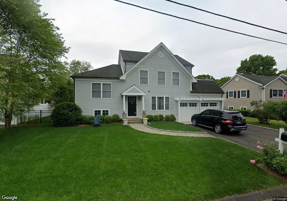
12 Halock Dr Greenwich, CT 06831
Pemberwick NeighborhoodEstimated Value: $1,110,000 - $1,797,000
4
Beds
3
Baths
2,900
Sq Ft
$547/Sq Ft
Est. Value
About This Home
This home is located at 12 Halock Dr, Greenwich, CT 06831 and is currently estimated at $1,587,517, approximately $547 per square foot. 12 Halock Dr is a home located in Fairfield County with nearby schools including Glenville School, Western Middle School, and Greenwich High School.
Ownership History
Date
Name
Owned For
Owner Type
Purchase Details
Closed on
Aug 17, 2012
Sold by
Est Lalla Mildred and Fornado Marlene
Bought by
Decarlo Michael J and Decarlo Mary Kate
Current Estimated Value
Home Financials for this Owner
Home Financials are based on the most recent Mortgage that was taken out on this home.
Original Mortgage
$350,000
Outstanding Balance
$242,464
Interest Rate
3.67%
Estimated Equity
$1,345,053
Purchase Details
Closed on
Nov 28, 2011
Sold by
Est Lalla Mildred
Bought by
Fornaro Marlene
Create a Home Valuation Report for This Property
The Home Valuation Report is an in-depth analysis detailing your home's value as well as a comparison with similar homes in the area
Home Values in the Area
Average Home Value in this Area
Purchase History
| Date | Buyer | Sale Price | Title Company |
|---|---|---|---|
| Decarlo Michael J | $460,000 | -- | |
| Fornaro Marlene | -- | -- |
Source: Public Records
Mortgage History
| Date | Status | Borrower | Loan Amount |
|---|---|---|---|
| Open | Decarlo Michael J | $215,000 | |
| Open | Decarlo Michael J | $350,000 |
Source: Public Records
Tax History Compared to Growth
Tax History
| Year | Tax Paid | Tax Assessment Tax Assessment Total Assessment is a certain percentage of the fair market value that is determined by local assessors to be the total taxable value of land and additions on the property. | Land | Improvement |
|---|---|---|---|---|
| 2025 | $11,168 | $903,630 | $355,810 | $547,820 |
| 2024 | $10,786 | $903,630 | $355,810 | $547,820 |
| 2023 | $10,515 | $903,630 | $355,810 | $547,820 |
| 2022 | $10,419 | $903,630 | $355,810 | $547,820 |
| 2021 | $9,122 | $757,680 | $266,630 | $491,050 |
| 2020 | $9,107 | $757,680 | $266,630 | $491,050 |
| 2019 | $9,198 | $757,680 | $266,630 | $491,050 |
| 2018 | $8,994 | $757,680 | $266,630 | $491,050 |
| 2017 | $9,107 | $757,680 | $266,630 | $491,050 |
| 2016 | $8,818 | $745,430 | $266,630 | $478,800 |
| 2015 | $6,660 | $558,530 | $289,800 | $268,730 |
| 2014 | $5,555 | $477,890 | $289,800 | $188,090 |
Source: Public Records
Map
Nearby Homes
- 107 Pemberwick Rd
- 40 Moshier St
- 3 Green Ln
- 28 1/2 Pilgrim Dr
- 70 Byram Terrace Dr
- 52 Almira Dr Unit D
- 608 W Lyon Farm Dr
- 93 Greenwich Hills Dr
- 8 Reynolds Place
- 53 Upland St
- 626 W Lyon Farm Dr
- 41 Chapel St
- 38 Riverdale Ave
- 238 Madison Ave
- 563 King St
- 565 King St
- 17 Austin Place
- 180 Madison Ave
- 531 1/2 Willett Ave
- 39 Homestead Rd