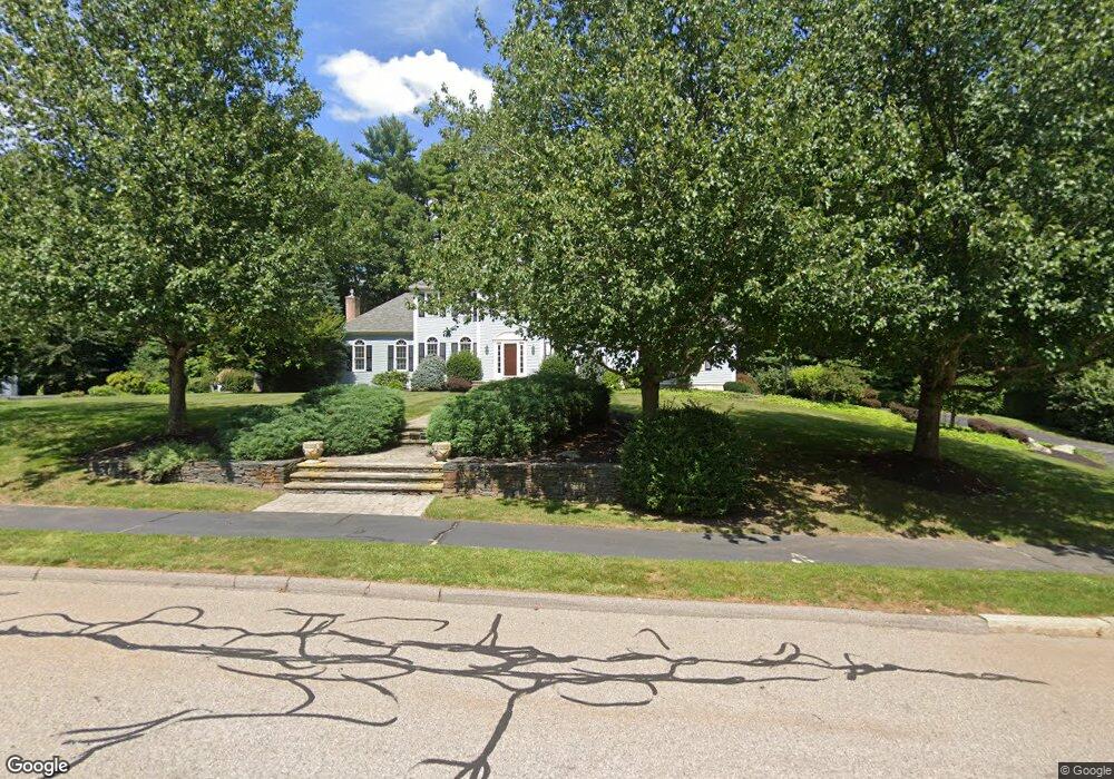
12 Haydn Ln Walpole, MA 02081
Estimated Value: $1,238,060 - $1,556,000
4
Beds
4
Baths
4,022
Sq Ft
$346/Sq Ft
Est. Value
About This Home
This home is located at 12 Haydn Ln, Walpole, MA 02081 and is currently estimated at $1,392,265, approximately $346 per square foot. 12 Haydn Ln is a home located in Norfolk County with nearby schools including Elm Street School, Eleanor N. Johnson Middle School, and Walpole High School.
Ownership History
Date
Name
Owned For
Owner Type
Purchase Details
Closed on
Sep 21, 2017
Sold by
Dorci Fredric J
Bought by
Fredric J Dorci Irt
Current Estimated Value
Purchase Details
Closed on
Feb 28, 2012
Sold by
Dorci Diana and Dorci Fredric J
Bought by
Dorci Fredric J
Home Financials for this Owner
Home Financials are based on the most recent Mortgage that was taken out on this home.
Original Mortgage
$344,500
Interest Rate
3.89%
Mortgage Type
New Conventional
Purchase Details
Closed on
May 15, 2007
Sold by
Marshall Frederick and Marshall Janet S
Bought by
Dorci Diana and Dorci Fredric J
Home Financials for this Owner
Home Financials are based on the most recent Mortgage that was taken out on this home.
Original Mortgage
$417,000
Interest Rate
6.21%
Mortgage Type
Purchase Money Mortgage
Purchase Details
Closed on
Sep 21, 2000
Sold by
Massapoag Rt
Bought by
Rondo Co Inc
Create a Home Valuation Report for This Property
The Home Valuation Report is an in-depth analysis detailing your home's value as well as a comparison with similar homes in the area
Home Values in the Area
Average Home Value in this Area
Purchase History
| Date | Buyer | Sale Price | Title Company |
|---|---|---|---|
| Fredric J Dorci Irt | -- | -- | |
| Dorci Fredric J | -- | -- | |
| Dorci Diana | $792,000 | -- | |
| Rondo Co Inc | $100,000 | -- |
Source: Public Records
Mortgage History
| Date | Status | Borrower | Loan Amount |
|---|---|---|---|
| Previous Owner | Dorci Fredric J | $344,500 | |
| Previous Owner | Rondo Co Inc | $338,000 | |
| Previous Owner | Rondo Co Inc | $50,000 | |
| Previous Owner | Rondo Co Inc | $389,000 | |
| Previous Owner | Dorci Diana | $417,000 |
Source: Public Records
Tax History Compared to Growth
Tax History
| Year | Tax Paid | Tax Assessment Tax Assessment Total Assessment is a certain percentage of the fair market value that is determined by local assessors to be the total taxable value of land and additions on the property. | Land | Improvement |
|---|---|---|---|---|
| 2025 | $13,828 | $1,077,800 | $382,600 | $695,200 |
| 2024 | $13,347 | $1,009,600 | $368,100 | $641,500 |
| 2023 | $12,411 | $893,500 | $319,900 | $573,600 |
| 2022 | $11,413 | $789,300 | $296,200 | $493,100 |
| 2021 | $11,243 | $757,600 | $279,600 | $478,000 |
| 2020 | $10,706 | $714,200 | $263,600 | $450,600 |
| 2019 | $10,408 | $689,300 | $253,900 | $435,400 |
| 2018 | $10,306 | $674,900 | $243,500 | $431,400 |
| 2017 | $10,023 | $653,800 | $234,100 | $419,700 |
| 2016 | $9,765 | $627,600 | $227,200 | $400,400 |
| 2015 | $9,525 | $606,700 | $217,800 | $388,900 |
| 2014 | $9,204 | $584,000 | $217,800 | $366,200 |
Source: Public Records
Map
Nearby Homes
- 43 Chandler Ave
- 533 Lincoln Rd
- 12 Brookside Ln
- 27 Thomas Mann Cir Unit 18
- 37 Thomas Mann Cir Unit 23
- 28 Thomas Mann Cir Unit Lot 38
- 1648 Main St
- 42 Thomas Mann Unit 39
- 51 Thomas Mann Unit 30
- 53 Thomas Mann Cir Unit 31
- The Georgetown L Plan at Lakeland Hills
- The Georgetown Grand L Plan at Lakeland Hills
- The Georgetown R Plan at Lakeland Hills
- The Georgetown Grand R Plan at Lakeland Hills
- 57 Thomas Mann Cir Unit 57
- 63 Thomas Mann Cir Unit 36
- 375 Winter St
- 8 Boyde's Crossing
- 8 Boyde's Crossing Unit 4
- 16 Stop River Rd