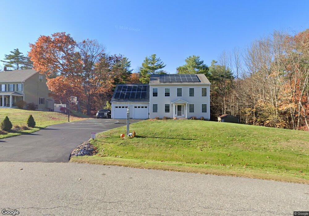
12 Jessie Ln Biddeford, ME 04005
Estimated Value: $580,000 - $680,000
3
Beds
3
Baths
1,972
Sq Ft
$311/Sq Ft
Est. Value
About This Home
This home is located at 12 Jessie Ln, Biddeford, ME 04005 and is currently estimated at $614,071, approximately $311 per square foot. 12 Jessie Ln is a home located in York County with nearby schools including John F Kennedy Memorial School, Biddeford Intermediate School, and Biddeford Primary School.
Ownership History
Date
Name
Owned For
Owner Type
Purchase Details
Closed on
Jun 22, 2005
Sold by
Dwn Asset Mgmt Inc
Bought by
Pollard Sarah R and Pollard Charles A
Current Estimated Value
Home Financials for this Owner
Home Financials are based on the most recent Mortgage that was taken out on this home.
Original Mortgage
$254,250
Outstanding Balance
$133,246
Interest Rate
5.82%
Mortgage Type
Purchase Money Mortgage
Estimated Equity
$480,825
Create a Home Valuation Report for This Property
The Home Valuation Report is an in-depth analysis detailing your home's value as well as a comparison with similar homes in the area
Home Values in the Area
Average Home Value in this Area
Purchase History
| Date | Buyer | Sale Price | Title Company |
|---|---|---|---|
| Pollard Sarah R | -- | -- |
Source: Public Records
Mortgage History
| Date | Status | Borrower | Loan Amount |
|---|---|---|---|
| Open | Pollard Sarah R | $254,250 |
Source: Public Records
Tax History Compared to Growth
Tax History
| Year | Tax Paid | Tax Assessment Tax Assessment Total Assessment is a certain percentage of the fair market value that is determined by local assessors to be the total taxable value of land and additions on the property. | Land | Improvement |
|---|---|---|---|---|
| 2024 | $6,665 | $468,700 | $156,200 | $312,500 |
| 2023 | $6,115 | $466,100 | $153,600 | $312,500 |
| 2022 | $6,024 | $367,100 | $111,100 | $256,000 |
| 2021 | $5,666 | $310,800 | $96,100 | $214,700 |
| 2020 | $5,624 | $280,500 | $84,200 | $196,300 |
| 2019 | $5,604 | $280,500 | $84,200 | $196,300 |
| 2018 | $5,526 | $280,500 | $84,200 | $196,300 |
| 2017 | $5,491 | $273,600 | $84,200 | $189,400 |
| 2016 | $5,434 | $273,600 | $84,200 | $189,400 |
| 2015 | $5,132 | $273,600 | $84,200 | $189,400 |
| 2014 | $5,006 | $273,600 | $84,200 | $189,400 |
| 2013 | -- | $284,800 | $88,200 | $196,600 |
Source: Public Records
Map
Nearby Homes