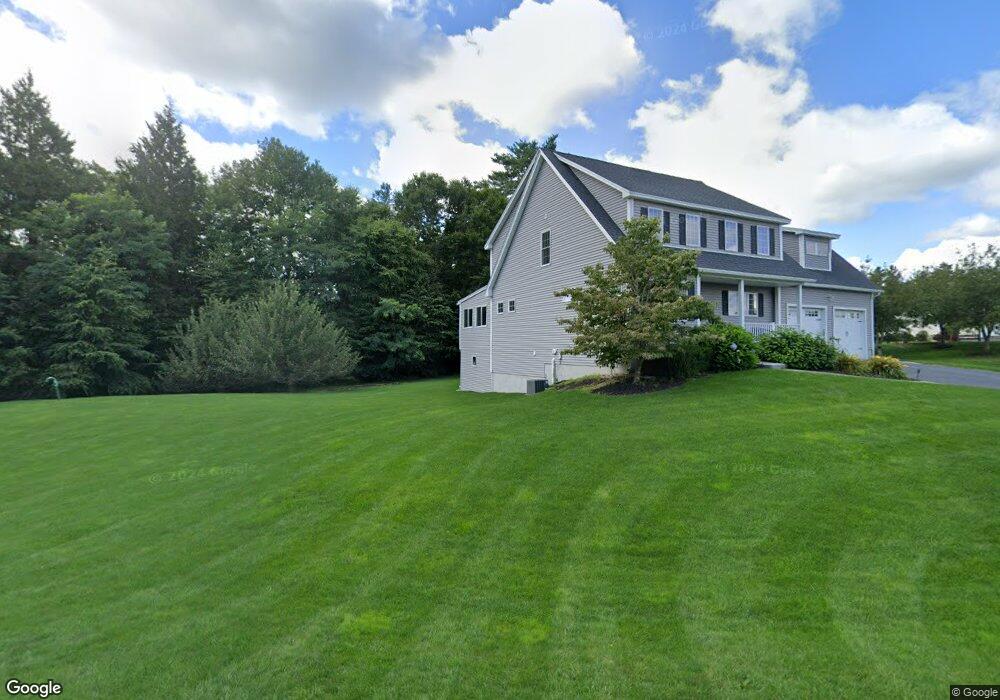
12 Macintosh Ln Epping, NH 03042
Estimated Value: $684,000 - $766,000
3
Beds
3
Baths
2,099
Sq Ft
$348/Sq Ft
Est. Value
About This Home
This home is located at 12 Macintosh Ln, Epping, NH 03042 and is currently estimated at $731,501, approximately $348 per square foot. 12 Macintosh Ln is a home with nearby schools including Epping Elementary School, Epping Middle School, and Epping High School.
Ownership History
Date
Name
Owned For
Owner Type
Purchase Details
Closed on
Aug 27, 2014
Sold by
Prescott Orchards Land
Bought by
Fragala Michael J and Gagnon-Fragala Nicole
Current Estimated Value
Create a Home Valuation Report for This Property
The Home Valuation Report is an in-depth analysis detailing your home's value as well as a comparison with similar homes in the area
Home Values in the Area
Average Home Value in this Area
Purchase History
| Date | Buyer | Sale Price | Title Company |
|---|---|---|---|
| Fragala Michael J | $342,000 | -- | |
| Fragala Michael J | $342,000 | -- |
Source: Public Records
Mortgage History
| Date | Status | Borrower | Loan Amount |
|---|---|---|---|
| Closed | Fragala Michael J | $0 |
Source: Public Records
Tax History
| Year | Tax Paid | Tax Assessment Tax Assessment Total Assessment is a certain percentage of the fair market value that is determined by local assessors to be the total taxable value of land and additions on the property. | Land | Improvement |
|---|---|---|---|---|
| 2024 | $11,230 | $445,100 | $116,700 | $328,400 |
| 2023 | $10,392 | $444,100 | $116,700 | $327,400 |
| 2022 | $9,628 | $428,100 | $116,700 | $311,400 |
| 2021 | $9,369 | $417,900 | $116,700 | $301,200 |
| 2020 | $9,879 | $417,900 | $116,700 | $301,200 |
| 2019 | $9,784 | $353,200 | $88,900 | $264,300 |
| 2018 | $9,162 | $353,200 | $88,900 | $264,300 |
| 2017 | $9,162 | $353,200 | $88,900 | $264,300 |
| 2016 | $8,708 | $335,700 | $88,900 | $246,800 |
| 2015 | $8,708 | $335,700 | $88,900 | $246,800 |
| 2014 | $7,778 | $318,500 | $79,900 | $238,600 |
| 2013 | $2 | $100 | $100 | $0 |
Source: Public Records
Map
Nearby Homes
- lot 103 Megans Way Unit 103
- lot 95 Megans Way Unit 95
- 100 Megans Way
- 101 Megans Way Unit 101
- 96 Megans Way
- 97 Megans Way Unit 97
- 277 Prescott Rd
- 1 Olde Bridge Ln
- 104 Olde Bridge Ln
- 27 Old State Rd
- 3B Connor Ct Unit 3B
- 5A Connor Ct Unit 5A
- 55 Sunset Ridge Rd Unit 55A
- 55 Sunset Ridge Rd Unit 55B
- 54 Sunset Ridge Rd Unit 54B
- 9B Connor Ct Unit 9B
- 3A Connor Ct Unit 3A
- 1A Connor Ct Unit 1A
- 5B Connor Ct Unit 5B
- 9A Connor Ct Unit 9A
- 81 Apple Way Unit 92
- 81 Apple Way
- 67 Apple Way Unit 67
- 106 Apple Way Unit 106
- 92 Apple Way Unit 92
- Lot 82 Prescott Orchards
- 7 Apple Way
- Lot 70 Prescott Orchards
- 2 Apple Way
- 80 Apple Way
- 79 Apple Way Unit 79
- 79 Apple Way
- 47 Cider St
- 9 Apple Way Unit 59
- Lot 69 Prescott Orchards
- 4 Macintosh Ln
- 75 Apple Way
- 4 Cortland Dr
- 0 Apple Way Unit 60 4832576
- 45 Cider St