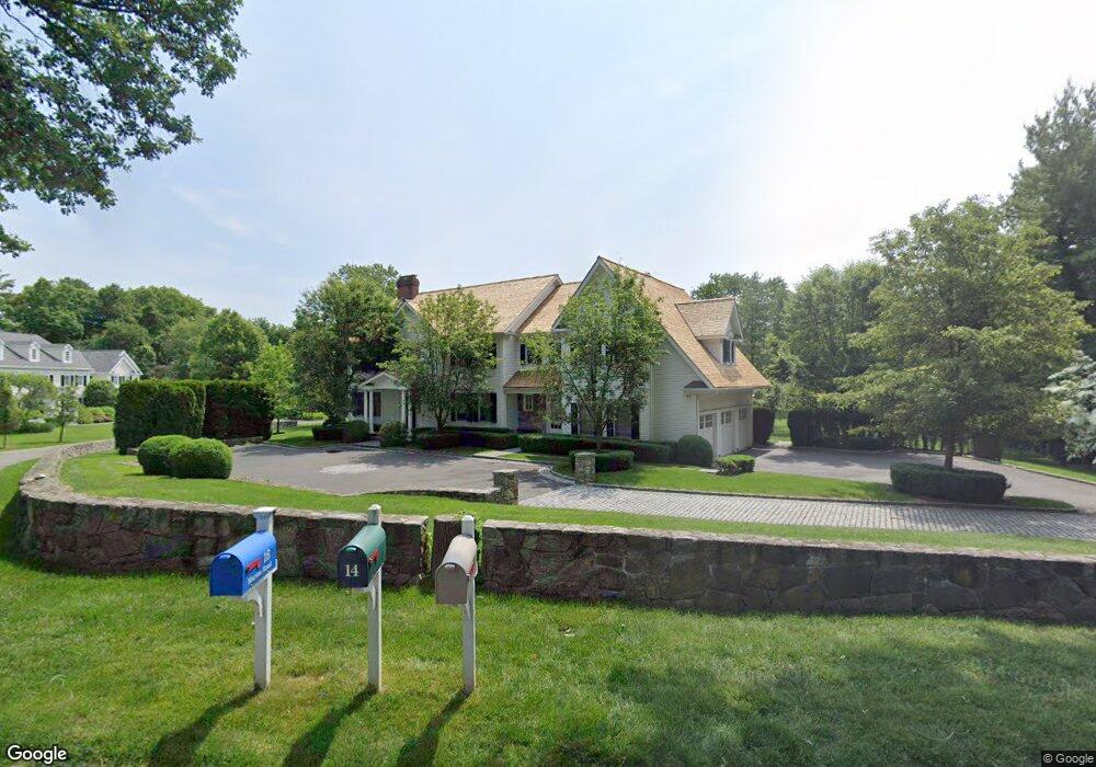
12 Marion Rd Westport, CT 06880
Old Hill NeighborhoodEstimated Value: $3,555,000 - $4,182,000
6
Beds
9
Baths
5,603
Sq Ft
$693/Sq Ft
Est. Value
About This Home
This home is located at 12 Marion Rd, Westport, CT 06880 and is currently estimated at $3,885,062, approximately $693 per square foot. 12 Marion Rd is a home located in Fairfield County with nearby schools including King's Highway Elementary School, Coleytown Middle School, and Staples High School.
Ownership History
Date
Name
Owned For
Owner Type
Purchase Details
Closed on
Sep 25, 2003
Sold by
Joseph J Lagana Bldrs
Bought by
Greenberg Michael D and Greenberg Stacy Gs
Current Estimated Value
Purchase Details
Closed on
Aug 28, 2001
Sold by
Lavender Lane Assoc
Bought by
Joe Lagana Bldg
Purchase Details
Closed on
Oct 30, 2000
Sold by
Nevas Bernard
Bought by
Lavender Lane Assoc
Create a Home Valuation Report for This Property
The Home Valuation Report is an in-depth analysis detailing your home's value as well as a comparison with similar homes in the area
Home Values in the Area
Average Home Value in this Area
Purchase History
| Date | Buyer | Sale Price | Title Company |
|---|---|---|---|
| Greenberg Michael D | $2,150,000 | -- | |
| Greenberg Michael D | $2,150,000 | -- | |
| Joe Lagana Bldg | $669,000 | -- | |
| Joe Lagana Bldg | $669,000 | -- | |
| Lavender Lane Assoc | $381,250 | -- | |
| Lavender Lane Assoc | $381,250 | -- |
Source: Public Records
Mortgage History
| Date | Status | Borrower | Loan Amount |
|---|---|---|---|
| Open | Lavender Lane Assoc | $1,250,000 | |
| Closed | Lavender Lane Assoc | $1,250,000 |
Source: Public Records
Tax History Compared to Growth
Tax History
| Year | Tax Paid | Tax Assessment Tax Assessment Total Assessment is a certain percentage of the fair market value that is determined by local assessors to be the total taxable value of land and additions on the property. | Land | Improvement |
|---|---|---|---|---|
| 2025 | $28,381 | $1,504,800 | $403,300 | $1,101,500 |
| 2024 | $28,019 | $1,504,800 | $403,300 | $1,101,500 |
| 2023 | $27,613 | $1,504,800 | $403,300 | $1,101,500 |
| 2022 | $27,192 | $1,504,800 | $403,300 | $1,101,500 |
| 2021 | $6,451 | $1,504,800 | $403,300 | $1,101,500 |
| 2020 | $6,354 | $1,660,600 | $425,700 | $1,234,900 |
| 2019 | $27,998 | $1,660,600 | $425,700 | $1,234,900 |
| 2018 | $27,998 | $1,660,600 | $425,700 | $1,234,900 |
| 2017 | $5,849 | $1,660,600 | $425,700 | $1,234,900 |
| 2016 | $27,998 | $1,660,600 | $425,700 | $1,234,900 |
| 2015 | $29,648 | $1,638,900 | $352,000 | $1,286,900 |
| 2014 | $29,402 | $1,638,900 | $352,000 | $1,286,900 |
Source: Public Records
Map
Nearby Homes
- 42 Kings Hwy S
- 13 Hills Ln
- 13 Orchard Hill Rd
- 7 Renzulli Rd
- 33 Pequot Trail
- 505 Westport Ave
- 142 Wolfpit Ave
- 7 Peaceful Ln
- 26 Treadwell Ave
- 14 Strathmore Ln
- 100 Wolfpit Ave Unit 2
- 202 Bradley Ln Unit 202
- 80 County St Unit 9K
- 80 County St Unit 1U
- 80 County St Unit 3A
- 80 County St Unit 2Q
- 80 County St Unit 11K
- 341 Strawberry Hill Ave
- 110 William St
- 21 Wright St