Estimated Value: $340,000 - $346,000
3
Beds
2
Baths
1,660
Sq Ft
$207/Sq Ft
Est. Value
About This Home
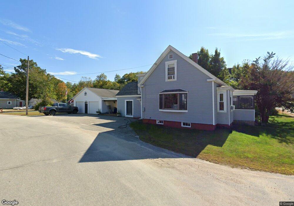
This home is located at 12 Railroad Ave, Union, NH 03887 and is currently estimated at $343,498, approximately $206 per square foot. 12 Railroad Ave is a home with nearby schools including Paul Elementary School and Shortridge Academy.
Ownership History
Date
Name
Owned For
Owner Type
Purchase Details
Closed on
Jul 13, 2015
Sold by
Tibbetts James E
Bought by
Drake Kevin R
Current Estimated Value
Purchase Details
Closed on
May 16, 2006
Sold by
Fetters Randolph M and Fetters Karen E
Bought by
Drake Lisa P and Drake Kevin R
Home Financials for this Owner
Home Financials are based on the most recent Mortgage that was taken out on this home.
Original Mortgage
$145,600
Interest Rate
6.4%
Mortgage Type
Purchase Money Mortgage
Purchase Details
Closed on
Dec 23, 2004
Sold by
Laskey Debra A
Bought by
Fetters Karen E and Fetters Randolph M
Home Financials for this Owner
Home Financials are based on the most recent Mortgage that was taken out on this home.
Original Mortgage
$160,000
Interest Rate
5.74%
Mortgage Type
Purchase Money Mortgage
Create a Home Valuation Report for This Property
The Home Valuation Report is an in-depth analysis detailing your home's value as well as a comparison with similar homes in the area
Home Values in the Area
Average Home Value in this Area
Purchase History
| Date | Buyer | Sale Price | Title Company |
|---|---|---|---|
| Drake Kevin R | $54,533 | -- | |
| Drake Lisa P | $182,000 | -- | |
| Fetters Karen E | $185,000 | -- |
Source: Public Records
Mortgage History
| Date | Status | Borrower | Loan Amount |
|---|---|---|---|
| Previous Owner | Fetters Karen E | $145,600 | |
| Previous Owner | Fetters Karen E | $160,000 |
Source: Public Records
Tax History
| Year | Tax Paid | Tax Assessment Tax Assessment Total Assessment is a certain percentage of the fair market value that is determined by local assessors to be the total taxable value of land and additions on the property. | Land | Improvement |
|---|---|---|---|---|
| 2025 | $2,763 | $317,200 | $48,800 | $268,400 |
| 2024 | $2,385 | $317,200 | $48,800 | $268,400 |
| 2023 | $2,173 | $317,200 | $48,800 | $268,400 |
| 2022 | $2,252 | $183,800 | $27,400 | $156,400 |
| 2021 | $2,268 | $183,800 | $27,400 | $156,400 |
| 2020 | $2,275 | $183,800 | $27,400 | $156,400 |
| 2019 | $2,292 | $183,800 | $27,400 | $156,400 |
| 2018 | $1,655 | $183,800 | $27,400 | $156,400 |
| 2017 | $1,704 | $132,300 | $27,400 | $104,900 |
| 2016 | $1,712 | $132,300 | $27,400 | $104,900 |
| 2015 | $1,728 | $132,300 | $27,400 | $104,900 |
| 2014 | $1,686 | $132,300 | $27,400 | $104,900 |
| 2013 | $1,625 | $132,300 | $27,400 | $104,900 |
Source: Public Records
Map
Nearby Homes
- 66 Chapel St
- 271 Main St
- 336 Main St
- 46-2 & 47 New Hampshire 153
- lot 20 Access Rd
- Lot 19 Access Rd
- lot 15 Access Rd
- lot 14 Access Rd
- 0 White Mountain Hwy Unit 5033185
- 564 White Mountain Hwy
- 50 Kings Hwy
- 266 Access Rd
- 10 New Durham Rd
- 57 Pinkham Rd
- Lot 19-17 NE Pond Rd
- 0 Pinkham Rd Unit Map 8 Lot 6-4
- 123 Pinkham Rd
- 35 Highland Ave
- 44 Shore Dr Unit 100
- 164 18 3 Mason Rd
Your Personal Tour Guide
Ask me questions while you tour the home.