Estimated Value: $405,000 - $455,000
3
Beds
1
Bath
1,265
Sq Ft
$340/Sq Ft
Est. Value
About This Home
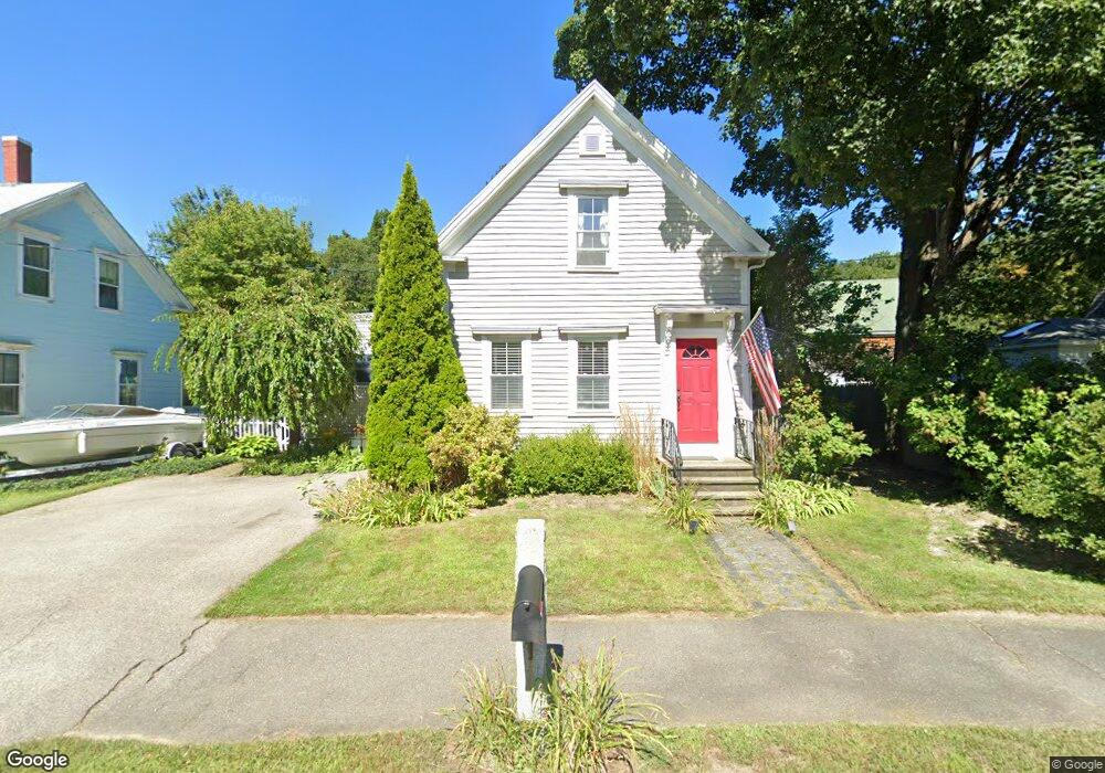
This home is located at 12 Samuel Hanson Ave, Dover, NH 03820 and is currently estimated at $430,438, approximately $340 per square foot. 12 Samuel Hanson Ave is a home located in Strafford County with nearby schools including Garrison School, Dover Middle School, and Dover Senior High School.
Ownership History
Date
Name
Owned For
Owner Type
Purchase Details
Closed on
Jul 7, 2020
Sold by
Dakin Mark
Bought by
Dakin Mark and Dakin Meghan
Current Estimated Value
Home Financials for this Owner
Home Financials are based on the most recent Mortgage that was taken out on this home.
Original Mortgage
$136,000
Outstanding Balance
$97,373
Interest Rate
3.7%
Mortgage Type
New Conventional
Estimated Equity
$333,065
Purchase Details
Closed on
Aug 16, 2002
Sold by
Kirby Kathleen M
Bought by
Dakin Mark
Home Financials for this Owner
Home Financials are based on the most recent Mortgage that was taken out on this home.
Original Mortgage
$140,800
Interest Rate
6.61%
Create a Home Valuation Report for This Property
The Home Valuation Report is an in-depth analysis detailing your home's value as well as a comparison with similar homes in the area
Home Values in the Area
Average Home Value in this Area
Purchase History
| Date | Buyer | Sale Price | Title Company |
|---|---|---|---|
| Dakin Mark | -- | None Available | |
| Dakin Mark | $176,000 | -- |
Source: Public Records
Mortgage History
| Date | Status | Borrower | Loan Amount |
|---|---|---|---|
| Open | Dakin Mark | $136,000 | |
| Previous Owner | Dakin Mark | $170,000 | |
| Previous Owner | Dakin Mark | $140,800 |
Source: Public Records
Tax History Compared to Growth
Tax History
| Year | Tax Paid | Tax Assessment Tax Assessment Total Assessment is a certain percentage of the fair market value that is determined by local assessors to be the total taxable value of land and additions on the property. | Land | Improvement |
|---|---|---|---|---|
| 2024 | $6,285 | $345,900 | $150,200 | $195,700 |
| 2023 | $6,337 | $338,900 | $158,100 | $180,800 |
| 2022 | $6,214 | $313,200 | $150,200 | $163,000 |
| 2021 | $6,289 | $289,800 | $142,200 | $147,600 |
| 2020 | $6,148 | $247,400 | $126,400 | $121,000 |
| 2019 | $5,872 | $233,100 | $114,600 | $118,500 |
| 2018 | $5,535 | $222,100 | $106,700 | $115,400 |
| 2017 | $5,143 | $198,800 | $86,900 | $111,900 |
| 2016 | $4,982 | $189,500 | $91,500 | $98,000 |
| 2015 | $4,758 | $178,800 | $83,200 | $95,600 |
| 2014 | $4,651 | $178,800 | $83,200 | $95,600 |
| 2011 | $4,085 | $162,600 | $74,300 | $88,300 |
Source: Public Records
Map
Nearby Homes
- 15 Hubbard Rd
- 18 S Pine St
- 4 Teresa Dr
- 73 Cricketbrook
- 93 Henry Law Ave Unit 61
- 93 Henry Law Ave Unit 29
- 93 Henry Law Ave Unit Cricket Brook Condo
- 55 Pointe Place Unit 304
- 55 Pointe Place Unit 206
- 55 Pointe Place Unit 108
- 55 Pointe Place Unit 202
- 55 Pointe Place Unit 103
- 55 Pointe Place Unit 204
- 21 Artisan Way
- 2 Shamrock Ln
- 44 Northfield Dr
- 13 Monroe St
- 98 Henry Law Ave Unit 28
- 65 Pointe Place Unit 106
- 4 Madelyn Dr
- 10 Samuel Hanson Ave
- 14 Samuel Hanson Ave
- 8 Samuel Hanson Ave
- 2 Mount Pleasant Rd
- 16 Samuel Hanson Ave
- 3 Samuel Hanson Ave
- 5 Samuel Hanson Ave
- 144 Court St
- 7 Samuel Hanson Ave
- 1 Samuel Hanson Ave
- 18 Samuel Hanson Ave
- 6 Samuel Hanson Ave
- 6 Back Rd
- 20 Samuel Hanson Ave
- 8 Back Rd
- 7 Back Rd
- 142 Court St
- 3 Back Rd
- 22 Samuel Hanson Ave
- 138 Court St