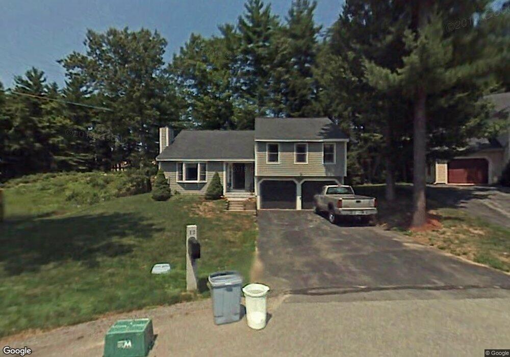
12 Sterling Way Hudson, NH 03051
Estimated Value: $412,384 - $474,000
2
Beds
2
Baths
1,429
Sq Ft
$306/Sq Ft
Est. Value
About This Home
This home is located at 12 Sterling Way, Hudson, NH 03051 and is currently estimated at $436,596, approximately $305 per square foot. 12 Sterling Way is a home located in Hillsborough County with nearby schools including Hills Garrison Elementary School, Hudson Memorial School, and Alvirne High School.
Ownership History
Date
Name
Owned For
Owner Type
Purchase Details
Closed on
Aug 31, 2020
Sold by
Rosa Daniel D and Adams Erin L
Bought by
Darins Places Ret
Current Estimated Value
Purchase Details
Closed on
Jan 22, 2019
Sold by
Rouleau Bertrand D
Bought by
Rosa Daniel D and Adams Erin L
Home Financials for this Owner
Home Financials are based on the most recent Mortgage that was taken out on this home.
Original Mortgage
$232,750
Interest Rate
4.6%
Purchase Details
Closed on
Aug 13, 2018
Sold by
Rouleau Ursula A
Bought by
Rouleau Bertrand D
Purchase Details
Closed on
Aug 25, 2003
Sold by
Berry Kenneth
Bought by
Rouleau Bertrand D and Rouleau Ursula A
Home Financials for this Owner
Home Financials are based on the most recent Mortgage that was taken out on this home.
Original Mortgage
$176,000
Interest Rate
5.52%
Create a Home Valuation Report for This Property
The Home Valuation Report is an in-depth analysis detailing your home's value as well as a comparison with similar homes in the area
Home Values in the Area
Average Home Value in this Area
Purchase History
| Date | Buyer | Sale Price | Title Company |
|---|---|---|---|
| Darins Places Ret | -- | None Available | |
| Rosa Daniel D | $245,000 | -- | |
| Rouleau Bertrand D | -- | -- | |
| Rouleau Bertrand D | $220,000 | -- |
Source: Public Records
Mortgage History
| Date | Status | Borrower | Loan Amount |
|---|---|---|---|
| Previous Owner | Rosa Daniel D | $232,750 | |
| Previous Owner | Rouleau Bertrand D | $160,057 | |
| Previous Owner | Rouleau Bertrand D | $176,000 |
Source: Public Records
Tax History Compared to Growth
Tax History
| Year | Tax Paid | Tax Assessment Tax Assessment Total Assessment is a certain percentage of the fair market value that is determined by local assessors to be the total taxable value of land and additions on the property. | Land | Improvement |
|---|---|---|---|---|
| 2024 | $4,828 | $293,500 | $0 | $293,500 |
| 2023 | $4,602 | $293,500 | $0 | $293,500 |
| 2022 | $4,232 | $288,100 | $0 | $288,100 |
| 2021 | $5,203 | $240,100 | $0 | $240,100 |
| 2020 | $5,125 | $239,800 | $0 | $239,800 |
| 2019 | $4,863 | $239,800 | $0 | $239,800 |
| 2018 | $4,786 | $238,100 | $0 | $238,100 |
| 2017 | $4,747 | $240,700 | $0 | $240,700 |
| 2016 | $4,401 | $200,300 | $0 | $200,300 |
| 2015 | $4,256 | $200,300 | $0 | $200,300 |
| 2014 | $4,172 | $200,300 | $0 | $200,300 |
| 2013 | $4,067 | $197,800 | $0 | $197,800 |
Source: Public Records
Map
Nearby Homes
- 151 Highland St
- 149 Highland St
- 32 Sousa Blvd
- 4 Shoal Creek Rd
- 138 Barbara Ln
- 34 Gabrielle Dr
- 5 Washington St
- 4 Washington St
- 38 Robin Dr
- 319 Fox Run Rd
- 327 Fox Run Rd
- 10 Wagner Way
- 13 Phillips Dr
- 105 Ferry St
- 216-001 Ferry St
- 10 Phillips Dr
- 202 Elmwood Dr
- 12 April Ct Unit B
- 25 Clearview Cir Unit A
- 16 Intervale Ct Unit B
- 17 Scottsdale Dr
- 31 Scottsdale Dr
- 56 Glasgow Cir
- 28 Glasgow Cir
- 11 Scottsdale Dr
- 41 Glasgow Cir
- 65 Glasgow Cir
- 62 Glasgow Cir
- 54 Glasgow Cir
- 52 Glasgow Cir
- 50 Glasgow Cir
- 44 Glasgow Cir
- 32 Glasgow Cir
- 18 Glasgow Cir
- 9 Glasgow Cir
- 41 Glasgow Cir Unit 1
- 62 Glasgow Cir Unit 70
- 32 Glasgow Cir Unit 32
- 35 Glasgow Cir
- 42 Glasgow Cir