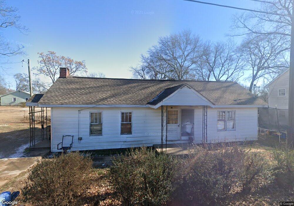
12 Tate St Gainesville, GA 30501
Browns Bridge NeighborhoodEstimated Value: $209,000 - $306,720
2
Beds
1
Bath
1,100
Sq Ft
$234/Sq Ft
Est. Value
About This Home
This home is located at 12 Tate St, Gainesville, GA 30501 and is currently estimated at $257,180, approximately $233 per square foot. 12 Tate St is a home located in Hall County with nearby schools including Lyman Hall Elementary School, West Hall Middle School, and West Hall High School.
Ownership History
Date
Name
Owned For
Owner Type
Purchase Details
Closed on
Aug 25, 2025
Sold by
Carrillos Properties Inc
Bought by
Qozb Development Llc
Current Estimated Value
Purchase Details
Closed on
Aug 15, 2025
Sold by
Los Carrillos Investments Llc
Bought by
Carrillos Properties Inc
Purchase Details
Closed on
Aug 14, 2025
Sold by
Carrillos Properties Inc
Bought by
Los Carrillos Investments Llc
Purchase Details
Closed on
Apr 1, 2024
Sold by
David Pierce Family L P
Bought by
Carrillos Properties Inc
Purchase Details
Closed on
Jul 15, 2014
Sold by
Branch Banking And Trust Co
Bought by
David Pierce Family Lp
Purchase Details
Closed on
May 6, 2014
Sold by
Willow Oak Llc
Bought by
Branch Banking And Trust Co and C/O Property Tax Compliance
Purchase Details
Closed on
Aug 6, 2004
Sold by
Turk Richard Thomas
Bought by
Willow Oak Llc
Purchase Details
Closed on
May 12, 2004
Sold by
Turk Rosalie J
Bought by
Turk Richard Thomas
Create a Home Valuation Report for This Property
The Home Valuation Report is an in-depth analysis detailing your home's value as well as a comparison with similar homes in the area
Home Values in the Area
Average Home Value in this Area
Purchase History
| Date | Buyer | Sale Price | Title Company |
|---|---|---|---|
| Qozb Development Llc | -- | -- | |
| Carrillos Properties Inc | -- | -- | |
| Los Carrillos Investments Llc | -- | -- | |
| Carrillos Properties Inc | $1,000,000 | -- | |
| David Pierce Family Lp | $150,000 | -- | |
| Branch Banking And Trust Co | $45,000 | -- | |
| Willow Oak Llc | $100,000 | -- | |
| Turk Richard Thomas | -- | -- |
Source: Public Records
Tax History Compared to Growth
Tax History
| Year | Tax Paid | Tax Assessment Tax Assessment Total Assessment is a certain percentage of the fair market value that is determined by local assessors to be the total taxable value of land and additions on the property. | Land | Improvement |
|---|---|---|---|---|
| 2025 | $2,294 | $90,040 | $11,720 | $78,320 |
| 2024 | $2,027 | $76,080 | $10,120 | $65,960 |
| 2023 | $1,505 | $72,560 | $10,120 | $62,440 |
| 2022 | $1,563 | $54,920 | $5,960 | $48,960 |
| 2021 | $1,161 | $38,560 | $2,400 | $36,160 |
| 2020 | $1,332 | $43,800 | $4,280 | $39,520 |
| 2019 | $946 | $29,232 | $4,860 | $24,372 |
| 2018 | $973 | $29,232 | $4,860 | $24,372 |
| 2017 | $948 | $33,712 | $5,040 | $28,672 |
| 2016 | $954 | $29,580 | $5,040 | $24,540 |
| 2015 | $925 | $28,300 | $3,760 | $24,540 |
| 2014 | $925 | $28,300 | $3,760 | $24,540 |
Source: Public Records
Map
Nearby Homes
- 593 Shallowford Rd NW
- 0 Hilton Dr Unit 10529633
- 0 Hilton Dr Unit 7585721
- 2054 Spring Rd
- 1255 Purina Dr
- 221 Shallowford Dr
- 2244 Bennett Cir
- 1122 Villa Clara Way
- 510 Nightfire Ct SW
- 518 Nightfire Ct SW
- 1636 Atlanta Hwy
- 775 Ridgewood Ave
- 110 Summit St SE
- #25 3022 Waterford Dr
- 3022 Waterford Dr
- 804 Wilshire Rd
- 601 Ridgewood Ave
- 810 Hillside Dr
- 384 Forrest Ave
- 372 Forrest Ave
- 1505 Westside Dr
- 1521 Westside Dr
- 10 Tate St
- 1508 Westside Dr
- 1501 Westside Dr
- 1538 Lyman St
- 1510 Westside Dr
- 1506 Westside Dr
- 1435 Lyman St
- 1511 Westside Dr
- 1433 Lyman St
- 1437 Lyman St
- 1429 Westside Dr
- 1429 Westside Dr Unit 58
- 1524 Carter St
- 2400 W Carter St
- 1426 Lyman St
- 1602 Westside Dr
- 1425 Westside Dr
- 1512 W Carter St