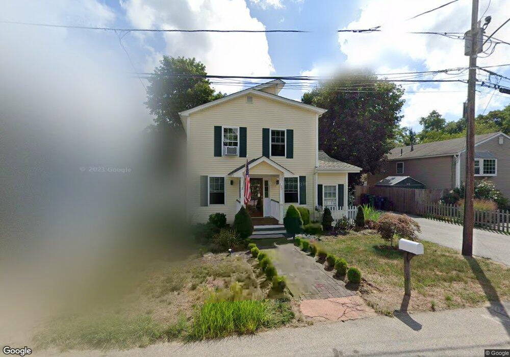
120 Abbott Ave Warwick, RI 02886
Nausauket NeighborhoodEstimated Value: $380,798 - $439,000
2
Beds
2
Baths
1,332
Sq Ft
$305/Sq Ft
Est. Value
About This Home
This home is located at 120 Abbott Ave, Warwick, RI 02886 and is currently estimated at $406,200, approximately $304 per square foot. 120 Abbott Ave is a home located in Kent County with nearby schools including St Rose Of Lima School and Eleanor Briggs School.
Ownership History
Date
Name
Owned For
Owner Type
Purchase Details
Closed on
Nov 29, 2004
Sold by
Nicholson Harold D Est and Avery
Bought by
Fisher Edward J
Current Estimated Value
Home Financials for this Owner
Home Financials are based on the most recent Mortgage that was taken out on this home.
Original Mortgage
$85,500
Interest Rate
5.75%
Mortgage Type
Purchase Money Mortgage
Create a Home Valuation Report for This Property
The Home Valuation Report is an in-depth analysis detailing your home's value as well as a comparison with similar homes in the area
Home Values in the Area
Average Home Value in this Area
Purchase History
| Date | Buyer | Sale Price | Title Company |
|---|---|---|---|
| Fisher Edward J | $45,000 | -- | |
| Fisher Edward J | $45,000 | -- |
Source: Public Records
Mortgage History
| Date | Status | Borrower | Loan Amount |
|---|---|---|---|
| Open | Fisher Edward J | $185,250 | |
| Closed | Fisher Edward J | $130,000 | |
| Closed | Fisher Edward J | $85,500 |
Source: Public Records
Tax History Compared to Growth
Tax History
| Year | Tax Paid | Tax Assessment Tax Assessment Total Assessment is a certain percentage of the fair market value that is determined by local assessors to be the total taxable value of land and additions on the property. | Land | Improvement |
|---|---|---|---|---|
| 2025 | $4,622 | $363,900 | $109,000 | $254,900 |
| 2024 | $4,153 | $287,000 | $91,300 | $195,700 |
| 2023 | $4,073 | $287,000 | $91,300 | $195,700 |
| 2022 | $4,036 | $215,500 | $67,300 | $148,200 |
| 2021 | $4,036 | $215,500 | $67,300 | $148,200 |
| 2020 | $4,036 | $215,500 | $67,300 | $148,200 |
| 2019 | $4,036 | $215,500 | $67,300 | $148,200 |
| 2018 | $3,165 | $176,900 | $67,300 | $109,600 |
| 2017 | $3,580 | $176,900 | $67,300 | $109,600 |
| 2016 | $3,580 | $176,900 | $67,300 | $109,600 |
| 2015 | $3,424 | $165,000 | $53,600 | $111,400 |
| 2014 | $3,310 | $165,000 | $53,600 | $111,400 |
| 2013 | $3,265 | $165,000 | $53,600 | $111,400 |
Source: Public Records
Map
Nearby Homes
- 345 Nausauket Rd
- 15 Abbott Ave
- 45 Juniper Ave
- 132 Bakers Creek Rd
- 67 Oak Tree Ave
- 52 Inez Ave
- 46 Andrew Comstock Rd
- 3524 W Shore Rd Unit 503
- 3524 W Shore Rd Unit 215
- 151 Wethersfield Dr
- 3383 W Shore Rd
- 3976 Post Rd
- 3940 Post Rd Unit 26
- 3940 Post Rd Unit 3
- 78 Keeley Ave
- 3945 Post Rd
- 6 Island View Dr
- 5 Mill Wheel Rd
- 45 Tourtelot Ave
- 43 Highland Ave
- 114 Abbott Ave
- 124 Abbott Ave
- 110 Abbott Ave
- 130 Abbott Ave
- 125 Theodore Ave
- 117 Theodore Ave
- 129 Theodore Ave
- 104 Abbott Ave
- 134 Abbott Ave
- 115 Abbott Ave
- 125 Abbott Ave
- 135 Theodore Ave
- 107 Abbott Ave
- 98 Abbott Ave
- 135 Abbott Ave
- 103 Abbott Ave
- 139 Abbott Ave
- 47 Walton Ave
- 41 Walton Ave
- 92 Abbott Ave