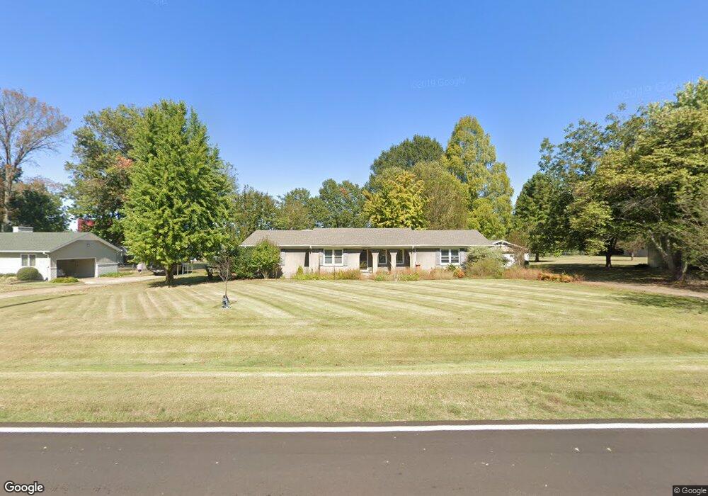
120 Baker Rd Martin, TN 38237
Estimated Value: $253,000 - $302,000
--
Bed
3
Baths
2,236
Sq Ft
$126/Sq Ft
Est. Value
About This Home
This home is located at 120 Baker Rd, Martin, TN 38237 and is currently estimated at $281,209, approximately $125 per square foot. 120 Baker Rd is a home located in Weakley County with nearby schools including Central Christian Academy and Unity Christian School.
Ownership History
Date
Name
Owned For
Owner Type
Purchase Details
Closed on
Jan 24, 2005
Sold by
Federal National Mortgage Association
Bought by
Alexander Lynn M
Current Estimated Value
Home Financials for this Owner
Home Financials are based on the most recent Mortgage that was taken out on this home.
Original Mortgage
$96,800
Interest Rate
5.66%
Mortgage Type
Cash
Purchase Details
Closed on
Jul 30, 2002
Sold by
Greenlocke Karen M
Bought by
Shane Martin
Purchase Details
Closed on
Apr 23, 2001
Sold by
Greenockle Karen M
Bought by
Purvis Gracie J
Purchase Details
Closed on
Aug 25, 1989
Bought by
Jane Purvis Gracie and Greenockle Karen M
Purchase Details
Closed on
Jul 20, 1987
Bought by
Elam M Greg M and Elam Holly M
Create a Home Valuation Report for This Property
The Home Valuation Report is an in-depth analysis detailing your home's value as well as a comparison with similar homes in the area
Home Values in the Area
Average Home Value in this Area
Purchase History
| Date | Buyer | Sale Price | Title Company |
|---|---|---|---|
| Alexander Lynn M | $121,000 | -- | |
| Shane Martin | $145,500 | -- | |
| Purvis Gracie J | -- | -- | |
| Jane Purvis Gracie | $83,000 | -- | |
| Elam M Greg M | $78,500 | -- |
Source: Public Records
Mortgage History
| Date | Status | Borrower | Loan Amount |
|---|---|---|---|
| Closed | Elam M Greg M | $96,800 |
Source: Public Records
Tax History Compared to Growth
Tax History
| Year | Tax Paid | Tax Assessment Tax Assessment Total Assessment is a certain percentage of the fair market value that is determined by local assessors to be the total taxable value of land and additions on the property. | Land | Improvement |
|---|---|---|---|---|
| 2024 | -- | $59,725 | $3,750 | $55,975 |
| 2023 | $1,802 | $59,725 | $3,750 | $55,975 |
| 2022 | $1,479 | $39,675 | $3,300 | $36,375 |
| 2021 | $1,479 | $39,675 | $3,300 | $36,375 |
| 2020 | $1,479 | $39,675 | $3,300 | $36,375 |
| 2019 | $1,340 | $39,675 | $3,300 | $36,375 |
| 2018 | $1,340 | $39,675 | $3,300 | $36,375 |
| 2017 | $1,372 | $37,775 | $2,750 | $35,025 |
| 2016 | $1,372 | $37,775 | $0 | $0 |
| 2015 | $1,372 | $37,784 | $0 | $0 |
| 2014 | $1,372 | $37,784 | $0 | $0 |
Source: Public Records
Map
Nearby Homes
- 338 Mount Pelia Rd
- 126 Lilly Pond Ln
- 131 Big John Dr
- 304 Tyler Austin Rd
- 102 Cherry Dr
- 110 3 Point Rd
- 0 Kennedy Dr Unit RRA40830
- 0 Kennedy Dr Unit 187533
- 0 Hawks Rd Unit Brooks
- 0 Skyhawk Pkwy Unit Brooks RRA45195
- 1035 Harrison Rd
- 206 S Dodd Dr
- 299 Tarver Rd
- 1127 Harrison Rd
- 0 University St Unit 2504446
- 551 Elm St
- 500 Fowler Rd
- 105 Dogwood Ln
- 239 Charger Ln
- 210 Oakland St
- 128 Baker Rd
- 364 Mount Pelia Rd
- 370 Mount Pelia Rd
- 123 Baker Rd
- 358 Mount Pelia Rd
- 132 Baker Rd
- 115 Baker Rd
- 112 Baker Rd
- 111 Baker Rd
- 371 Mount Pelia Rd
- 109 Boyte Dr
- 354 Mount Pelia Rd
- 128 Brundige Dr
- 142 Baker Rd
- 107 Baker Rd
- 113 Boyte Dr
- 124 Brundige Dr
- 143 Lilly Pond Ln
- 391 Mount Pelia Rd
- 117 Boyte Dr