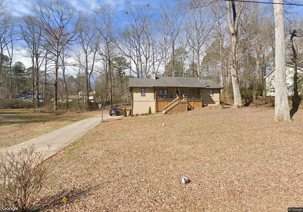
120 Bob White Dr Unit 3 Stockbridge, GA 30281
Estimated Value: $260,916 - $285,000
3
Beds
2
Baths
1,682
Sq Ft
$162/Sq Ft
Est. Value
About This Home
This home is located at 120 Bob White Dr Unit 3, Stockbridge, GA 30281 and is currently estimated at $272,229, approximately $161 per square foot. 120 Bob White Dr Unit 3 is a home located in Henry County with nearby schools including Austin Road Elementary School, Austin Road Middle School, and Woodland High School.
Ownership History
Date
Name
Owned For
Owner Type
Purchase Details
Closed on
Aug 21, 2006
Sold by
Hud
Bought by
Collier Samuel J
Current Estimated Value
Home Financials for this Owner
Home Financials are based on the most recent Mortgage that was taken out on this home.
Original Mortgage
$108,450
Interest Rate
6.39%
Mortgage Type
New Conventional
Purchase Details
Closed on
Mar 7, 2006
Sold by
Washington Mutual Bk Fa
Bought by
Hud
Purchase Details
Closed on
Mar 30, 2004
Sold by
Queen Lloyd A
Bought by
Queen Lloyd A and Queen Kelly
Home Financials for this Owner
Home Financials are based on the most recent Mortgage that was taken out on this home.
Original Mortgage
$139,894
Interest Rate
5.35%
Mortgage Type
VA
Create a Home Valuation Report for This Property
The Home Valuation Report is an in-depth analysis detailing your home's value as well as a comparison with similar homes in the area
Home Values in the Area
Average Home Value in this Area
Purchase History
| Date | Buyer | Sale Price | Title Company |
|---|---|---|---|
| Collier Samuel J | -- | -- | |
| Hud | -- | -- | |
| Washington Mutual Bk Fa | $159,956 | -- | |
| Queen Lloyd A | -- | -- | |
| Queen Lloyd A | $141,000 | -- |
Source: Public Records
Mortgage History
| Date | Status | Borrower | Loan Amount |
|---|---|---|---|
| Previous Owner | Collier Samuel J | $108,450 | |
| Previous Owner | Queen Lloyd A | $139,894 |
Source: Public Records
Tax History Compared to Growth
Tax History
| Year | Tax Paid | Tax Assessment Tax Assessment Total Assessment is a certain percentage of the fair market value that is determined by local assessors to be the total taxable value of land and additions on the property. | Land | Improvement |
|---|---|---|---|---|
| 2025 | $3,067 | $109,368 | $14,000 | $95,368 |
| 2024 | $3,067 | $102,560 | $14,000 | $88,560 |
| 2023 | $2,429 | $100,280 | $10,000 | $90,280 |
| 2022 | $2,607 | $86,440 | $10,000 | $76,440 |
| 2021 | $2,229 | $70,440 | $10,000 | $60,440 |
| 2020 | $1,995 | $60,520 | $8,000 | $52,520 |
| 2019 | $1,940 | $58,200 | $8,000 | $50,200 |
| 2018 | $1,830 | $53,720 | $8,000 | $45,720 |
| 2016 | $1,420 | $43,040 | $8,000 | $35,040 |
| 2015 | $1,073 | $33,400 | $4,000 | $29,400 |
| 2014 | $965 | $30,480 | $4,000 | $26,480 |
Source: Public Records
Map
Nearby Homes
- 125 Bob White Dr
- 106 Bob White Dr
- 105 Bobolink Dr
- 108 Hilltop Cir
- 1080 Gardner Rd
- 107 Woodridge Dr
- 230 Mimosa Ln
- 221 Lakeview Dr
- 342 Lakeshore Dr
- 562 Patillo Rd
- 780 Gardner Rd
- 154 Johns Creek Ln
- 565 Patillo Rd
- 1100 Gardner Rd
- 418 Honeysuckle Ln
- 40 Lake Ct
- 109 Greenwood Dr
- 214 Ashland Dr
- 453 Azalea Dr
- 200 Johns Creek Ln
- 130 Bob White Dr
- 110 Bob White Dr
- 0 Bob White Dr Unit 8221408
- 0 Bob White Dr Unit 7326178
- 0 Bob White Dr Unit 7099772
- 0 Bob White Dr Unit 7375068
- 0 Bob White Dr Unit 7458788
- 131 Audubon Pkwy
- 131 Audubon Pkwy Unit 1
- 133 Audubon Pkwy Unit 1
- 129 Audubon Pkwy Unit 1
- 140 Bob White Dr
- 135 Bob White Dr Unit 4
- 115 Bob White Dr Unit 12
- 115 Bob White Dr
- 135 Audubon Pkwy Unit 1
- 127 Audubon Pkwy
- 127 Audubon Pkwy Unit 1
- 0 Audubon Pkwy Unit 7466097
- 0 Audubon Pkwy Unit 8640839