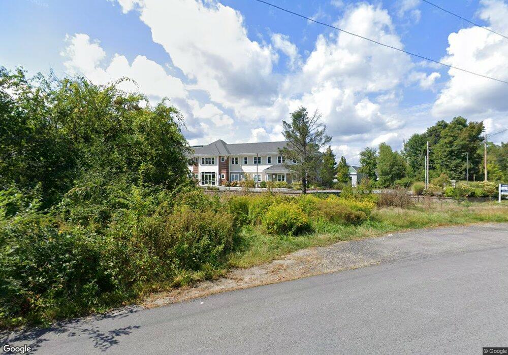
120 Boston Rd Unit C Groton, MA 01450
--
Bed
8
Baths
1,100
Sq Ft
2.97
Acres
About This Home
This home is located at 120 Boston Rd Unit C, Groton, MA 01450. 120 Boston Rd Unit C is a home located in Middlesex County with nearby schools including Groton Dunstable Regional High School and Groton School.
Ownership History
Date
Name
Owned For
Owner Type
Purchase Details
Closed on
Sep 30, 2015
Sold by
Pcm Rt and Myette
Bought by
120 Boston Road Llc
Home Financials for this Owner
Home Financials are based on the most recent Mortgage that was taken out on this home.
Original Mortgage
$1
Outstanding Balance
$1
Interest Rate
3.95%
Mortgage Type
Commercial
Purchase Details
Closed on
Aug 30, 1996
Sold by
Fairview Orchards Inc
Bought by
Pcm Rt and Myette
Create a Home Valuation Report for This Property
The Home Valuation Report is an in-depth analysis detailing your home's value as well as a comparison with similar homes in the area
Home Values in the Area
Average Home Value in this Area
Purchase History
| Date | Buyer | Sale Price | Title Company |
|---|---|---|---|
| 120 Boston Road Llc | $475,000 | -- | |
| 120 Boston Road Llc | $475,000 | -- | |
| 120 Boston Road Llc | $475,000 | -- | |
| Pcm Rt | $370,000 | -- |
Source: Public Records
Mortgage History
| Date | Status | Borrower | Loan Amount |
|---|---|---|---|
| Open | 120 Boston Road Llc | $1 | |
| Previous Owner | Pcm Rt | $30,000 | |
| Previous Owner | Pcm Rt | $365,000 | |
| Previous Owner | Pcm Rt | $73,000 |
Source: Public Records
Tax History Compared to Growth
Tax History
| Year | Tax Paid | Tax Assessment Tax Assessment Total Assessment is a certain percentage of the fair market value that is determined by local assessors to be the total taxable value of land and additions on the property. | Land | Improvement |
|---|---|---|---|---|
| 2025 | $43,418 | $2,847,100 | $334,600 | $2,512,500 |
| 2024 | $44,177 | $2,927,600 | $334,600 | $2,593,000 |
| 2023 | $45,788 | $2,927,600 | $334,600 | $2,593,000 |
| 2022 | $39,726 | $2,311,000 | $301,000 | $2,010,000 |
| 2021 | $39,855 | $2,264,500 | $273,000 | $1,991,500 |
| 2020 | $39,357 | $2,264,500 | $273,000 | $1,991,500 |
| 2019 | $28,755 | $1,587,800 | $273,000 | $1,314,800 |
| 2018 | $29,644 | $1,587,800 | $273,000 | $1,314,800 |
| 2017 | $28,993 | $1,587,800 | $273,000 | $1,314,800 |
| 2016 | $11,058 | $588,800 | $256,600 | $332,200 |
| 2015 | $10,757 | $588,800 | $256,600 | $332,200 |
Source: Public Records
Map
Nearby Homes
- 65 Skyfields Dr
- 227 Boston Rd
- 100 Whitman Rd
- PL 639 Indian Hill Rd
- 117 Main St
- 45 Legacy Ln Unit B
- 72 Dale Ln
- 12 Oriole Dr
- 284 Martins Pond Rd
- 111 Farmers Row
- 228 Main St
- 247 Main St
- 52 Chestnut Hill Rd
- 20 Hayes Woods Ln
- Lot 9A Hayes Woods Ln
- 18 Douglas Dr
- 40 Hemlock Park Dr
- 17 Douglas Dr
- 5 Douglas Dr
- 35 Oxbow Ln
- 120 Boston Rd
- 116 Boston Rd
- 112 Boston Rd
- 112b Boston Rd Unit B
- 158 Boston Rd
- 13 Skyfields Dr
- 44 Forest Dr Unit B
- 31 Skyfields Dr
- 144 Boston Rd Unit 146
- 146 Boston Rd
- 144 Boston Rd
- 144 Boston Rd Unit 1
- 100 Boston Rd
- 100 Boston Rd Unit C
- 100 Boston Rd Unit A
- 100 Boston Rd Unit 300
- 152 Boston Rd Unit A
- 152 Boston Rd Unit 156
- 81 Boston Rd
- 17 Lovers Ln