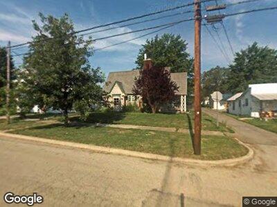
120 N Main St Rawson, OH 45881
Estimated Value: $97,000 - $150,383
4
Beds
2
Baths
2,532
Sq Ft
$50/Sq Ft
Est. Value
About This Home
This home is located at 120 N Main St, Rawson, OH 45881 and is currently estimated at $126,846, approximately $50 per square foot. 120 N Main St is a home located in Hancock County with nearby schools including Cory-Rawson Elementary School and Cory-Rawson High School.
Ownership History
Date
Name
Owned For
Owner Type
Purchase Details
Closed on
Apr 12, 2018
Sold by
Camper Vanessa
Bought by
Camper Dennis L
Current Estimated Value
Purchase Details
Closed on
Dec 12, 2012
Sold by
Sprosty William L and Sprosty Kelley C
Bought by
Camper Dennis
Purchase Details
Closed on
Mar 31, 1994
Bought by
Thatcher Todd C and Thatcher Kelley C
Create a Home Valuation Report for This Property
The Home Valuation Report is an in-depth analysis detailing your home's value as well as a comparison with similar homes in the area
Home Values in the Area
Average Home Value in this Area
Purchase History
| Date | Buyer | Sale Price | Title Company |
|---|---|---|---|
| Camper Dennis L | -- | None Available | |
| Camper Dennis | $35,000 | Whitman Title Security | |
| Thatcher Todd C | $66,000 | -- |
Source: Public Records
Mortgage History
| Date | Status | Borrower | Loan Amount |
|---|---|---|---|
| Previous Owner | Sprosty William L | $25,000 |
Source: Public Records
Tax History Compared to Growth
Tax History
| Year | Tax Paid | Tax Assessment Tax Assessment Total Assessment is a certain percentage of the fair market value that is determined by local assessors to be the total taxable value of land and additions on the property. | Land | Improvement |
|---|---|---|---|---|
| 2024 | $1,248 | $39,410 | $4,160 | $35,250 |
| 2023 | $1,244 | $39,410 | $4,160 | $35,250 |
| 2022 | $1,651 | $39,600 | $4,160 | $35,440 |
| 2021 | $1,498 | $31,790 | $4,370 | $27,420 |
| 2020 | $1,115 | $31,790 | $4,370 | $27,420 |
| 2019 | $1,456 | $31,790 | $4,370 | $27,420 |
| 2018 | $1,172 | $25,440 | $3,360 | $22,080 |
| 2017 | $607 | $25,440 | $3,360 | $22,080 |
| 2016 | $1,227 | $25,440 | $3,360 | $22,080 |
| 2015 | $1,118 | $23,930 | $2,100 | $21,830 |
| 2014 | $1,133 | $23,950 | $2,100 | $21,850 |
| 2012 | $1,180 | $23,950 | $2,100 | $21,850 |
Source: Public Records
Map
Nearby Homes
- 0 County Road 12
- 0 Hidden Trails Dr Unit 6127301
- 16392 County Road 12
- 202 S Main St
- 309 Lincoln St
- 0 State Route 12
- 9004 County Road 26
- 18875 County Road 12
- 9500 County Road 37
- 17297 Township Road 51
- 302 E Sandusky St
- 7016 County Road 86
- 11070 Township Road 67
- 9152 W State Route 12
- 9307 W State Route 12
- 0 County Road 15 Unit C 6127499
- 151 Riley St
- 9641 Early Dr
- 9222 Hiegel Dr
- 204 N Jackson St