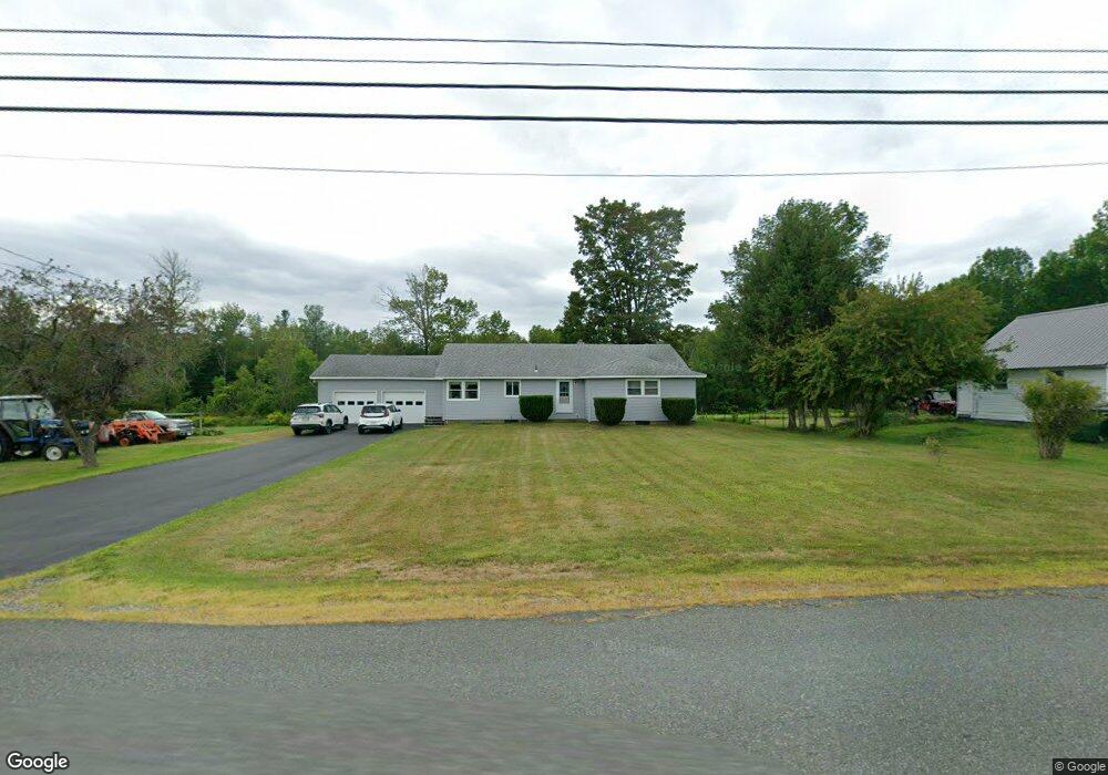
120 S Central St Plainfield, MA 01070
Estimated Value: $284,151 - $383,000
3
Beds
1
Bath
1,569
Sq Ft
$204/Sq Ft
Est. Value
About This Home
This home is located at 120 S Central St, Plainfield, MA 01070 and is currently estimated at $320,288, approximately $204 per square foot. 120 S Central St is a home located in Hampshire County with nearby schools including Mohawk Trail Regional High School.
Create a Home Valuation Report for This Property
The Home Valuation Report is an in-depth analysis detailing your home's value as well as a comparison with similar homes in the area
Home Values in the Area
Average Home Value in this Area
Tax History
| Year | Tax Paid | Tax Assessment Tax Assessment Total Assessment is a certain percentage of the fair market value that is determined by local assessors to be the total taxable value of land and additions on the property. | Land | Improvement |
|---|---|---|---|---|
| 2025 | $3,705 | $200,500 | $34,600 | $165,900 |
| 2024 | $3,633 | $169,600 | $34,600 | $135,000 |
| 2023 | $3,514 | $169,600 | $34,600 | $135,000 |
| 2022 | $3,384 | $169,600 | $34,600 | $135,000 |
| 2021 | $3,246 | $168,700 | $33,500 | $135,200 |
| 2020 | $3,459 | $171,900 | $33,800 | $138,100 |
| 2019 | $3,043 | $156,700 | $33,800 | $122,900 |
| 2018 | $2,944 | $154,300 | $31,400 | $122,900 |
| 2017 | $2,812 | $144,500 | $31,400 | $113,100 |
| 2016 | $2,693 | $142,800 | $29,700 | $113,100 |
| 2015 | $2,560 | $143,600 | $34,200 | $109,400 |
| 2014 | $2,571 | $143,800 | $33,800 | $110,000 |
Source: Public Records
Map
Nearby Homes
- 296 E Main St
- 10 Maple St
- 311 Cummington Rd
- 333 Ranney Corner Rd
- 39 Hawley St
- 0 John Ford Rd Unit 73403156
- 678 W Main St
- 0 Spruce Corner Rd Unit 73244975
- 13 Jordan Rd
- 220 Hawley Rd
- 54 Porter Hill Rd
- 0 Sears Rd Unit 73373850
- 40 Suburban Dr
- 237 Trouble St
- 504 Loop Rd
- 500 Loop Rd
- 146 Berkshire Trail W
- 00 Capen Clark Rd
- 00 Yale Rd
- 527 Main St
Your Personal Tour Guide
Ask me questions while you tour the home.