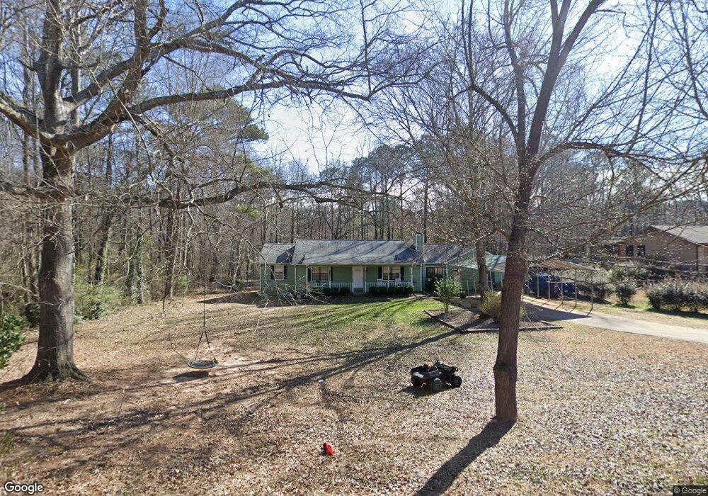
120 Summerfield Ct Stockbridge, GA 30281
Estimated Value: $220,000 - $233,141
3
Beds
2
Baths
1,488
Sq Ft
$152/Sq Ft
Est. Value
About This Home
This home is located at 120 Summerfield Ct, Stockbridge, GA 30281 and is currently estimated at $225,535, approximately $151 per square foot. 120 Summerfield Ct is a home located in Henry County with nearby schools including Woodland Elementary School, Woodland Middle School, and Woodland High School.
Ownership History
Date
Name
Owned For
Owner Type
Purchase Details
Closed on
Aug 29, 2003
Sold by
Green Bruce L and Green Barbara
Bought by
Mahon Michael A and Mahon Rebekah
Current Estimated Value
Home Financials for this Owner
Home Financials are based on the most recent Mortgage that was taken out on this home.
Original Mortgage
$114,363
Outstanding Balance
$51,203
Interest Rate
5.85%
Mortgage Type
New Conventional
Estimated Equity
$174,332
Purchase Details
Closed on
Feb 20, 1996
Sold by
Davis Michael Lori
Bought by
Hagewood Harlan Colleen
Create a Home Valuation Report for This Property
The Home Valuation Report is an in-depth analysis detailing your home's value as well as a comparison with similar homes in the area
Home Values in the Area
Average Home Value in this Area
Purchase History
| Date | Buyer | Sale Price | Title Company |
|---|---|---|---|
| Mahon Michael A | $117,900 | -- | |
| Hagewood Harlan Colleen | $87,900 | -- |
Source: Public Records
Mortgage History
| Date | Status | Borrower | Loan Amount |
|---|---|---|---|
| Open | Mahon Michael A | $114,363 | |
| Closed | Hagewood Harlan Colleen | $0 |
Source: Public Records
Tax History Compared to Growth
Tax History
| Year | Tax Paid | Tax Assessment Tax Assessment Total Assessment is a certain percentage of the fair market value that is determined by local assessors to be the total taxable value of land and additions on the property. | Land | Improvement |
|---|---|---|---|---|
| 2025 | $2,572 | $93,760 | $12,000 | $81,760 |
| 2024 | $2,572 | $90,880 | $12,000 | $78,880 |
| 2023 | $2,043 | $88,640 | $10,000 | $78,640 |
| 2022 | $2,104 | $69,840 | $10,000 | $59,840 |
| 2021 | $1,754 | $55,000 | $10,000 | $45,000 |
| 2020 | $1,605 | $48,720 | $8,000 | $40,720 |
| 2019 | $1,411 | $42,800 | $8,000 | $34,800 |
| 2018 | $1,366 | $41,640 | $8,000 | $33,640 |
| 2016 | $1,277 | $39,320 | $6,000 | $33,320 |
| 2015 | $1,148 | $35,320 | $6,000 | $29,320 |
| 2014 | $914 | $29,200 | $4,400 | $24,800 |
Source: Public Records
Map
Nearby Homes
- 0 Oakview Dr Unit 10472931
- 0 Oakview Dr Unit 7533331
- 0 Flakes Rd Unit 24
- 0 Freeman #128 Dr
- 90 Chimney Rise Ct
- 0 Freeman Dr Unit 128 10480940
- 109 Greenwood Dr
- 115 Lakeview Dr
- 110 Wildwood Dr
- 342 Lakeshore Dr
- 176 Swan Lake Dr
- 0 Chimney Smoke Dr Unit 10640945
- 0 Chimney Smoke Dr Unit 182111
- 30 Hickory Dr
- 107 Woodridge Dr
- 128 Belair Ln Unit 1
- 221 Lakeview Dr
- 297 Edison Dr
- 277 Edison Dr
- 418 Honeysuckle Ln
- 110 Summerfield Ct
- 100 Summerfield Ct
- 125 Summerfield Ct
- 105 Summerfield Ct
- 115 Summerfield Ct
- 95 Summerfield Ct Unit 2
- 85 Summerfield Ct
- 90 Summerfield Ct
- 75 Summerfield Ct
- 80 Summerfield Ct Unit 2
- 55 Freeman Dr
- 90 Windsong Ct
- 80 Windsong Ct
- 100 Windsong Ct
- 70 Windsong Ct
- 65 Summerfield Ct
- 110 Windsong Ct
- 45 Freeman Dr
- 70 Summerfield Ct
- 0 Summerfield Ct Unit 7596746