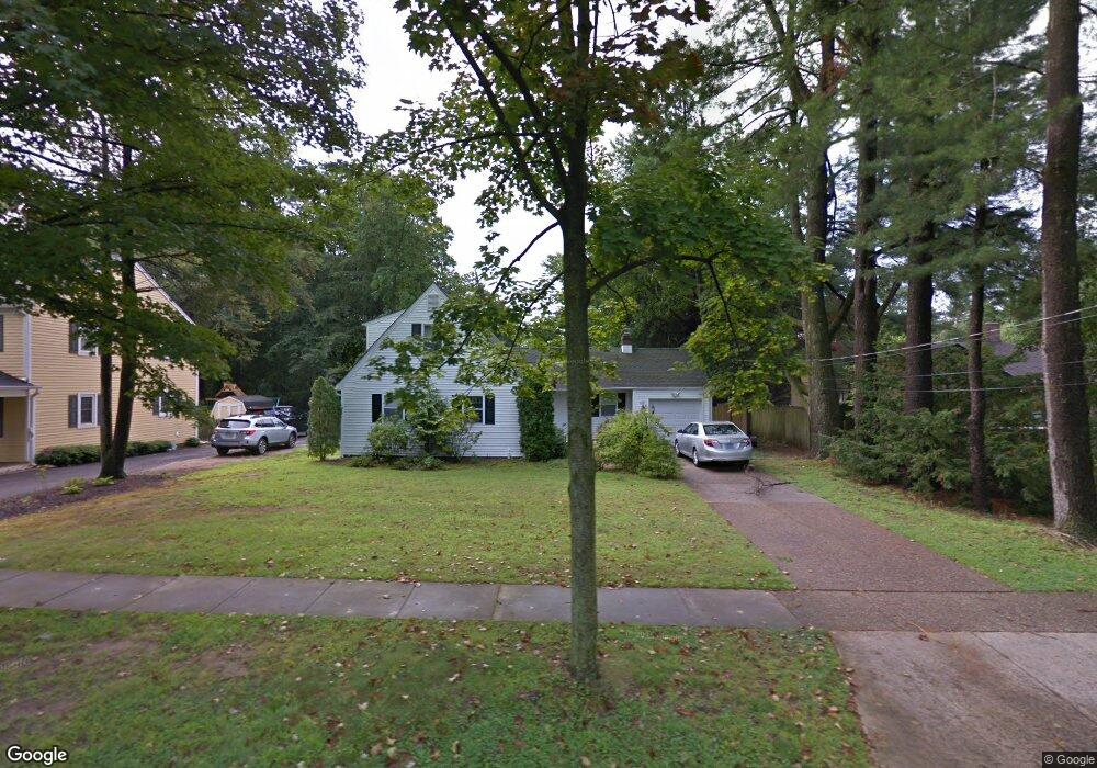
120 W Maple Ave Moorestown, NJ 08057
Estimated Value: $532,000 - $631,000
--
Bed
--
Bath
1,721
Sq Ft
$339/Sq Ft
Est. Value
About This Home
This home is located at 120 W Maple Ave, Moorestown, NJ 08057 and is currently estimated at $582,870, approximately $338 per square foot. 120 W Maple Ave is a home located in Burlington County with nearby schools including George C. Baker Elementary School, Moorestown Upper Elementary School, and William Allen Middle School.
Ownership History
Date
Name
Owned For
Owner Type
Purchase Details
Closed on
Apr 7, 2023
Sold by
Benvenuto Janet
Bought by
Scott Julia and Scott Andrew
Current Estimated Value
Home Financials for this Owner
Home Financials are based on the most recent Mortgage that was taken out on this home.
Original Mortgage
$355,200
Outstanding Balance
$344,812
Interest Rate
6.32%
Mortgage Type
New Conventional
Estimated Equity
$238,058
Purchase Details
Closed on
Dec 18, 1970
Bought by
Mcelliott Lynn J
Create a Home Valuation Report for This Property
The Home Valuation Report is an in-depth analysis detailing your home's value as well as a comparison with similar homes in the area
Home Values in the Area
Average Home Value in this Area
Purchase History
| Date | Buyer | Sale Price | Title Company |
|---|---|---|---|
| Scott Julia | $444,000 | First American Title | |
| Scott Julia | $444,000 | First American Title | |
| Mcelliott Lynn J | $35,000 | -- |
Source: Public Records
Mortgage History
| Date | Status | Borrower | Loan Amount |
|---|---|---|---|
| Open | Scott Julia | $355,200 | |
| Closed | Scott Julia | $355,200 |
Source: Public Records
Tax History Compared to Growth
Tax History
| Year | Tax Paid | Tax Assessment Tax Assessment Total Assessment is a certain percentage of the fair market value that is determined by local assessors to be the total taxable value of land and additions on the property. | Land | Improvement |
|---|---|---|---|---|
| 2025 | $9,013 | $317,700 | $199,100 | $118,600 |
| 2024 | $8,740 | $317,700 | $199,100 | $118,600 |
| 2023 | $8,740 | $317,700 | $199,100 | $118,600 |
| 2022 | $8,651 | $317,700 | $199,100 | $118,600 |
| 2021 | $8,537 | $317,700 | $199,100 | $118,600 |
| 2020 | $8,483 | $317,700 | $199,100 | $118,600 |
| 2019 | $8,333 | $317,700 | $199,100 | $118,600 |
| 2018 | $8,108 | $317,700 | $199,100 | $118,600 |
| 2017 | $8,178 | $317,700 | $199,100 | $118,600 |
| 2016 | $8,149 | $317,700 | $199,100 | $118,600 |
| 2015 | $8,051 | $317,700 | $199,100 | $118,600 |
| 2014 | $7,644 | $317,700 | $199,100 | $118,600 |
Source: Public Records
Map
Nearby Homes
- 116 W Maple Ave
- 122 W Maple Ave
- 114 W Maple Ave
- 509 Irving Ct
- 507 Irving Ct
- 130 W Maple Ave
- 123 W Maple Ave
- 121 W Maple Ave
- 112 W Maple Ave
- 125 W Maple Ave
- 132 W Maple Ave
- 127 W Maple Ave
- 127 W Oak Ave
- 123 W Oak Ave
- 115 W Maple Ave
- 606 Maple Ct
- 501 Irving Ct
- 113 W Oak Ave
- 108 W Maple Ave
- 134 W Maple Ave