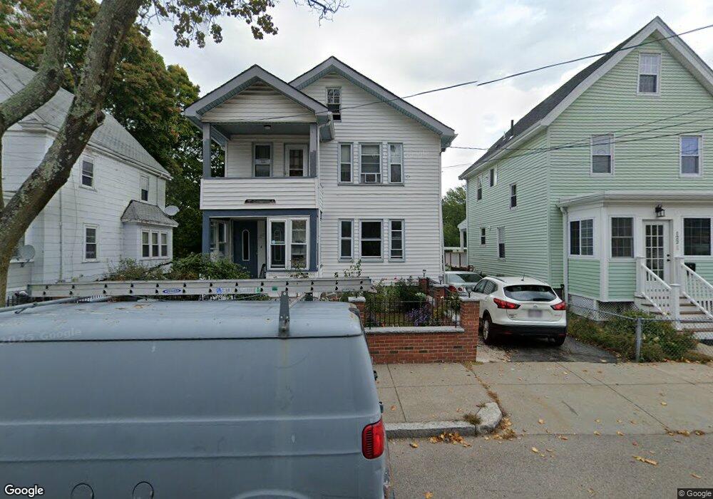
120 Walworth St Roslindale, MA 02131
Roslindale NeighborhoodEstimated Value: $908,000 - $1,617,000
6
Beds
3
Baths
2,184
Sq Ft
$522/Sq Ft
Est. Value
About This Home
This home is located at 120 Walworth St, Roslindale, MA 02131 and is currently estimated at $1,139,416, approximately $521 per square foot. 120 Walworth St is a home located in Suffolk County with nearby schools including Brooke Charter School Roslindale, Holy Name Parish School, and Sacred Heart STEM School.
Ownership History
Date
Name
Owned For
Owner Type
Purchase Details
Closed on
Aug 10, 1989
Sold by
Karistiano Anthonyh
Bought by
Soilemezoglou A
Current Estimated Value
Home Financials for this Owner
Home Financials are based on the most recent Mortgage that was taken out on this home.
Original Mortgage
$148,000
Interest Rate
9.93%
Mortgage Type
Purchase Money Mortgage
Create a Home Valuation Report for This Property
The Home Valuation Report is an in-depth analysis detailing your home's value as well as a comparison with similar homes in the area
Home Values in the Area
Average Home Value in this Area
Purchase History
| Date | Buyer | Sale Price | Title Company |
|---|---|---|---|
| Soilemezoglou A | $185,000 | -- |
Source: Public Records
Mortgage History
| Date | Status | Borrower | Loan Amount |
|---|---|---|---|
| Closed | Soilemezoglou A | $148,000 |
Source: Public Records
Tax History Compared to Growth
Tax History
| Year | Tax Paid | Tax Assessment Tax Assessment Total Assessment is a certain percentage of the fair market value that is determined by local assessors to be the total taxable value of land and additions on the property. | Land | Improvement |
|---|---|---|---|---|
| 2025 | $9,966 | $860,600 | $249,400 | $611,200 |
| 2024 | $8,521 | $781,700 | $222,000 | $559,700 |
| 2023 | $7,920 | $737,400 | $209,400 | $528,000 |
| 2022 | $7,358 | $676,300 | $192,100 | $484,200 |
| 2021 | $6,939 | $650,300 | $184,700 | $465,600 |
| 2020 | $6,277 | $594,400 | $172,400 | $422,000 |
| 2019 | $5,923 | $562,000 | $141,900 | $420,100 |
| 2018 | $5,057 | $482,500 | $143,300 | $339,200 |
| 2017 | $5,059 | $477,700 | $143,300 | $334,400 |
| 2016 | $4,820 | $438,200 | $143,300 | $294,900 |
| 2015 | $4,415 | $364,600 | $138,700 | $225,900 |
| 2014 | $4,234 | $336,600 | $136,400 | $200,200 |
Source: Public Records
Map
Nearby Homes
- 105 Orange St
- 34 Averton St
- 276 Cornell St
- 142 Birch St
- 142 Birch St Unit 2
- 142 Birch St Unit 1
- 40 Newburg St Unit 1
- 80 Roslindale Ave Unit 3
- 6 Hayes Rd Unit 16
- 52 Metropolitan Ave Unit 3
- 15 Newburg St Unit 1
- 43 Aldrich St
- 59 Aldrich St Unit 2
- 69 Metropolitan Ave
- 29 Rosecliff St
- 103 Belgrade Ave Unit 2
- 82 Birch St Unit 1
- 242 Belgrade Ave
- 65 Birch St Unit 3
- 146 Kittredge St Unit 2
- 120 Walworth St Unit 1
- 122 Walworth St
- 118 Walworth St
- 114 Walworth St
- 126 Walworth St
- 11 Alder St
- 121 Walworth St
- 117 Walworth St
- 69 Averton St
- 69 Averton St Unit 1
- 125 Walworth St
- 111 Walworth St
- 111 Walworth St Unit 2
- 15 Havey St
- 34 Fresno St
- 129 Walworth St
- 4 Hillock St
- 65 Averton St
- 163 Roslindale Ave Unit 21
- 163 Roslindale Ave Unit 2