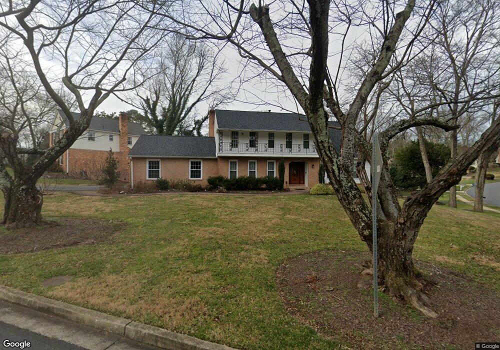
1200 Stable Gate Ct McLean, VA 22102
Estimated Value: $1,468,000 - $1,677,000
5
Beds
4
Baths
2,598
Sq Ft
$607/Sq Ft
Est. Value
About This Home
This home is located at 1200 Stable Gate Ct, McLean, VA 22102 and is currently estimated at $1,577,679, approximately $607 per square foot. 1200 Stable Gate Ct is a home located in Fairfax County with nearby schools including Spring Hill Elementary School, Cooper Middle School, and Langley High School.
Ownership History
Date
Name
Owned For
Owner Type
Purchase Details
Closed on
Jul 26, 1999
Sold by
Kirdar Fahir A
Bought by
Gover Robert E
Current Estimated Value
Home Financials for this Owner
Home Financials are based on the most recent Mortgage that was taken out on this home.
Original Mortgage
$340,000
Outstanding Balance
$96,483
Interest Rate
7.49%
Mortgage Type
Purchase Money Mortgage
Estimated Equity
$1,481,196
Create a Home Valuation Report for This Property
The Home Valuation Report is an in-depth analysis detailing your home's value as well as a comparison with similar homes in the area
Home Values in the Area
Average Home Value in this Area
Purchase History
| Date | Buyer | Sale Price | Title Company |
|---|---|---|---|
| Gover Robert E | $485,000 | -- |
Source: Public Records
Mortgage History
| Date | Status | Borrower | Loan Amount |
|---|---|---|---|
| Open | Gover Robert E | $340,000 |
Source: Public Records
Tax History
| Year | Tax Paid | Tax Assessment Tax Assessment Total Assessment is a certain percentage of the fair market value that is determined by local assessors to be the total taxable value of land and additions on the property. | Land | Improvement |
|---|---|---|---|---|
| 2025 | $15,881 | $1,535,230 | $563,000 | $972,230 |
| 2024 | $15,881 | $1,344,140 | $563,000 | $781,140 |
| 2023 | $15,048 | $1,306,820 | $556,000 | $750,820 |
| 2022 | $13,244 | $1,158,210 | $556,000 | $602,210 |
| 2021 | $12,389 | $1,035,460 | $488,000 | $547,460 |
| 2020 | $12,628 | $1,046,630 | $488,000 | $558,630 |
| 2019 | $12,495 | $1,035,680 | $488,000 | $547,680 |
| 2018 | $11,832 | $1,028,900 | $488,000 | $540,900 |
| 2017 | $11,160 | $942,540 | $488,000 | $454,540 |
| 2016 | $11,136 | $942,540 | $488,000 | $454,540 |
Source: Public Records
Map
Nearby Homes
- 1106 Mill Ridge
- 1400 Gower Ct
- 1314 Macbeth St
- 8011 Lewinsville Rd
- 1109 Old Cedar Rd
- 7925 Falstaff Rd
- 8023 Lewinsville Rd
- 1003 Gelston Cir
- 7400 Churchill Rd
- 1580 Spring Gate Dr Unit 4406
- 1580 Spring Gate Dr Unit 4314
- 1581 Spring Gate Dr Unit 5403
- 1530 Spring Gate Dr Unit 9317
- 1530 Spring Gate Dr Unit 9308
- 7351 Nicole Marie Ct
- 1600 Spring Gate Dr Unit 2204
- 1600 Spring Gate Dr Unit 2202
- 1600 Spring Gate Dr Unit 2402
- 1112 Balls Hill Rd
- 1521 Spring Gate Dr Unit 10102
- 7737 Bridle Path Ln
- 1204 Stable Gate Ct
- 1201 Stable Gate Ct
- 7736 Bridle Path Ln
- 1203 Stable Gate Ct
- 7739 Bridle Path Ln
- 7730 Bridle Path Ln
- 1206 Stable Gate Ct
- 1205 Stable Gate Ct
- 7725 Bridle Path Ln
- 7734 Bridle Path Ln
- 7732 Bridle Path Ln
- 1207 Stable Gate Ct
- 7740 Bridle Path Ln
- 7728 Bridle Path Ln
- 1208 Stable Gate Ct
- 7723 Bridle Path Ln
- 7741 Bridle Path Ln
- 1209 Stable Gate Ct
- 7726 Bridle Path Ln
Your Personal Tour Guide
Ask me questions while you tour the home.