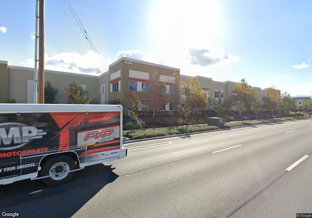
12000 Magnolia Ave Unit 100 Riverside, CA 92503
La Sierra South NeighborhoodEstimated Value: $81,112,608
--
Bed
--
Bath
129,911
Sq Ft
$624/Sq Ft
Est. Value
About This Home
This home is located at 12000 Magnolia Ave Unit 100, Riverside, CA 92503 and is currently estimated at $81,112,608, approximately $624 per square foot. 12000 Magnolia Ave Unit 100 is a home located in Riverside County with nearby schools including Phillip M. Stokoe Elementary School, Ysmael Villegas Middle School, and Hillcrest High School.
Ownership History
Date
Name
Owned For
Owner Type
Purchase Details
Closed on
Sep 13, 2021
Sold by
Pierce Owner Llc
Bought by
Ca Ibg Magnolia De Llc
Current Estimated Value
Purchase Details
Closed on
Jul 13, 2020
Sold by
Magnolia Partnership Lp
Bought by
Pierce Owner Llc
Home Financials for this Owner
Home Financials are based on the most recent Mortgage that was taken out on this home.
Original Mortgage
$17,100,000
Interest Rate
3.2%
Mortgage Type
Commercial
Create a Home Valuation Report for This Property
The Home Valuation Report is an in-depth analysis detailing your home's value as well as a comparison with similar homes in the area
Home Values in the Area
Average Home Value in this Area
Purchase History
| Date | Buyer | Sale Price | Title Company |
|---|---|---|---|
| Ca Ibg Magnolia De Llc | $70,000,000 | Old Republic Natl Ttl Ins Co | |
| Pierce Owner Llc | $24,000,000 | Old Republic Title Ins Co |
Source: Public Records
Mortgage History
| Date | Status | Borrower | Loan Amount |
|---|---|---|---|
| Previous Owner | Pierce Owner Llc | $17,100,000 | |
| Closed | Ca Ibg Magnolia De Llc | $0 |
Source: Public Records
Tax History Compared to Growth
Tax History
| Year | Tax Paid | Tax Assessment Tax Assessment Total Assessment is a certain percentage of the fair market value that is determined by local assessors to be the total taxable value of land and additions on the property. | Land | Improvement |
|---|---|---|---|---|
| 2025 | $443,529 | $37,142,280 | $5,306,040 | $31,836,240 |
| 2023 | $443,529 | $35,700,000 | $5,100,000 | $30,600,000 |
| 2022 | $410,314 | $35,000,000 | $5,000,000 | $30,000,000 |
| 2021 | $281,704 | $24,000,000 | $4,000,000 | $20,000,000 |
| 2020 | $168,985 | $14,494,732 | $2,685,172 | $11,809,560 |
| 2019 | $166,762 | $14,210,522 | $2,632,522 | $11,578,000 |
Source: Public Records
Map
Nearby Homes
- 3883 Buchanan St Unit 133
- 3883 Buchanan St Unit 3
- 3663 Buchanan St Unit 110
- 3663 Buchanan St Unit 90
- 11868 National Dr
- 12149 Indiana Ave Unit 18
- 12149 Indiana Ave Unit 95
- 4000 Pierce St Unit 135
- 4000 Pierce St Unit 197
- 4000 Pierce St Unit 267
- 4000 Pierce St Unit 282
- 4000 Pierce St Unit 284
- 4000 Pierce St Unit 132
- 4000 Pierce St Unit 220
- 3700 Buchanan Ave Unit 204
- 3700 Buchanan Ave Unit Spc 131
- 3700 Buchanan St Unit 108
- 3700 Buchanan St Unit 180
- 3700 Buchanan St Unit 189
- 3700 Buchanan St Unit 8
- 3812 Pierce St
- 3812 Pierce St Unit G
- 12015 Taylor St
- 12021 Taylor St
- 12009 Taylor St
- 11981 Taylor St
- 12033 Taylor St
- 11971 Taylor St
- 12039 Taylor St
- 11961 Taylor St
- 12045 Taylor St
- 11951 Taylor St
- 12051 Taylor St
- 11941 Taylor St
- 12057 Taylor St
- 11931 Taylor St
- 12063 Taylor St
- 3748 Pierce St
- 13306 Magnolia Ave
- 12012 Taylor St