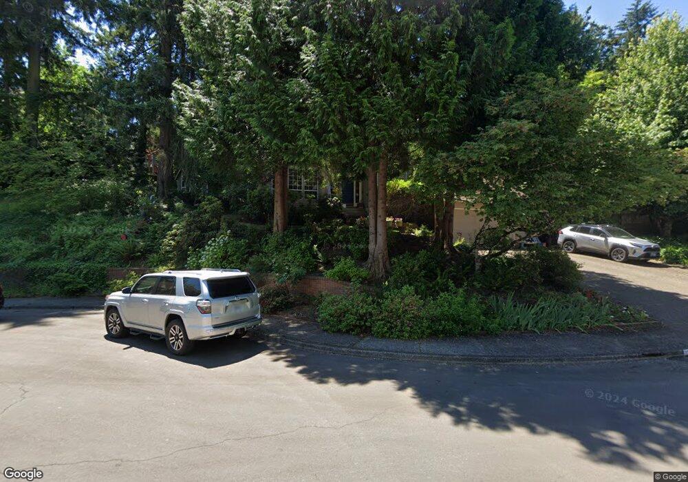
1203 Stonehaven Ct West Linn, OR 97068
Marylhurst NeighborhoodEstimated Value: $926,000 - $949,000
3
Beds
3
Baths
2,678
Sq Ft
$350/Sq Ft
Est. Value
About This Home
This home is located at 1203 Stonehaven Ct, West Linn, OR 97068 and is currently estimated at $936,931, approximately $349 per square foot. 1203 Stonehaven Ct is a home located in Clackamas County with nearby schools including Stafford Primary School, West Linn High School, and Harmony Academy.
Ownership History
Date
Name
Owned For
Owner Type
Purchase Details
Closed on
Aug 2, 2021
Sold by
Brock Mitch Emond and Brock Karoline Schafir
Bought by
Brock Karoline Schafir and Brock Mitch Edmond
Current Estimated Value
Purchase Details
Closed on
Jun 8, 2021
Sold by
Brock Mitch Emond and Brock Karoline Schafir
Bought by
Karoline And Mitch Brock Revocable Trust and Brock
Purchase Details
Closed on
May 15, 1996
Sold by
Desimone Samuel R and Desimone Elizabeth H
Bought by
Brock Mitch Edmond and Brock Karoline Schafir
Home Financials for this Owner
Home Financials are based on the most recent Mortgage that was taken out on this home.
Original Mortgage
$207,000
Interest Rate
7.97%
Create a Home Valuation Report for This Property
The Home Valuation Report is an in-depth analysis detailing your home's value as well as a comparison with similar homes in the area
Home Values in the Area
Average Home Value in this Area
Purchase History
| Date | Buyer | Sale Price | Title Company |
|---|---|---|---|
| Brock Karoline Schafir | -- | None Available | |
| Karoline And Mitch Brock Revocable Trust | -- | Buck-Romero Michele | |
| Brock Mitch Edmond | $279,000 | First American Title Ins Co |
Source: Public Records
Mortgage History
| Date | Status | Borrower | Loan Amount |
|---|---|---|---|
| Previous Owner | Brock Mitch Edmond | $207,000 |
Source: Public Records
Tax History Compared to Growth
Tax History
| Year | Tax Paid | Tax Assessment Tax Assessment Total Assessment is a certain percentage of the fair market value that is determined by local assessors to be the total taxable value of land and additions on the property. | Land | Improvement |
|---|---|---|---|---|
| 2025 | $12,025 | $623,961 | -- | -- |
| 2024 | $11,575 | $605,788 | -- | -- |
| 2023 | $11,575 | $588,144 | $0 | $0 |
| 2022 | $10,925 | $571,014 | $0 | $0 |
| 2021 | $10,244 | $554,383 | $0 | $0 |
| 2020 | $9,825 | $521,253 | $0 | $0 |
| 2019 | $9,394 | $506,071 | $0 | $0 |
| 2018 | $8,949 | $491,331 | $0 | $0 |
| 2017 | $8,578 | $477,020 | $0 | $0 |
| 2016 | $8,209 | $463,126 | $0 | $0 |
| 2015 | $7,847 | $449,637 | $0 | $0 |
| 2014 | $7,402 | $436,541 | $0 | $0 |
Source: Public Records
Map
Nearby Homes
- 1321 Troon Dr
- 1611 Arran Ct
- 1397 Skye Pkwy
- 1384 Celtic Ct
- 1777 Skyland Dr
- 17900 Crestline Dr
- 1354 Skye Pkwy
- 18300 S Whitten Ln
- 2167 Marylwood Ct
- 17514 Brookhurst Dr
- 2455 College Hill Place
- 17833 Marylcreek Dr
- 2041 Marylhurst Dr
- 17634 Brookhurst Dr
- 655 Rosemont Rd
- 19640 Kapteyns St
- 451 S Wilda Rd
- 17700 Upper Cherry Ln
- 777 Cherry Cir
- 19661 Sun Cir
- 1213 Stonehaven Ct
- 1329 Troon Dr
- 1331 Troon Dr
- 1215 Stonehaven Ct
- 1201 Stonehaven Ct
- 1204 Stonehaven Ct
- 1333 Troon Dr
- 1206 Stonehaven Ct
- 1200 Stonehaven Ct
- 1202 Stonehaven Ct
- 1335 Troon Dr 4 15 Bac
- 1335 Troon Dr Relisted
- 1335 Troon Dr
- 1208 Stonehaven Ct
- 1323 Troon Dr
- 1330 Troon Dr
- 1301 Stonehaven Dr
- 1332 Troon Dr
- 1212 Stonehaven Ct
- 1214 Stonehaven Ct