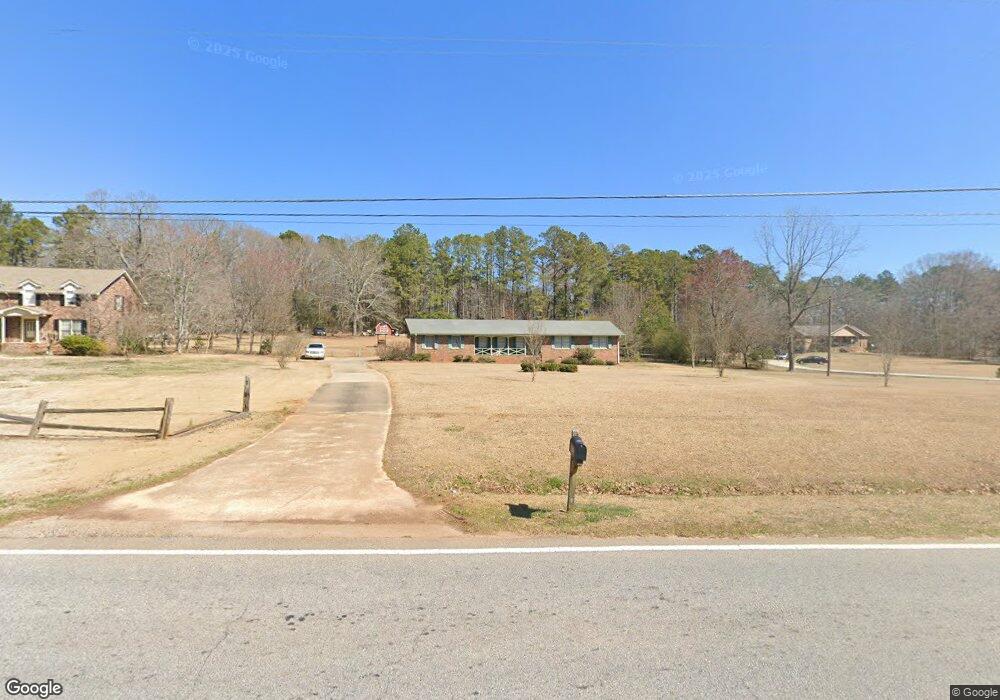
1204 Flat Rock Rd Unit 11 Stockbridge, GA 30281
Estimated Value: $254,000 - $281,000
3
Beds
2
Baths
1,792
Sq Ft
$150/Sq Ft
Est. Value
About This Home
This home is located at 1204 Flat Rock Rd Unit 11, Stockbridge, GA 30281 and is currently estimated at $268,062, approximately $149 per square foot. 1204 Flat Rock Rd Unit 11 is a home located in Henry County with nearby schools including Cotton Indian Elementary School, Stockbridge Middle School, and Stockbridge High School.
Ownership History
Date
Name
Owned For
Owner Type
Purchase Details
Closed on
Feb 25, 2019
Sold by
West Vernon T Estate
Bought by
Sanders Yondrell
Current Estimated Value
Home Financials for this Owner
Home Financials are based on the most recent Mortgage that was taken out on this home.
Original Mortgage
$151,905
Outstanding Balance
$133,279
Interest Rate
4.4%
Mortgage Type
New Conventional
Estimated Equity
$134,783
Create a Home Valuation Report for This Property
The Home Valuation Report is an in-depth analysis detailing your home's value as well as a comparison with similar homes in the area
Home Values in the Area
Average Home Value in this Area
Purchase History
| Date | Buyer | Sale Price | Title Company |
|---|---|---|---|
| Sanders Yondrell | $159,900 | -- |
Source: Public Records
Mortgage History
| Date | Status | Borrower | Loan Amount |
|---|---|---|---|
| Open | Sanders Yondrell | $151,905 |
Source: Public Records
Tax History Compared to Growth
Tax History
| Year | Tax Paid | Tax Assessment Tax Assessment Total Assessment is a certain percentage of the fair market value that is determined by local assessors to be the total taxable value of land and additions on the property. | Land | Improvement |
|---|---|---|---|---|
| 2025 | $4,436 | $111,200 | $14,400 | $96,800 |
| 2024 | $4,436 | $96,200 | $14,400 | $81,800 |
| 2023 | $3,696 | $95,320 | $14,400 | $80,920 |
| 2022 | $3,253 | $83,760 | $14,400 | $69,360 |
| 2021 | $2,682 | $68,880 | $14,400 | $54,480 |
| 2020 | $2,338 | $59,920 | $9,600 | $50,320 |
| 2019 | $522 | $57,880 | $9,600 | $48,280 |
| 2018 | $0 | $48,480 | $9,600 | $38,880 |
| 2016 | $479 | $44,800 | $7,200 | $37,600 |
| 2015 | -- | $39,680 | $7,200 | $32,480 |
| 2014 | -- | $37,120 | $5,760 | $31,360 |
Source: Public Records
Map
Nearby Homes
- 30 Hickory Dr
- 1527 Old Conyers Rd Unit 4
- 0 Freeman Dr Unit 128 10480940
- 0 Flakes Rd Unit 24
- 0 Freeman #128 Dr
- 0 Old Conyers Rd Unit 10574658
- 364 Sound Cir
- 90 Chimney Rise Ct
- 193 Edison Dr
- 155 Hickory Dr
- 277 Edison Dr
- 180 Cowan Dr
- 0 Chimney Smoke Dr Unit 10640945
- 0 Chimney Smoke Dr Unit 182111
- 200 Cowan Dr
- 15 Chimney Smoke Dr
- 128 Belair Ln Unit 1
- 125 Johnsons Walk Unit 2
- 159 Brookwood Estates Trail
- 0 Oakview Dr Unit 10472931
- 1204 Flat Rock Rd
- 1218 Flat Rock Rd
- 1190 Flat Rock Rd
- 94 Bloomfield Dr
- 1168 Flat Rock Rd
- 16 Cedar Ct
- 1240 Flat Rock Rd
- 5 Hickory Dr
- 100 Bloomfield Dr
- 100 Bloomfield Dr
- 100 Bloomfield Dr Unit 1
- 95 Bloomfield Dr
- 35 Cedar Ct
- 100 Edison Dr
- 0 Bloomfield Dr Unit 8008571
- 15 Cedar Ct Unit V
- 1268 Flat Rock Rd
- 101 Bloomfield Dr
- 1146 Flat Rock Rd
- 15 Hickory Dr