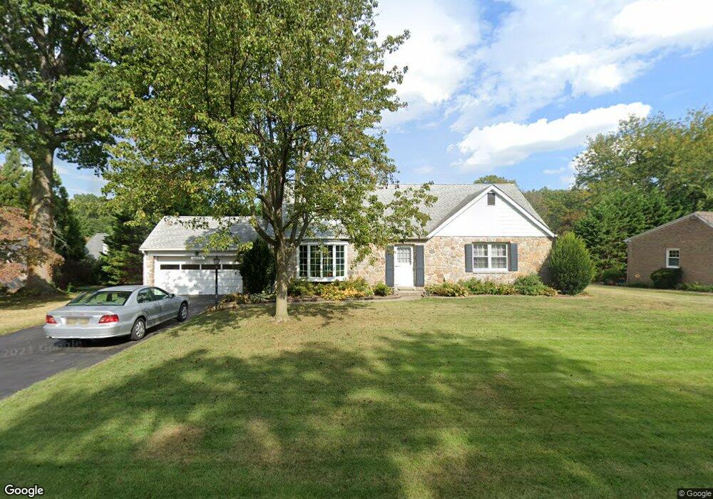
1205 Norbee Dr Wilmington, DE 19803
Carrcroft NeighborhoodEstimated Value: $570,000 - $731,000
3
Beds
2
Baths
1,932
Sq Ft
$328/Sq Ft
Est. Value
About This Home
This home is located at 1205 Norbee Dr, Wilmington, DE 19803 and is currently estimated at $632,880, approximately $327 per square foot. 1205 Norbee Dr is a home located in New Castle County with nearby schools including Carrcroft Elementary School, Springer Middle School, and Mount Pleasant High School.
Ownership History
Date
Name
Owned For
Owner Type
Purchase Details
Closed on
Nov 19, 2009
Sold by
Palmer Harry B
Bought by
Trotz Leroy H and Trotz Eunice
Current Estimated Value
Home Financials for this Owner
Home Financials are based on the most recent Mortgage that was taken out on this home.
Original Mortgage
$100,000
Interest Rate
4.92%
Mortgage Type
New Conventional
Purchase Details
Closed on
Aug 23, 2006
Sold by
House Barbara W and Dotts Barbara W
Bought by
Palmer Harry B
Home Financials for this Owner
Home Financials are based on the most recent Mortgage that was taken out on this home.
Original Mortgage
$280,000
Interest Rate
1%
Mortgage Type
Purchase Money Mortgage
Create a Home Valuation Report for This Property
The Home Valuation Report is an in-depth analysis detailing your home's value as well as a comparison with similar homes in the area
Home Values in the Area
Average Home Value in this Area
Purchase History
| Date | Buyer | Sale Price | Title Company |
|---|---|---|---|
| Trotz Leroy H | $335,000 | Lawyers Title Insurance Corp | |
| Palmer Harry B | $350,000 | None Available |
Source: Public Records
Mortgage History
| Date | Status | Borrower | Loan Amount |
|---|---|---|---|
| Closed | Trotz Leroy H | $100,000 | |
| Previous Owner | Palmer Harry B | $280,000 |
Source: Public Records
Tax History Compared to Growth
Tax History
| Year | Tax Paid | Tax Assessment Tax Assessment Total Assessment is a certain percentage of the fair market value that is determined by local assessors to be the total taxable value of land and additions on the property. | Land | Improvement |
|---|---|---|---|---|
| 2024 | $3,313 | $100,200 | $16,200 | $84,000 |
| 2023 | $2,985 | $100,200 | $16,200 | $84,000 |
| 2022 | $3,045 | $100,200 | $16,200 | $84,000 |
| 2021 | $193 | $100,200 | $16,200 | $84,000 |
| 2020 | $193 | $100,200 | $16,200 | $84,000 |
| 2019 | $193 | $100,200 | $16,200 | $84,000 |
| 2018 | $2,988 | $100,200 | $16,200 | $84,000 |
| 2017 | $2,935 | $100,200 | $16,200 | $84,000 |
| 2016 | $2,833 | $100,200 | $16,200 | $84,000 |
| 2015 | $2,567 | $100,200 | $16,200 | $84,000 |
| 2014 | $2,565 | $100,200 | $16,200 | $84,000 |
Source: Public Records
Map
Nearby Homes
- 13 Newark Union Public Rd
- 1300 Hillside Blvd
- 200 Churchill Dr
- 42 Paschall Rd
- 302 Baynard Blvd
- 820 Montico Rd
- 207 Kirk Ave
- 409 Rowland Park Blvd
- 816 Wilson Rd
- 7 Dakota Ave
- 133 Marcella Rd
- 1218 Winstead Rd
- 1224 Grinnell Rd
- 607 Brighton Rd
- 526 Brighton Rd
- 22 Bradley Dr
- 1400 Carson Rd
- 4559 Simon Rd
- 1425 Bucknell Rd
- 1111 N Hilton Rd
- 1203 Norbee Dr
- 1202 Brook Dr
- 1207 Norbee Dr
- 1204 Brook Dr
- 1204 Norbee Dr
- 1206 Norbee Dr
- 1200 Brook Dr
- 1208 Norbee Dr
- 1209 Norbee Dr
- 1206 Brook Dr
- 1201 Norbee Dr
- 1202 Norbee Dr
- 11 Newark Union Public Rd
- 1209 Brook Dr
- 1210 Norbee Dr
- 1211 Norbee Dr
- 1207 Brook Dr
- 1200 Norbee Dr
- 1208 Brook Dr
- 9 Newark Union Public Rd