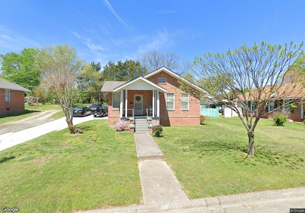
1205 Westside Dr Greensboro, NC 27405
Rosewood NeighborhoodEstimated Value: $136,000 - $172,000
3
Beds
1
Bath
1,164
Sq Ft
$132/Sq Ft
Est. Value
About This Home
This home is located at 1205 Westside Dr, Greensboro, NC 27405 and is currently estimated at $153,206, approximately $131 per square foot. 1205 Westside Dr is a home located in Guilford County with nearby schools including Irving Park Elementary School, Melvin C. Swann Jr. Middle School, and Page High School.
Ownership History
Date
Name
Owned For
Owner Type
Purchase Details
Closed on
Jul 30, 2008
Sold by
Mardis Mary and Mardis Alfred
Bought by
Mee Y and Pha Fnu
Current Estimated Value
Home Financials for this Owner
Home Financials are based on the most recent Mortgage that was taken out on this home.
Original Mortgage
$72,856
Outstanding Balance
$47,911
Interest Rate
6.37%
Mortgage Type
FHA
Estimated Equity
$105,295
Create a Home Valuation Report for This Property
The Home Valuation Report is an in-depth analysis detailing your home's value as well as a comparison with similar homes in the area
Home Values in the Area
Average Home Value in this Area
Purchase History
| Date | Buyer | Sale Price | Title Company |
|---|---|---|---|
| Mee Y | $74,000 | None Available |
Source: Public Records
Mortgage History
| Date | Status | Borrower | Loan Amount |
|---|---|---|---|
| Open | Mee Y | $72,856 |
Source: Public Records
Tax History Compared to Growth
Tax History
| Year | Tax Paid | Tax Assessment Tax Assessment Total Assessment is a certain percentage of the fair market value that is determined by local assessors to be the total taxable value of land and additions on the property. | Land | Improvement |
|---|---|---|---|---|
| 2025 | $1,117 | $79,600 | $20,000 | $59,600 |
| 2024 | $1,117 | $79,600 | $20,000 | $59,600 |
| 2023 | $1,117 | $79,600 | $20,000 | $59,600 |
| 2022 | $1,085 | $79,600 | $20,000 | $59,600 |
| 2021 | $963 | $69,100 | $20,000 | $49,100 |
| 2020 | $963 | $69,100 | $20,000 | $49,100 |
| 2019 | $963 | $69,100 | $0 | $0 |
| 2018 | $935 | $69,100 | $0 | $0 |
| 2017 | $942 | $69,100 | $0 | $0 |
| 2016 | $677 | $48,900 | $0 | $0 |
| 2015 | $681 | $48,900 | $0 | $0 |
| 2014 | $686 | $48,900 | $0 | $0 |
Source: Public Records
Map
Nearby Homes
- 1210 Summit Ave
- 1307 Mayfair Ave
- 1406 Fairview St
- 1600 Ridgewood Ave
- 1317 Joyce St
- 1605 Ball St
- 1507 Tucker St
- 1502 Fairview St
- 1525 Tucker St
- 1612 N English St
- 1728 Kay St
- 1719 Phillips Ave
- 311 Huffman St
- 805 N Church St
- 309 E Bessemer Ave
- 215 Marshall St
- 306 Winston St
- 206 Huffman St
- 915 Olive St
- 1703 Buffalo St
- 1203 Westside Dr
- 1207 Westside Dr
- 1209 Westside Dr
- 1204 Homeland Ave
- 1201 Westside Dr
- 1206 Homeland Ave
- 1202 Homeland Ave
- 1208 Homeland Ave
- 1211 Westside Dr
- 1200 Homeland Ave
- 1206 Westside Dr
- 1208 Westside Dr
- 1210 Homeland Ave
- 1210 Westside Dr
- 1204 Westside Dr
- 1212 Westside Dr
- 1202 Westside Dr
- 1214 Westside Dr
- 1506 4th St
- 1213 Westside Dr