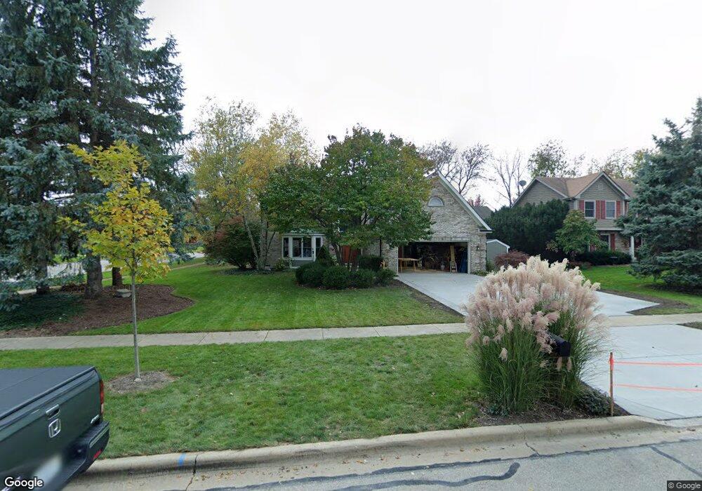
1206 Danforth Dr Batavia, IL 60510
Southwest Batavia NeighborhoodEstimated Value: $486,675 - $570,000
4
Beds
--
Bath
2,498
Sq Ft
$215/Sq Ft
Est. Value
About This Home
This home is located at 1206 Danforth Dr, Batavia, IL 60510 and is currently estimated at $537,169, approximately $215 per square foot. 1206 Danforth Dr is a home located in Kane County with nearby schools including Sam Rotolo Middle School, Batavia Sr High School, and Immanuel Lutheran School.
Ownership History
Date
Name
Owned For
Owner Type
Purchase Details
Closed on
Apr 12, 2006
Sold by
Babel Thomas Alan and Babel Rebecca A
Bought by
Babel Thomas Alan and Babel Rebecca A
Current Estimated Value
Home Financials for this Owner
Home Financials are based on the most recent Mortgage that was taken out on this home.
Original Mortgage
$304,150
Outstanding Balance
$175,993
Interest Rate
6.48%
Mortgage Type
Fannie Mae Freddie Mac
Estimated Equity
$361,176
Purchase Details
Closed on
Jul 1, 1999
Sold by
Peters Thomas C and Peters Claudia M
Bought by
Babel Thomas Alan and Waltrip Rebecca Ann
Home Financials for this Owner
Home Financials are based on the most recent Mortgage that was taken out on this home.
Original Mortgage
$204,000
Interest Rate
7.29%
Create a Home Valuation Report for This Property
The Home Valuation Report is an in-depth analysis detailing your home's value as well as a comparison with similar homes in the area
Home Values in the Area
Average Home Value in this Area
Purchase History
| Date | Buyer | Sale Price | Title Company |
|---|---|---|---|
| Babel Thomas Alan | -- | Multiple | |
| Babel Thomas Alan | $255,000 | -- |
Source: Public Records
Mortgage History
| Date | Status | Borrower | Loan Amount |
|---|---|---|---|
| Open | Babel Thomas Alan | $304,150 | |
| Closed | Babel Thomas Alan | $204,000 |
Source: Public Records
Tax History
| Year | Tax Paid | Tax Assessment Tax Assessment Total Assessment is a certain percentage of the fair market value that is determined by local assessors to be the total taxable value of land and additions on the property. | Land | Improvement |
|---|---|---|---|---|
| 2024 | $10,838 | $145,074 | $13,272 | $131,802 |
| 2023 | $10,612 | $131,670 | $12,046 | $119,624 |
| 2022 | $10,221 | $123,056 | $11,258 | $111,798 |
| 2021 | $9,366 | $111,658 | $10,677 | $100,981 |
| 2020 | $9,135 | $109,512 | $10,472 | $99,040 |
| 2019 | $8,985 | $105,635 | $10,101 | $95,534 |
| 2018 | $8,627 | $101,611 | $9,716 | $91,895 |
| 2017 | $8,417 | $98,261 | $9,396 | $88,865 |
| 2016 | $8,237 | $95,399 | $9,122 | $86,277 |
| 2015 | -- | $93,227 | $8,914 | $84,313 |
| 2014 | -- | $90,292 | $8,633 | $81,659 |
| 2013 | -- | $90,647 | $10,581 | $80,066 |
Source: Public Records
Map
Nearby Homes
- 1375 Green Pheasant Ln
- 979 Millview Dr
- 332 Evergreen Dr
- 206 Weirich Way Unit 88004
- 113 Furnas Dr
- 137 Furnas Dr
- 143 Furnas Dr
- 218 Weirich Way Unit 88001
- 131 Furnas Dr
- 1676 Carlstedt Dr
- 724 S Jefferson St
- 884 Twin Elms Ln
- 469 S Jefferson St Unit 469
- 54 Willey Ln Unit 54
- 65 Weirich Way Unit 78002
- 73 Weirich Way Unit 78003
- 1355 Georgetown Dr Unit 3
- 57 Weirich Way Unit 78001
- 1071 Houston St Unit 89003
- 1067 Houston St Unit 89004
- 1216 Danforth Dr
- 1203 Payne Ave
- 1213 Payne Ave
- 1226 Danforth Dr
- 1192 Danforth Dr
- 1211 Danforth Dr
- 920 Millview Dr
- 1221 Danforth Dr
- 1182 Danforth Dr
- 1233 Payne Ave
- 930 Millview Dr
- 1236 Danforth Dr
- 1231 Danforth Dr
- 1151 Millview Dr
- 852 Millview Dr
- 1214 Payne Ave
- 833 Millview Dr
- 1150 Millview Dr
- 1224 Payne Ave Unit 2
- 1241 Danforth Dr
Your Personal Tour Guide
Ask me questions while you tour the home.