Estimated Value: $77,178 - $101,000
2
Beds
1
Bath
912
Sq Ft
$100/Sq Ft
Est. Value
About This Home
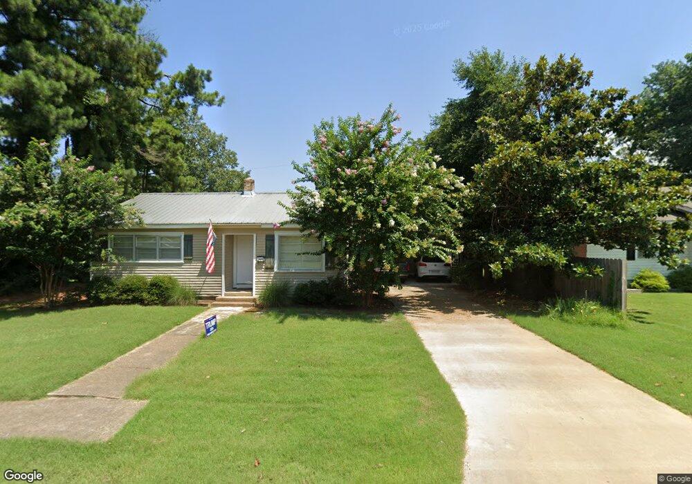
This home is located at 1206 Forrest Ave E, Wynne, AR 72396 and is currently estimated at $91,295, approximately $100 per square foot. 1206 Forrest Ave E is a home located in Cross County with nearby schools including Wynne Primary School, Wynne Intermediate School, and Wynne Junior High School.
Ownership History
Date
Name
Owned For
Owner Type
Purchase Details
Closed on
Jul 12, 2012
Sold by
Garner Rentals Llc
Bought by
Smith Meda D
Current Estimated Value
Home Financials for this Owner
Home Financials are based on the most recent Mortgage that was taken out on this home.
Original Mortgage
$29,000
Outstanding Balance
$4,092
Interest Rate
3.79%
Mortgage Type
New Conventional
Estimated Equity
$87,203
Purchase Details
Closed on
Nov 11, 2011
Sold by
Mccord Carl Chambers and Mccord Antonia Darlene
Bought by
Mccord Antonia Darlene
Purchase Details
Closed on
Dec 16, 2009
Sold by
Mccord Antonia Darlene
Bought by
Garner Rentals Llc
Purchase Details
Closed on
Jan 17, 1990
Bought by
Smith Clarence and Smith Madge
Create a Home Valuation Report for This Property
The Home Valuation Report is an in-depth analysis detailing your home's value as well as a comparison with similar homes in the area
Purchase History
| Date | Buyer | Sale Price | Title Company |
|---|---|---|---|
| Smith Meda D | $42,000 | Cowling Title Company | |
| Mccord Antonia Darlene | -- | None Available | |
| Garner Rentals Llc | $22,000 | Cowling Title Company | |
| Smith Clarence | $20,000 | -- |
Source: Public Records
Mortgage History
| Date | Status | Borrower | Loan Amount |
|---|---|---|---|
| Open | Smith Meda D | $29,000 |
Source: Public Records
Tax History
| Year | Tax Paid | Tax Assessment Tax Assessment Total Assessment is a certain percentage of the fair market value that is determined by local assessors to be the total taxable value of land and additions on the property. | Land | Improvement |
|---|---|---|---|---|
| 2025 | -- | $13,530 | $3,470 | $10,060 |
| 2024 | -- | $9,010 | $3,030 | $5,980 |
| 2023 | $0 | $9,010 | $3,030 | $5,980 |
| 2022 | $0 | $9,010 | $3,030 | $5,980 |
| 2021 | $1,481 | $9,010 | $3,030 | $5,980 |
| 2020 | $0 | $9,010 | $3,030 | $5,980 |
| 2019 | $0 | $7,560 | $2,750 | $4,810 |
| 2018 | $0 | $7,560 | $2,750 | $4,810 |
| 2017 | $0 | $7,560 | $2,750 | $4,810 |
| 2016 | -- | $7,560 | $2,750 | $4,810 |
| 2015 | -- | $7,560 | $2,750 | $4,810 |
| 2014 | -- | $6,650 | $2,500 | $4,150 |
Source: Public Records
Map
Nearby Homes
- 1112 Poplar Ave E
- 1310 Forrest Ave E
- 594 Malone St N
- 108 Nathan Dr E
- 109 Nathan Dr E
- 1106 Marion Dr
- 909 Killough Rd N
- 1008 Killough Rd N
- 621 Lemons St N
- 1420 Hamilton Ave E
- 1011 Hilltop Dr
- 1201 Peterson Dr
- 1308 Killough Rd N
- 802 Poplar Ave E
- 39 Morningside Dr
- 1621 Dodd Dr
- 8 Acres Arkansas 1
- 1009 Falls Blvd
- 810 Union Ave E
- 205 Kerry Dr
- 1210 Forrest Ave E
- 310 Nathan Dr E
- 1212 Forrest Ave E
- 807 Pinewood Cove
- 1207 Forrest Ave E
- 1209 Forrest Ave E
- 1205 Forrest Ave E
- 809 Pinewood Cove
- 304 Nathan Dr E
- 1251 Forrest Ave E
- 309 Nathan Dr E
- 1302 Forrest Ave E
- 1127 Forrest Ave E
- 305 Nathan Dr E
- 805 Pinewood Cove
- 1303 Forrest Ave E
- 226 Nathan Dr E
- 811 Pinewood Cove
- 1208 Poplar Ave E
- 1123 Forrest Ave E
Your Personal Tour Guide
Ask me questions while you tour the home.